Old Maps of Wood Lake District, North Dakota for Hiking & Exploration
Hike through history with 71 historic maps of Wood Lake District. Explore old trails, ghost towns, and forgotten backroads — perfect for outdoor adventurers and local explorers.
- Rediscover forgotten places: Map out old mining camps, roads, and footpaths that no longer exist on modern maps.
- Layer with modern tools: Combine with LiDAR or satellite views to plan hikes through historical terrain.
- Made for exploration: Popular among hikers, overlanders, and local history lovers.
Use these maps to find adventure and explore the hidden past of Wood Lake District.
Wood Lake District, ND maps
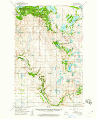
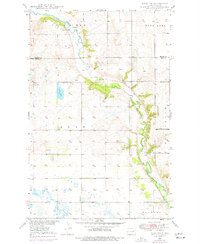
(71)- 1928 Map of Tokio, 1954 Print
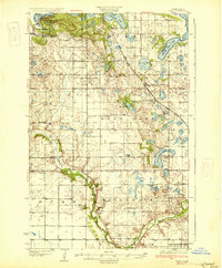
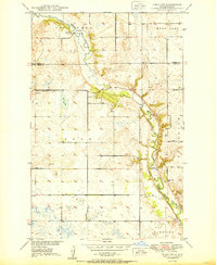
 1928 Tokio1954 Print · USGSThe Devils Lake Indian Reservation and the shores of Devils Lake are captured here in the late 1920s. Genealogists and local historians can trace the Great Northern rail line through Tokio or locate rural landmarks like Wood Lake Ch and Fort Totten P O.
 - 1930 Map of Hamar
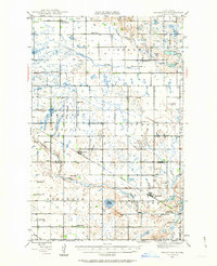
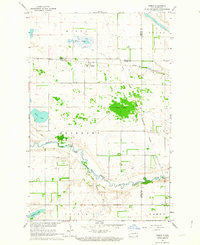
 1930 Hamar1930 Print · USGSBenson County and the Sheyenne River valley are captured here in the late 1920s as the rail-and-river economy flourished. Genealogists can trace the rural communities around Warwick and Hamar, locating landmarks like the Jerusalem Ch and Lookout Mtn.
 - 1931 Map of Tokio
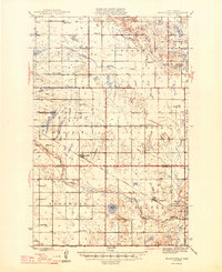
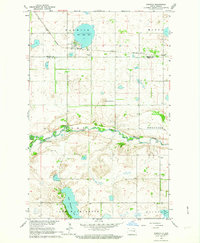
 1931 Tokio1931 Print · USGSThe southern shores of Devils Lake come into focus in the late twenties, detailing the area around Fort Totten P O and the Devils Lake Indian Reservation. Genealogists can trace local landmarks like Devils Heart and numerous rural schoolhouses including School No 2 and School No 4.2 unique versions available
 - 1944 Map of Brantford, 1963 Print
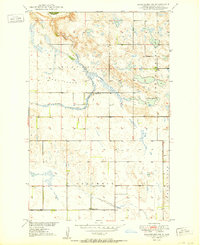
 1944 Brantford1963 Print · USGSEddy and Foster Counties appear here during the mid-1940s, showing a prairie landscape shaped by the Great Northern railroad and the James River. Researchers can locate numerous rural schoolhouses and church sites like Kvernes Ch and Columbia Sch.
 - 1946 Map of Brantford
 1946 Brantford1946 Print · USGSCentral North Dakota’s prairie landscape is captured here in the mid-1940s, showing a rural economy tied to the Great Northern rail line. Genealogists can trace family footprints through numerous township schools and landmarks like Kvernes Ch or the Grace City Cem.2 unique versions available
 - 1950 Map of Brantford NE
 1950 Brantford NE1950 Print · USGSEddy County’s rural landscape is captured here in the post-war years during the expansion of the Missouri River Basin project. Genealogists can locate specific local landmarks like School No 1, School No 3, and the township Town Hall.3 unique versions available
 - 1950 Map of Tokio SW
 1950 Tokio SW1950 Print · USGSMid-century Eddy County is captured here as a landscape of prairie schoolhouses and river bends before modern consolidation. Family researchers can trace local landmarks like Bourett Cem, School No 4, and the winding Sheyenne River.
 - 1950 Map of Tokio, 1952 Print
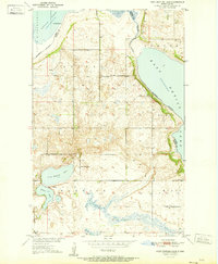
 1950 Tokio1952 Print · USGSBenson County at the start of the 1950s was a landscape defined by the shifting waters of the Devils Lake basin and the lifeline of the railroad. Researchers can trace the mid-century footprints of Saint Michael and Tokio, or find local landmarks like Wood Lake Ch and Devils Heart Butte.
 - 1950 Map of Devils Lake Mountain, 1978 Print
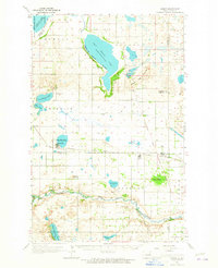
 1950 Devils Lake Mountain1978 Print · USGSRamsey County and the surrounding prairies are captured here at mid-century as rural life centered around small township hubs. Genealogists can locate the Odessa Cem and early landmarks like School No 2 near the shores of East Devils Lake.
 - 1951 Map of Devils Lake Mountain
 1951 Devils Lake Mountain1951 Print · USGSThe rural landscapes of Ramsey and Nelson counties are captured here in the early fifties, showing the sparse prairie settlements of Odessa and Minco. Genealogists can trace family footprints near School No 2 and the Odessa Cem, while the Old Indian Reservation Boundary marks a significant historical line.
 - 1951 Map of Free Peoples Lake
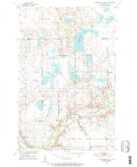
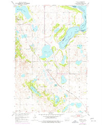
 1951 Free Peoples Lake1951 Print · USGSBenson and Ramsey Counties show their mid-century rural character before shifting water levels altered the landscape. Genealogists and local historians can trace specific district boundaries and find the locations of early rural landmarks like Free Peoples School, School No 8, and Free Peoples Lake.2 unique versions available
 - 1951 Map of Horseshoe Lake, 1952 Print
 1951 Horseshoe Lake1952 Print · USGSEddy and Benson counties in the early fifties reveal a landscape defined by glacial lakes and the historical Old Indian Reservation Boundary. Genealogists can locate rural schoolhouses such as School No 2 and the School No 3 (Abandoned) near the Sheyenne River.
 - 1951 Map of Fort Totten, 1953 Print
 1951 Fort Totten1953 Print · USGSBenson and Ramsey Counties were undergoing significant transitions in the early fifties along the shores of Devils Lake. Genealogists and local historians can locate the Fort Totten Indian Agency, the Great Northern rail line, and rural landmarks like Lone Tree Sch No 1.2 unique versions available
 - 1951 Map of Tokio, 1959 Print
 1951 Tokio1959 Print · USGSBenson County in the early 1950s is a landscape defined by the intersection of military history, tribal lands, and glacial lakes. Genealogists and historians can trace old routes like the Old Indian Military Road or locate family sites near Tokio, Saint Michael, and Wood Lake Ch.
 - 1952 Map of New Rockford, 1968 Print
 1952 New Rockford1968 Print · USGSThe North Dakota prairie during the mid-1950s was a landscape of rail-dependent farm towns and vast wildlife refuges. Genealogists and historians can trace the foundations of local communities at Fort Totten Indian Agenc, Concordia Lutheran Church, and the Bowdon Country Church and Cemetery.3 unique versions available
 - 1956 Map of New Rockford
 1956 New Rockford1956 Print · USGSMid-century central North Dakota is captured here as a landscape of prairie rail towns and vast wildlife refuges. Trace family roots at the Bowdon Country Church and Cemetery or locate the old St Michael Mission School and Fort Totten.
 - 1962 Map of Hamar, 1964 Print
 1962 Hamar1964 Print · USGSEddy and Benson counties at the start of the 1960s reveal a landscape of prairie townships and river bends. Genealogists and local historians can trace the Great Northern rail line through Hamar or locate family sites near Sigdal Ch and Battle Lake.
 - 1962 Map of Warwick, 1964 Print
 1962 Warwick1964 Print · USGSThe Benson and Eddy County line in the early sixties is dominated by the Sheyenne River and the small rail-town of Warwick. Local researchers can trace family roots at Warwick Cem or locate the historic Great Northern rail route and the Indian Reservation Boundary.
 - 1962 Map of Hamar, 1965 Print
 1962 Hamar1965 Print · USGSBenson and Ramsey counties are depicted in the early sixties as a network of lakeside settlements and prairie rail lines. You can locate rural schoolhouses and family landmarks like Sigdal Ch, the Indian Mound, and cemeteries in Warwick and Hamar.
 - 1971 Map of New Rockford, 1974 Print
 1971 New Rockford1974 Print · USGSCentral North Dakota was a landscape of wildlife refuges and rail-linked agricultural towns in the early seventies. Genealogists and local historians can trace the development of the Fort Totten Indian Reservation and locate old railway points like Maddock, Hamal, and Kloten.
 - 1975 Map of Tokio SW, 1977 Print
 1975 Tokio SW1977 Print · USGSThe Sheyenne River valley in Eddy County is captured here in the mid-seventies, showing a landscape defined by the Old Indian Reservation Bdy. Researchers can locate Bourett Cem, trace the Jackson Truck Trail, and find the site of School No 1.
 - 1975 Map of Tokio, 1977 Print
 1975 Tokio1977 Print · USGSBenson County's prairie and lakelands are captured in the 1970s, showcasing the intricate shores of Devils Lake and the rail-oriented settlement of Tokio. Genealogists and local historians can locate Wood Lake Ch, Saint Michael, and School No 3 among the region's many lakes and buttes.
 - 1985 Map of Stump Lake
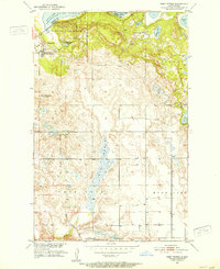
 1985 Stump Lake1985 Print · USGSNorth Dakota's lake country in the mid-eighties shows a landscape shaped by the Burlington Northern rail line and tribal lands. Genealogists and historians can locate family sites near Warwick, Tokio, and the Fort Totten Indian Reservation.2 unique versions available
 - 1994 Map of Fort Totten, 1995 Print
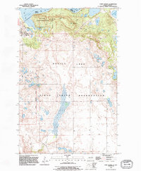 1994 Fort Totten1995 Print · USGSThe shore of Devils Lake and the Sioux Indian Reservation are captured here in the mid-1990s as the landscape balances conservation and community life. Trace the historic Old Military Reservation Boundary or locate local landmarks like Fort Totten and Little Hoop Community College.
 - 1994 Map of Free Peoples Lake, 1995 Print
 1994 Free Peoples Lake1995 Print · USGSBenson and Ramsey counties are captured in the mid-1990s, showcasing the intersection of the Sioux Indian Reservation and various glacial lakes. Researchers can locate the settlement of Warwick and trace the shores of Free Peoples Lake and East Devils Lake.
Showing maps 1-25 of 71
Top cities near Wood Lake District
Top neighborhoods of Wood Lake District
Frequently asked questions
- What are the different types of historical maps available for Wood Lake District?
- What is the oldest map of Wood Lake District?
- Where can I purchase historical maps of Wood Lake District for my home or office?
- Where can I download high-res historical maps of Wood Lake District?
- Are there historical topographic maps available for Wood Lake District?
- Is there historical aerial imagery available for Wood Lake District?
- Where are historical maps of Wood Lake District sourced from?