Old Maps of Lincoln County, Oklahoma for Genealogy
Trace your family roots with 199 historic maps of Lincoln County. These high-res maps reveal old neighborhoods, homesites, landmarks, and streets — helping you uncover where your ancestors lived and how the area evolved over time.
- Explore historic neighborhoods: Identify where your relatives may have lived in the 1800s or 1900s.
- Compare maps over time: Trace the changes in streets, buildings, and landmarks for multi-generational research.
- Perfect for genealogy & ancestry research: Used by family historians and researchers to map out lineage and migration.
These maps are an incredible resource for exploring your personal connection to Lincoln County's past.
Lincoln County, OK maps
(199)- 1896 Map of Seminole and Prague
 1896 Seminole and Prague1896 Print · USGSOklahoma Territory and tribal nations meet in the mid-1890s along the North Fork Canadian River. Researchers can trace early tribal boundaries and find vanished locations like Mekosukey, Heliswa, and the Seminole Creek Nation Boundary.
 - 1898 Map of Purcell
 1898 Purcell1898 Print · USGSOklahoma and Indian Territory are captured at the end of the century during a period of rapid regional expansion. Genealogists and historians can trace the early rail alignment of the G C and S F R R as it passes through Purcell near Walnut Creek.
 - 1905 Map of Chandler, 1968 Print
 1905 Chandler1968 Print · USGSLincoln County was a bustling intersection of railroads and river valleys in the years just before Oklahoma statehood. Researchers can trace early rural life through numerous country schools like Red Eagle Sch and Sweet Home Sch or locate homesteads near Chandler and Sparks.
 - 1907 Map of Chandler
 1907 Chandler1907 Print · USGSOklahoma Territory was on the cusp of statehood when this survey recorded Lincoln County’s burgeoning rail towns. Local historians can trace the early footprints of Chandler and Davenport, or locate smaller sites like Midlothian and Payson along the Deep Fork Canadian River.2 unique versions available
 - 1908 Map of Agra
 1908 Agra1908 Print · USGSAs the Oklahoma Territory transitioned into statehood, this area was a bustling network of new rail lines and rural school districts. Researchers can trace early township developments and family-centric landmarks like Free Silver School, the riverside stop at Cottingham, or the junction at Agra.3 unique versions available
 - 1909 Map of Shawnee
 1909 Shawnee1909 Print · USGSPottawatomie County thrives as a booming rail and agricultural center in the first years of Oklahoma statehood. Genealogists can trace the early grids of Shawnee and Tecumseh or find rural landmarks like Shawnee Mission and Econtuchka.3 unique versions available
 - 1909 Map of Luther
 1909 Luther1909 Print · USGSDuring the final years of the Oklahoma Territory, this area saw rapid growth as railroads connected towns like Luther and Wellston. Genealogists and historians can locate dozens of early community sites, from the German Church to rural schoolhouses like Peach Grove School and Arbuckle School.2 unique versions available
 - 1909 Map of Perkins
 1909 Perkins1909 Print · USGSOklahoma Territory near the turn of the century is a landscape of new rail-side towns and scattered one-room schoolhouses. Genealogists and historians can trace family roots through dozens of named sites like Vim PO, Mt Bethel Church, and Eagle College School.4 unique versions available
 - 1929 Map of Stroud, 1972 Print
 1929 Stroud1972 Print · USGSCentral Oklahoma is captured here in the late twenties, showing the intersection of early highway travel and deep-rooted rural communities. Researchers can trace historic schools and rail lines, including the Sac and Fox Sch, Paden, and the legendary Highway No 66.
 - 1930 Map of McLoud
 1930 McLoud1930 Print · USGSCentral Oklahoma is captured in the late 1920s as a landscape of rural school districts and river crossings. Researchers can trace early settlements and family landmarks like the Kickapoo Mission, Sweeney Bridge, and the Moore & Nordin Gin.2 unique versions available
 - 1931 Map of Drumright
 1931 Drumright1931 Print · USGSOklahoma's oil boom era is captured here at its peak, showing the industrial landscape around Drumright and Shamrock. Local historians can trace dozens of rural school sites like Happy Valley Sch and the original path of Highway No 66.4 unique versions available
 - 1932 Map of Stroud
 1932 Stroud1932 Print · USGSCentral Oklahoma at the start of the 1930s reveals a landscape shaped by former territorial boundaries and a dense network of rural schools. Genealogists and historians can trace family roots through landmarks like Sac and Fox Sch, Arlington, and the many country schools such as Pettiquah Sch.2 unique versions available
 - 1954 Map of Oklahoma City
 1954 Oklahoma City1954 Print · USGSOklahoma City and its surrounding counties are captured here in the early fifties during a period of significant postwar growth. Researchers can trace the development of the Turner Turnpike and locate aviation hubs like Tinker Field or Will Rogers Field.
 - 1956 Map of Harrah, 1957 Print
 1956 Harrah1957 Print · USGSOklahoma county lines and the winding river bottom highlight this mid-fifties survey of the frontier between central and eastern Oklahoma. Researchers can trace the path of the Indian Meridian and locate landmarks like Newalla, Texas Sch (Abandoned), and the oil wells scattered near the Cleveland County border.4 unique versions available
 - 1956 Map of Horseshoe Lake, 1957 Print
 1956 Horseshoe Lake1957 Print · USGSOklahoma and Lincoln Counties appear here in the mid-fifties, centered on the river-fed industrial infrastructure near Harrah. Genealogists and local historians can locate early landmarks like Mt Carmel Cem, the St Louis - San Francisco rail line, and the State Center Sch.4 unique versions available
 - 1957 Map of Oklahoma City, 1969 Print
 1957 Oklahoma City1969 Print · USGSCentral Oklahoma is captured here in a period of significant mid-century growth and industrialization. Researchers can trace family roots through numerous rural markers like Memory Lane Cem, New Hope School, and the sprawling grounds of Tinker Air Force Base.3 unique versions available
 - 1963 Map of Oklahoma City
 1963 Oklahoma City1963 Print · USGSCentral Oklahoma in the early sixties showcases a landscape of rapid suburban growth and established oil production. Researchers can trace historic rail lines like the Chicago Rock Island and Pacific RR or locate rural landmarks such as Mayflower School and Bethel Church.
 - 1966 Map of Luther SE, 1967 Print
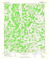 1966 Luther SE1967 Print · USGSLincoln County rural life in the mid-sixties is captured here through its network of small country churches and schoolhouses. Genealogists and researchers can trace family landmarks like Lutheran Cem, White Rock School, and the Wilson Chapel.2 unique versions available
 - 1966 Map of Wellston, 1967 Print
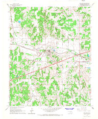 1966 Wellston1967 Print · USGSLincoln County in the mid-1960s highlights the intersection of the new Turner Toll Road and the historic St. Louis - San Francisco Railroad. Researchers can trace family sites near the Wellston Cem, identify local landmarks like the Flying G Landing Field, and locate old Oil Wells across the landscape.2 unique versions available
 - 1966 Map of Luther, 1967 Print
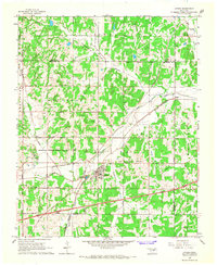 1966 Luther1967 Print · USGSThe town of Luther in the mid-sixties was a crossroads of rail commerce and active energy production. Genealogists and historians can trace family locations near several burial sites like Reunion and Tillman or follow the path of the St Louis-San Francisco railroad.3 unique versions available
 - 1966 Map of Mc Loud, 1968 Print
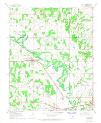 1966 Mc Loud1968 Print · USGSPottawatomie County in the mid-sixties shows a landscape defined by the winding North Canadian River and competing rail lines. Local historians can trace tribal roots and rural life through the Kickapoo Mission, Wagon Wheel Sch, and the Mc Loud townsite.3 unique versions available
 - 1967 Map of Prague NE, 1968 Print
 1967 Prague NE1968 Print · USGSOkfuskee and Seminole counties meet along the winding river loops of central Oklahoma in the late sixties. Genealogists and local historians can locate rural landmarks such as Vanzant Ch, Shady Grove Cem, and the prominent Red Mound.
 - 1967 Map of Aydelotte, 1968 Print
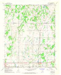 1967 Aydelotte1968 Print · USGSThe Lincoln and Pottawatomie county line in central Oklahoma is shown here in the late sixties as the local oil industry and rail network shaped the landscape. Researchers can trace the Atchison Topeka and Santa Fe tracks past Aydelotte and locate the North Rock Creek Sch.3 unique versions available
 - 1967 Map of Shawnee NE, 1968 Print
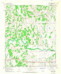 1967 Shawnee NE1968 Print · USGSPottawatomie and Lincoln counties during the late sixties are defined here by a winding river valley and a thriving petroleum industry. Genealogists can locate rural landmarks like McConnel Memorial Ch, Wakole Cem, and the settlement of Bellemont.
 - 1967 Map of Prague, 1968 Print
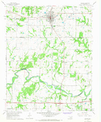 1967 Prague1968 Print · USGSThe Czech heritage and oil industry of central Oklahoma are on full display in this late 1960s survey of Prague. Researchers can locate numerous family burial sites like McKosato Cem and Lambdin Cem, or trace the North Canadian River past Keokuk Falls.2 unique versions available
Showing maps 1-25 of 199
Top cities of Lincoln County
- Chandler historical maps
- Prague historical maps
- Meeker historical maps
- Davenport historical maps
- Wellston historical maps
- Carney historical maps
See more
Frequently asked questions
- What are the different types of historical maps available for Lincoln County?
- What is the oldest map of Lincoln County?
- Where can I purchase historical maps of Lincoln County for my home or office?
- Where can I download high-res historical maps of Lincoln County?
- Are there historical topographic maps available for Lincoln County?
- Is there historical aerial imagery available for Lincoln County?
- Where are historical maps of Lincoln County sourced from?