1970s Maps of Lincoln County, Oklahoma
Explore 20 historic maps of Lincoln County from the 1970s. These maps offer a rare glimpse into what life looked like during the 1970s — showing old roads, neighborhoods, homes, and landmarks that have changed or disappeared over time.
Whether you're researching your family's past, planning a metal detecting trip, or studying how Lincoln County's landscape evolved across the 1970s, these high-resolution maps are a powerful tool for exploring the history of this region.
- Focus on a specific era: All maps on this page are from the 1970s, giving you a focused view of this time period.
- See what’s changed: Compare century-old streets, trails, and buildings to today's modern landscape using overlays and satellite layers.
- Research with precision: Use these maps for genealogy, historical research, land use analysis, or educational projects.
- View, download, or print: Maps are fully viewable online in high resolution, and can be downloaded or printed for your own records.
Start exploring Lincoln County's history through authentic maps from the 1970s. This is your window into the past.
Lincoln County, OK maps
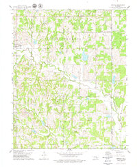
(20)- 1974 Map of Arlington, 1977 Print
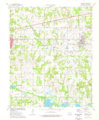
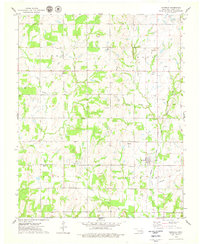
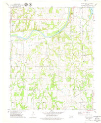
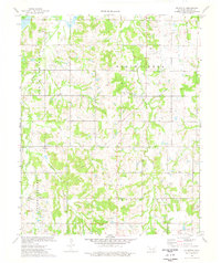 1974 Arlington1977 Print · USGSLincoln County in the mid-seventies shows a landscape shaped by petroleum extraction and small rural settlements. Researchers can trace the path of an Old Railroad Grade and locate family burial sites at Arlington Cem or Valley Cem.
 - 1974 Map of Meeker, 1977 Print
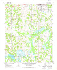
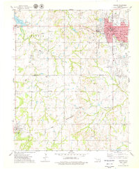
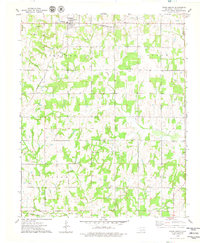
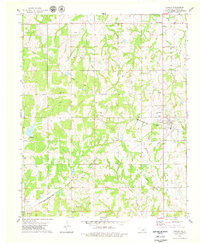
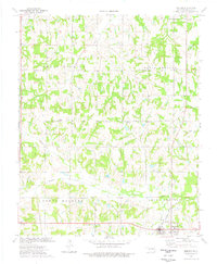 1974 Meeker1977 Print · USGSMeeker and its surrounding Lincoln County townships are shown here in the 1970s as an established agricultural and oil-producing landscape. Researchers can trace family sites near Hortons Chapel, Forest Ch, and the Atchison Topeka and Santa Fe rail line.
 - 1974 Map of Chandler, 1977 Print
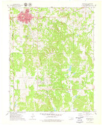
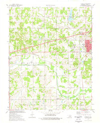 1974 Chandler1977 Print · USGSChandler and the surrounding Lincoln County countryside are captured here in the mid-1970s, showcasing a landscape shaped by petroleum and transportation. Genealogists and local historians can locate many rural landmarks including Sweet Home Cem, Mt Moriah Cem, and the settlement of Midlothian.
 - 1974 Map of Sparks, 1977 Print
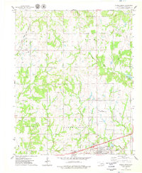
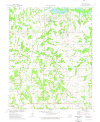 1974 Sparks1977 Print · USGSLincoln County in the mid-seventies remained a landscape of rail-fed settlements and winding creek beds. Genealogists and local historians can trace family locations near Payson, locate the White Dove Cem, or follow the Atchison Topeka and Santa Fe line.
 - 1974 Map of Davenport, 1977 Print
 1974 Davenport1977 Print · USGSLincoln County centers on Chandler and Davenport during the mid-seventies, a landscape defined by intensive energy production and rail history. Genealogists and researchers can trace family sites at Cardwell Cem, Booker Cem, and New Zion Chapel.
 - 1974 Map of Stroud South, 1977 Print
 1974 Stroud South1977 Print · USGSLincoln County's oil-rich landscape south of Stroud is captured here in the mid-1970s, showing a blend of industry and tribal heritage. Genealogists and historians can locate numerous rural burial sites like Sac & Fox Cem and Golden Valley Cem alongside the St Louis-San Francisco rail line.
 - 1974 Map of Ritts Junction, 1977 Print
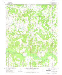 1974 Ritts Junction1977 Print · USGSThe area surrounding Ritts Junction is shown in the mid-seventies, defined by the winding Deep Fork and a heavy industrial footprint. Genealogists can locate family-named sites like Hosey Cem and Big Pond Cem or the Little Creek Ch near the rail line.
 - 1974 Map of Paden, 1977 Print
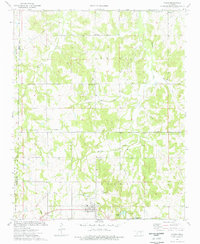 1974 Paden1977 Print · USGSIn the mid-1970s, the Paden area was a landscape of oil fields and quiet country churches. Researchers can trace the path of the Old RR Grade and locate family history at Oakdale Cem and Micawber Cem.
 - 1975 Map of Kendrick, 1979 Print
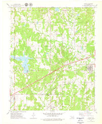
 1975 Kendrick1979 Print · USGSCentral Oklahoma's oil-rich landscape comes into focus during the 1970s between the settlements of Parkland and Kendrick. Researchers can trace the petroleum industry at the Refinery and Oil Field or locate family roots at Bethel Cem and Kendrick Cem.
 - 1975 Map of Stroud North, 1979 Print
 1975 Stroud North1979 Print · USGSThe oil fields and turnpike corridors of Lincoln County are captured here in the mid-1970s. Researchers can trace rural lineages through the Henry Cem and Black Cem or map the era's petroleum infrastructure across the North Fox Oil Field.
 - 1975 Map of Cushing, 1979 Print
 1975 Cushing1979 Print · USGSCushing and the surrounding Central Oklahoma oil country are captured here during the mid-seventies, showing the intersection of heavy industry and rural life. Genealogists and local historians can trace family locations near Union Cem, Avery, and the Lone Oak Community Hall.
 - 1975 Map of Drumright, 1979 Print
 1975 Drumright1979 Print · USGSOklahoma's oil country is captured in the mid-seventies, showing the developed landscapes of the Shannon Oil Field and the grid of Drumright. Genealogists and historians can trace the Indian Territory Oklahoma Boundary and locate the Shamrock Cem or the Old Railroad Grade.
 - 1975 Map of Tryon North, 1979 Print
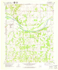
 1975 Tryon North1979 Print · USGSCentral Oklahoma's river valley comes alive in the mid-seventies, showing the intersection of rural agriculture and the oil industry. Genealogists can locate several burial sites including the Iowa Indian Cem and Oakdale Cem, while tracing the path of the Missouri - Kansas - Texas railroad.
 - 1975 Map of Depew, 1979 Print
 1975 Depew1979 Print · USGSCreek County at the peak of the 1970s energy era reveals a landscape shaped by both the Turner Toll Road and extensive oil field operations. Researchers can trace the legacy of local settlements like Depew and Milfay, or locate family sites at Oakdale Cems and Spring Creek Ch.
 - 1975 Map of Tryon South, 1979 Print
 1975 Tryon South1979 Print · USGSLincoln County, Oklahoma, in the mid-seventies reveals a landscape defined by petroleum extraction and early rail corridors. Researchers can locate active Oil Wells and a central Oil Field alongside rural landmarks like Valley Queen Cem and the Rock Spring Cem.
 - 1975 Map of North Village, 1979 Print
 1975 North Village1979 Print · USGSThe Oklahoma oil country east of Cushing comes into focus during the mid-seventies, revealing a landscape of heavy industry and quiet rural settlements. Researchers can trace the legacy of petroleum through several Tank Farms or locate family roots at Silver Star Cem and Harmony Sch.
 - 1978 Map of Meridian, 1979 Print
 1978 Meridian1979 Print · USGSOklahoma's rural borderlands between Logan and Lincoln Counties are captured here in the late seventies. Researchers can trace family history through numerous landmarks like Iowa Mission Cem, the Shiloh church, and the Old Railroad Grade.
 - 1978 Map of Carney, 1979 Print
 1978 Carney1979 Print · USGSCarney and the surrounding Iowa and Tohee townships are captured here in the late seventies as the region balanced its agricultural roots with a growing petroleum industry. Researchers can trace ancestral sites at Bethlehem Cem and Forest Cem or follow the route of the Missouri-Kansas-Texas rail line.
 - 1978 Map of Coyle, 1979 Print
 1978 Coyle1979 Print · USGSNear the banks of the Cimarron River in the late seventies, this landscape reflects a blend of energy production and rural settlement. Genealogists and historians can trace the foundations of Coyle and Langston alongside local landmarks like Paradise Cem and Friends Chapel.
 - 1978 Map of Perkins, 1979 Print
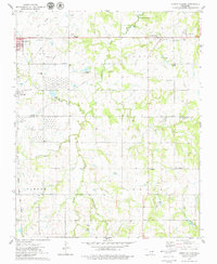
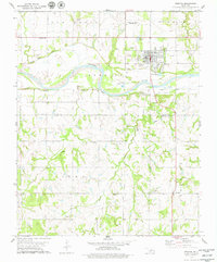 1978 Perkins1979 Print · USGSThe Cimarron River valley near Perkins is shown here in the late seventies as a landscape of agricultural research and rural community hubs. Researchers can trace the Old Railroad Grade and find family-history sites like Knipe Cem and Olivet Ch.
End of results
Showing maps 1-20 of 20
Top cities of Lincoln County
- Chandler historical maps
- Prague historical maps
- Meeker historical maps
- Davenport historical maps
- Wellston historical maps
- Carney historical maps
See more
Frequently asked questions
- What are the different types of historical maps available for Lincoln County?
- What is the oldest map of Lincoln County?
- Where can I purchase historical maps of Lincoln County for my home or office?
- Where can I download high-res historical maps of Lincoln County?
- Are there historical topographic maps available for Lincoln County?
- Is there historical aerial imagery available for Lincoln County?
- Where are historical maps of Lincoln County sourced from?