Old Maps of Stephens County, Oklahoma for Academic Research
Study the evolution of Stephens County with 166 high-resolution historic maps. Whether you're teaching, researching, or modeling changes in land use, these maps provide essential visual documentation of urban, environmental, and geographic change.
- Analyze long-term change: Track patterns in development, transportation, and natural features.
- Ideal for environmental or urban studies: Support academic projects with primary historical map data.
- Use in the classroom or lab: Educators and researchers rely on these maps to bring historical context to life.
These maps are a powerful tool for teaching, research, and visualizing how Stephens County has changed over the decades.
Stephens County, OK maps
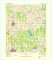
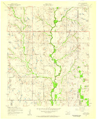
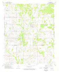
(166)- 1901 Map of Addington
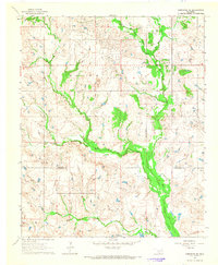
 1901 Addington1901 Print · USGSThe Chickasaw Nation at the turn of the century shows a landscape transitioning from cattle trails to rail commerce. Local historians can trace the Chisholm Trail and the Chicago Rock Island and Pacific rail line through Duncan, Comanche, and Addington.6 unique versions available
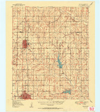
 - 1902 Map of Rush Springs
 1902 Rush Springs1902 Print · USGSThe Chickasaw Nation landscape at the turn of the century is defined by its deep river valleys and the arrival of the iron horse. Genealogists can trace early homesteads and rail-side growth in Rush Springs, Marlow, and settlements like Erin Springs along the Washita River.4 unique versions available
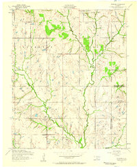
 - 1949 Map of Nellie, 1953 Print
 1949 Nellie1953 Print · USGSThe Oklahoma plains around the Comanche and Stephens county lines come alive in this post-war survey. Researchers can trace the social fabric of rural life through numerous country schools and churches, including Starr Sch, Nellie, and the Rock Creek Cem.2 unique versions available
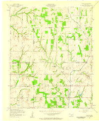
 - 1950 Map of Marlow, 1973 Print
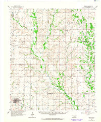
 1950 Marlow1973 Print · USGSMid-century Stephens County comes alive in this survey of the Marlow and Duncan corridor during a period of oil growth and educational shifts. Genealogists can locate family-named landmarks like Short Cem or rural schoolhouses including Gatlin Sch and Payne Sch.
 - 1951 Map of Marlow
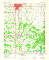
 1951 Marlow1951 Print · USGSStephens County transitions into a modern energy and transit hub during the early fifties, centering on the growing communities of Marlow and Duncan. Genealogists and historians can trace family locations near Union Center Ch, Stover Sch, or the historic path of the Chisholm Trail.2 unique versions available
 - 1955 Map of Lawton, 1958 Print
 1955 Lawton1958 Print · USGSSouthwestern Oklahoma and North Texas are shown here in the mid-fifties, dominated by the Wichita Mountains and the vital Red River watershed. Genealogists and historians can trace the foundations of Lawton alongside rural landmarks like Rainy Mountain Church and Pleasant Hill School.5 unique versions available
 - 1956 Map of Sterling, 1959 Print
 1956 Sterling1959 Print · USGSMid-century Comanche County is shown here as an active landscape of petroleum production and rural community life. Researchers can trace family roots through the Sterling Cemetery and Denton Cemetery or locate old industrial sites near Coxs Corner and the Oil Field.2 unique versions available
 - 1956 Map of Denton, 1959 Print
 1956 Denton1959 Print · USGSDenton and the rural tri-county border of southwestern Oklahoma are shown here during the mid-century petroleum expansion. Genealogists and local historians can trace family land near Woodlawn Church, Starr School, and the growing Oil and Gas Field.2 unique versions available
 - 1956 Map of Letitia, 1959 Print
 1956 Letitia1959 Print · USGSSouthwestern Oklahoma's rural landscape is captured here in the mid-fifties at the junction of three counties. Genealogists and local historians can locate the Cem near Letitia, rural schoolhouses like Beaver Bend School, and the community hub at Pumpkin Center.2 unique versions available
 - 1956 Map of Nellie, 1959 Print
 1956 Nellie1959 Print · USGSStephens County petroleum and ranching country comes to life in the mid-1950s, showing a landscape defined by small communities and oil production. Trace the locations of early schools and oil fields like Central High School, Oil City, and the Rock Creek Cemetery.2 unique versions available
 - 1956 Map of Nellie, 1960 Print
 1956 Nellie1960 Print · USGSComanche and Stephens counties are mapped in the mid-1950s, showing a rural landscape anchored by small agricultural and oil hubs. Genealogists can trace family footprints at Sterling Cemetery, Denton School, and the crossroads of Pumpkin Center.
 - 1957 Map of Ardmore, 1968 Print
 1957 Ardmore1968 Print · USGSSouth-central Oklahoma in the late fifties was a landscape of rising reservoir waters and expanding rail lines. Genealogists and historians can trace the foundations of Ardmore and Duncan or locate early recreation sites at Platt National Park and Lake Murray State Park.3 unique versions available
 - 1962 Map of Temple, 1964 Print
 1962 Temple1964 Print · USGSThe cotton and oil country of southwestern Oklahoma comes to life here in the early sixties. Genealogists and historians can trace the foundations of Temple and Corum, locating family landmarks like Shakelford Cem and the Lone Star Ch.2 unique versions available
 - 1963 Map of Ardmore
 1963 Ardmore1963 Print · USGSSouthern Oklahoma during the early sixties shows a landscape defined by the Arbuckle Mountains and a booming energy economy. Genealogists and historians can trace family-named sites across the Ardmore Oil Field, find old schools like Southeastern State College, or locate historic markers such as Boggy Depot State Park.2 unique versions available
 - 1963 Map of Harrisburg, 1964 Print
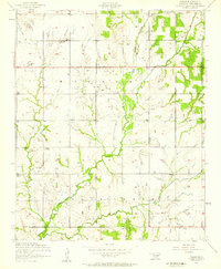
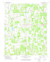
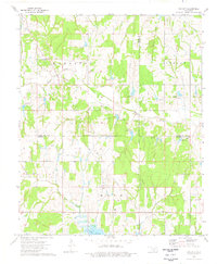
 1963 Harrisburg1964 Print · USGSStephens County, Oklahoma, is shown in the early 1960s as a landscape shaped by both cattle country and the booming petroleum industry. Researchers can trace the layout of the Harrisburg settlement or locate family sites at Stoner Cem and Fairview Ch.2 unique versions available
 - 1964 Map of Comanche SE, 1965 Print
 1964 Comanche SE1965 Print · USGSSouthern Oklahoma in the early sixties was a landscape of remote rural communities and active energy extraction. Genealogists and historians can trace family locations near Woolsey Cem and the small settlements of Brown and Loco.2 unique versions available
 - 1964 Map of Duncan South, 1965 Print
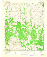
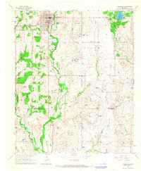
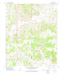
 1964 Duncan South1965 Print · USGSStephens County in the mid-1960s shows a landscape defined by its petroleum industry and deep territorial roots. Genealogists can trace family sites at Henderson-Harris Cem and Fairview Cem or locate old schools like Liberty Sch.2 unique versions available
 - 1964 Map of Comanche, 1965 Print
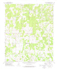
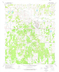
 1964 Comanche1965 Print · USGSThe city of Comanche and the surrounding Stephens County countryside are captured here in the mid-sixties as the oil industry and rail lines shaped the landscape. Genealogists and historians can trace the Old Oklahoma Territory Indian Territory Boundary Line or locate rural landmarks like Countryside Ch and the High Sch.2 unique versions available
 - 1974 Map of Pernell, 1977 Print
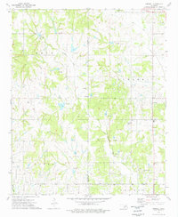 1974 Pernell1977 Print · USGSSouth-central Oklahoma's oil-rich landscapes come into focus during the mid-1970s as industrial development meets rural heritage. Researchers can trace local lineage through Pernell Sch and family landmarks like Robberson Cem and Dripping Springs Cem.
 - 1974 Map of Loco, 1977 Print
 1974 Loco1977 Print · USGSThe rural community of Loco and its surrounding oil-rich landscape are captured here during the mid-seventies. Researchers can trace family history at Mountain Grove Cem or study the industrial layout of the LOCO FIELD and Asphaltum.
 - 1974 Map of Ratliff City, 1977 Print
 1974 Ratliff City1977 Print · USGSThe Oklahoma oil country of Stephens and Carter Counties comes alive in this mid-seventies survey of the southern plains. Researchers can trace the petroleum infrastructure and small-town roots of Ratliff City, Alma, and the Graham Oil Field.
 - 1974 Map of Purdy, 1977 Print
 1974 Purdy1977 Print · USGSGarvin and Stephens counties are captured in the mid-1970s, showcasing the intersection of the regional petroleum industry and rural community life. Researchers can locate family landmarks such as Purdy Cem, Doyle Sch, and the Mountain View Ch.
 - 1974 Map of Cottonwood Creek, 1977 Print
 1974 Cottonwood Creek1977 Print · USGSIn the mid-1970s, this pocket of southern Oklahoma was a hub of energy production where the Loco Field met cattle-country creeks. Researchers can trace historical oil infrastructure alongside local landmarks like the Asphaltum Ch and Dixie Cemetery.
 - 1974 Map of Cox City, 1977 Print
 1974 Cox City1977 Print · USGSStephens and Grady counties are shown in the mid-seventies during a height of energy production. Genealogists and historians can trace family roots at Killgore Cem and Pearl Ch, or locate old drilling operations at the Cox City Oil Field.
 - 1974 Map of Velma, 1977 Print
 1974 Velma1977 Print · USGSVelma and the surrounding Stephens County countryside are shown at the height of the mid-1970s energy boom. Genealogists and local historians can trace family locations near Passmore Cem, Parks Cem, and the rural Country Side Ch.
Showing maps 1-25 of 166
Top cities of Stephens County
- Duncan historical maps
- Marlow historical maps
- Comanche historical maps
- Bray historical maps
- Central High historical maps
- Empire City historical maps
See more
Frequently asked questions
- What are the different types of historical maps available for Stephens County?
- What is the oldest map of Stephens County?
- Where can I purchase historical maps of Stephens County for my home or office?
- Where can I download high-res historical maps of Stephens County?
- Are there historical topographic maps available for Stephens County?
- Is there historical aerial imagery available for Stephens County?
- Where are historical maps of Stephens County sourced from?