1960s Maps of Woods County, Oklahoma
Explore 19 historic maps of Woods County from the 1960s. These maps offer a rare glimpse into what life looked like during the 1960s — showing old roads, neighborhoods, homes, and landmarks that have changed or disappeared over time.
Whether you're researching your family's past, planning a metal detecting trip, or studying how Woods County's landscape evolved across the 1960s, these high-resolution maps are a powerful tool for exploring the history of this region.
- Focus on a specific era: All maps on this page are from the 1960s, giving you a focused view of this time period.
- See what’s changed: Compare century-old streets, trails, and buildings to today's modern landscape using overlays and satellite layers.
- Research with precision: Use these maps for genealogy, historical research, land use analysis, or educational projects.
- View, download, or print: Maps are fully viewable online in high resolution, and can be downloaded or printed for your own records.
Start exploring Woods County's history through authentic maps from the 1960s. This is your window into the past.
Woods County, OK maps
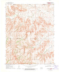
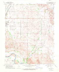
(19)- 1968 Map of Capron
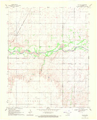
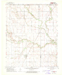 1968 Capron1968 Print · USGSWoods County and Alfalfa County meet along the Kansas border in the late sixties, where the railroad and winding creeks shaped rural life. Genealogists and local historians can locate the Capron Cem and trace the Atchison Topeka and Santa Fe tracks through Capron and Loder Siding.3 unique versions available
 - 1969 Map of Dacoma, 1971 Print
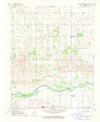
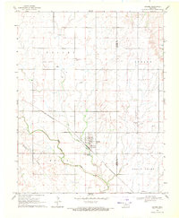 1969 Dacoma1971 Print · USGSThe agricultural plains of Woods County are captured here in the late sixties as the town of Dacoma remains a key rail stop. Researchers can locate family heritage sites like Union Center Cem and trace the original St Louis - San Francisco railroad route.2 unique versions available
 - 1969 Map of Tegarden NE, 1971 Print
 1969 Tegarden NE1971 Print · USGSNear the Oklahoma-Kansas border in the late sixties, this rural landscape centers on the winding Salt Fork Arkansas River. Genealogists and local historians can locate community pillars like Cedar Grove Ch, Winchester, and the Greenleaf Sch.
 - 1969 Map of Tegarden SE, 1971 Print
 1969 Tegarden SE1971 Print · USGSWoods County is shown at a moment of transition in the late sixties as the energy industry began to reshape the prairie. Genealogists and historians can locate Star Cem, Manila Cem, and early Gas Wells along the banks of Turkey Creek.
 - 1969 Map of Alva SE, 1971 Print
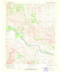
 1969 Alva SE1971 Print · USGSNorthwestern Oklahoma’s prairie and river landscape is captured here in the late sixties as railroads still dominated the rural transit corridors. Genealogists can locate Liberty Cem and Short Springs Cem or trace rail activity at Brink and Ashley.
 - 1969 Map of Dacoma SW, 1971 Print
 1969 Dacoma SW1971 Print · USGSWoods County land divisions and energy infrastructure are captured here in the late sixties. Genealogists and local historians can locate Highland Cem, trace the course of Sand Creek, and identify early Gas Wells near Belle.2 unique versions available
 - 1969 Map of Glass Mountains NW, 1971 Print
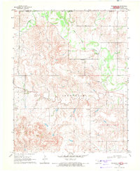
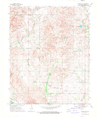
 1969 Glass Mountains NW1971 Print · USGSOklahoma's Glass Mountains region comes into focus during the late sixties as the riverbed defines the county line. Researchers can trace land ownership through labels like Jones and Crowell, or locate the historic Galena Cem near the Cimarron River.2 unique versions available
 - 1969 Map of Waynoka NW, 1971 Print
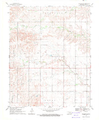
 1969 Waynoka NW1971 Print · USGSWoods County in the late sixties reveals a landscape shaped by creek systems and the energy industry. Researchers can trace the Atchison Topeka and Santa Fe rail line past Morning Star Ch and the Sand Dunes of the river valley.
 - 1969 Map of Tegarden NW, 1971 Print
 1969 Tegarden NW1971 Print · USGSThe Oklahoma-Kansas border country comes into focus in the late sixties, showing the rural townships of Woods County. Genealogists and explorers can locate Ewing Cemetery and Fulkner Cave, or trace the winding paths of Yellowstone Creek and Greenleaf Creek.
 - 1969 Map of Hopeton, 1971 Print
 1969 Hopeton1971 Print · USGSWoods County, Oklahoma, is documented here in the late sixties as a landscape of rail-side settlements and growing energy infrastructure. Genealogists can locate the IOOF Cem and Pleasant View Ch or trace the St Louis San Francisco rail line through Hopeton.
 - 1969 Map of Avard, 1971 Print
 1969 Avard1971 Print · USGSThe rail junction at Avard thrived in the late sixties at the crossroads of two major Oklahoma lines. Genealogists and historians can trace family locations near Memorial Hill Cem or locate the era's energy infrastructure like the Pipeline and scattered Gas Wells.
 - 1969 Map of Alva NW, 1971 Print
 1969 Alva NW1971 Print · USGSThe Oklahoma-Kansas borderlands in the late sixties come into focus here, showing a landscape shaped by the Salt Fork Arkansas River. Genealogists and local historians can locate Fairview Cem and the Fritzlen terrain near Driftwood Creek.
 - 1969 Map of Waynoka East, 1971 Print
 1969 Waynoka East1971 Print · USGSWoods County in the late sixties is revealed here as a landscape of rail transit and river boundaries. Genealogists and local historians can trace family ties to landmarks like Walnut Grove Cem, Rose Valley Sch, and the busy Waynoka rail corridor.
 - 1969 Map of Glass Mountains NE, 1971 Print
 1969 Glass Mountains NE1971 Print · USGSNorthwestern Oklahoma’s prairie and river lowlands are captured here in the late sixties, showing the rural communities of Woods and Major counties. Genealogists and historians can locate Pleasant Ridge Cem, Oakdale Ch, and early energy sites like the Southwest Oakdale Gas Field.
 - 1969 Map of Tegarden, 1971 Print
 1969 Tegarden1971 Print · USGSWoods County is seen here in the late sixties as the energy industry began to dot the ranching landscape with infrastructure. Researchers can locate the Whitehorse Cem, the small town of Tegarden, and industrial sites like the Oil Well near Turkey Creek.
 - 1969 Map of Togo, 1971 Print
 1969 Togo1971 Print · USGSMajor County during the late 1960s shows a landscape defined by the shifting Cimarron River and active energy exploration. Genealogists can locate the settlement of Togo and trace family sites near Lone Star Cem and Connor Cem.
 - 1969 Map of Waynoka West, 1971 Print
 1969 Waynoka West1971 Print · USGSWoods County in the late sixties reveals a landscape defined by the winding Cimarron River and the bustling rail operations in Waynoka. Genealogists and historians can trace the rail corridor through Heman or locate the early layout of the Little Sahara State Recreation Area.2 unique versions available
 - 1969 Map of Alva, 1971 Print
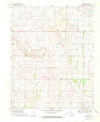
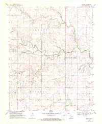
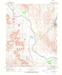
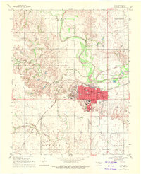 1969 Alva1971 Print · USGSAlva is captured in the late sixties as a thriving railway crossroads and educational center in Oklahoma's Woods County. Researchers can trace the neighborhood footprints of Northwestern State College, find the Sacred Heart Ch, or locate the historic siding at Noel.
 - 1969 Map of Dacoma SE, 1971 Print
 1969 Dacoma SE1971 Print · USGSWoods and Alfalfa counties show a landscape of rural tradition and growing petroleum production in the late sixties. Genealogists and historians can trace family ties at the Good Hope Cem and Green Valley Ch or follow the path of the St Louis San Francisco railroad.
End of results
Showing maps 1-19 of 19
Top cities of Woods County
- Alva historical maps
- Waynoka historical maps
- Freedom historical maps
- Dacoma historical maps
- Capron historical maps
- Avard historical maps
Frequently asked questions
- What are the different types of historical maps available for Woods County?
- What is the oldest map of Woods County?
- Where can I purchase historical maps of Woods County for my home or office?
- Where can I download high-res historical maps of Woods County?
- Are there historical topographic maps available for Woods County?
- Is there historical aerial imagery available for Woods County?
- Where are historical maps of Woods County sourced from?