Old Maps of Woods County, Oklahoma for Hiking & Exploration
Hike through history with 184 historic maps of Woods County. Explore old trails, ghost towns, and forgotten backroads — perfect for outdoor adventurers and local explorers.
- Rediscover forgotten places: Map out old mining camps, roads, and footpaths that no longer exist on modern maps.
- Layer with modern tools: Combine with LiDAR or satellite views to plan hikes through historical terrain.
- Made for exploration: Popular among hikers, overlanders, and local history lovers.
Use these maps to find adventure and explore the hidden past of Woods County.
Woods County, OK maps
(184)- 1892 Map of Coldwater
 1892 Coldwater1892 Print · USGSComanche County during the late nineteenth-century settlement boom shows a network of emerging prairie towns and cattle-shipping rail lines. Genealogists can trace early homestead locations near Coldwater, Nescatunga, and along the banks of Mule Creek.5 unique versions available
 - 1955 Map of Woodward, 1967 Print
 1955 Woodward1967 Print · USGSNorthwest Oklahoma and the bordering plains are captured during the mid-sixties, showing a landscape defined by river valleys and massive water projects. Researchers can trace family roots in towns like Woodward and Alva or locate landmarks such as the Western Oklahoma State Hospital and Kegelman AF.3 unique versions available
 - 1955 Map of Pratt, 1968 Print
 1955 Pratt1968 Print · USGSSouth-central Kansas during the mid-fifties presents a landscape of sprawling oil fields and critical rail junctions. Researchers can trace the paths of the Atchison Topeka and Santa Fe railroad or locate local landmarks like the Blue Ridge Community House and Camp Carlisle.3 unique versions available
 - 1958 Map of Woodward
 1958 Woodward1958 Print · USGSNorthwest Oklahoma and the neighboring panhandle borders are shown here during a period of steady mid-century growth. Researchers can trace the rail networks of the Atchison Topeka and Santa Fe and locate landmarks like the Western Oklahoma State Hospital and Port Supply Reservoir.2 unique versions available
 - 1959 Map of Pratt
 1959 Pratt1959 Print · USGSSouth-central Kansas thrived as a rail and agricultural hub in the late fifties, where the Arkansas River meets a vast grid of section roads. Researchers can trace the path of the Missouri Pacific railroad through settlements like Turon and Stafford, or locate family landmarks like the Prairie Oak School.2 unique versions available
 - 1968 Map of Capron
 1968 Capron1968 Print · USGSWoods County and Alfalfa County meet along the Kansas border in the late sixties, where the railroad and winding creeks shaped rural life. Genealogists and local historians can locate the Capron Cem and trace the Atchison Topeka and Santa Fe tracks through Capron and Loder Siding.3 unique versions available
 - 1969 Map of Dacoma, 1971 Print
 1969 Dacoma1971 Print · USGSThe agricultural plains of Woods County are captured here in the late sixties as the town of Dacoma remains a key rail stop. Researchers can locate family heritage sites like Union Center Cem and trace the original St Louis - San Francisco railroad route.2 unique versions available
 - 1969 Map of Tegarden NE, 1971 Print
 1969 Tegarden NE1971 Print · USGSNear the Oklahoma-Kansas border in the late sixties, this rural landscape centers on the winding Salt Fork Arkansas River. Genealogists and local historians can locate community pillars like Cedar Grove Ch, Winchester, and the Greenleaf Sch.
 - 1969 Map of Tegarden SE, 1971 Print
 1969 Tegarden SE1971 Print · USGSWoods County is shown at a moment of transition in the late sixties as the energy industry began to reshape the prairie. Genealogists and historians can locate Star Cem, Manila Cem, and early Gas Wells along the banks of Turkey Creek.
 - 1969 Map of Alva SE, 1971 Print
 1969 Alva SE1971 Print · USGSNorthwestern Oklahoma’s prairie and river landscape is captured here in the late sixties as railroads still dominated the rural transit corridors. Genealogists can locate Liberty Cem and Short Springs Cem or trace rail activity at Brink and Ashley.
 - 1969 Map of Dacoma SW, 1971 Print
 1969 Dacoma SW1971 Print · USGSWoods County land divisions and energy infrastructure are captured here in the late sixties. Genealogists and local historians can locate Highland Cem, trace the course of Sand Creek, and identify early Gas Wells near Belle.2 unique versions available
 - 1969 Map of Glass Mountains NW, 1971 Print
 1969 Glass Mountains NW1971 Print · USGSOklahoma's Glass Mountains region comes into focus during the late sixties as the riverbed defines the county line. Researchers can trace land ownership through labels like Jones and Crowell, or locate the historic Galena Cem near the Cimarron River.2 unique versions available
 - 1969 Map of Waynoka NW, 1971 Print
 1969 Waynoka NW1971 Print · USGSWoods County in the late sixties reveals a landscape shaped by creek systems and the energy industry. Researchers can trace the Atchison Topeka and Santa Fe rail line past Morning Star Ch and the Sand Dunes of the river valley.
 - 1969 Map of Tegarden NW, 1971 Print
 1969 Tegarden NW1971 Print · USGSThe Oklahoma-Kansas border country comes into focus in the late sixties, showing the rural townships of Woods County. Genealogists and explorers can locate Ewing Cemetery and Fulkner Cave, or trace the winding paths of Yellowstone Creek and Greenleaf Creek.
 - 1969 Map of Hopeton, 1971 Print
 1969 Hopeton1971 Print · USGSWoods County, Oklahoma, is documented here in the late sixties as a landscape of rail-side settlements and growing energy infrastructure. Genealogists can locate the IOOF Cem and Pleasant View Ch or trace the St Louis San Francisco rail line through Hopeton.
 - 1969 Map of Avard, 1971 Print
 1969 Avard1971 Print · USGSThe rail junction at Avard thrived in the late sixties at the crossroads of two major Oklahoma lines. Genealogists and historians can trace family locations near Memorial Hill Cem or locate the era's energy infrastructure like the Pipeline and scattered Gas Wells.
 - 1969 Map of Alva NW, 1971 Print
 1969 Alva NW1971 Print · USGSThe Oklahoma-Kansas borderlands in the late sixties come into focus here, showing a landscape shaped by the Salt Fork Arkansas River. Genealogists and local historians can locate Fairview Cem and the Fritzlen terrain near Driftwood Creek.
 - 1969 Map of Waynoka East, 1971 Print
 1969 Waynoka East1971 Print · USGSWoods County in the late sixties is revealed here as a landscape of rail transit and river boundaries. Genealogists and local historians can trace family ties to landmarks like Walnut Grove Cem, Rose Valley Sch, and the busy Waynoka rail corridor.
 - 1969 Map of Glass Mountains NE, 1971 Print
 1969 Glass Mountains NE1971 Print · USGSNorthwestern Oklahoma’s prairie and river lowlands are captured here in the late sixties, showing the rural communities of Woods and Major counties. Genealogists and historians can locate Pleasant Ridge Cem, Oakdale Ch, and early energy sites like the Southwest Oakdale Gas Field.
 - 1969 Map of Tegarden, 1971 Print
 1969 Tegarden1971 Print · USGSWoods County is seen here in the late sixties as the energy industry began to dot the ranching landscape with infrastructure. Researchers can locate the Whitehorse Cem, the small town of Tegarden, and industrial sites like the Oil Well near Turkey Creek.
 - 1969 Map of Togo, 1971 Print
 1969 Togo1971 Print · USGSMajor County during the late 1960s shows a landscape defined by the shifting Cimarron River and active energy exploration. Genealogists can locate the settlement of Togo and trace family sites near Lone Star Cem and Connor Cem.
 - 1969 Map of Waynoka West, 1971 Print
 1969 Waynoka West1971 Print · USGSWoods County in the late sixties reveals a landscape defined by the winding Cimarron River and the bustling rail operations in Waynoka. Genealogists and historians can trace the rail corridor through Heman or locate the early layout of the Little Sahara State Recreation Area.2 unique versions available
 - 1969 Map of Alva, 1971 Print
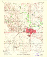 1969 Alva1971 Print · USGSAlva is captured in the late sixties as a thriving railway crossroads and educational center in Oklahoma's Woods County. Researchers can trace the neighborhood footprints of Northwestern State College, find the Sacred Heart Ch, or locate the historic siding at Noel.
 - 1969 Map of Dacoma SE, 1971 Print
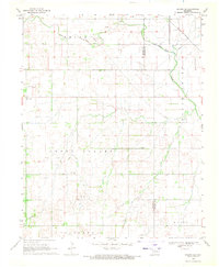 1969 Dacoma SE1971 Print · USGSWoods and Alfalfa counties show a landscape of rural tradition and growing petroleum production in the late sixties. Genealogists and historians can trace family ties at the Good Hope Cem and Green Valley Ch or follow the path of the St Louis San Francisco railroad.
 - 1970 Map of Lookout, 1972 Print
 1970 Lookout1972 Print · USGSThe Oklahoma-Kansas borderlands in the early 1970s reveal a landscape shaped by the energy industry and rural community life. Researchers can trace the sprawling Patterson Oil and Gas Field and locate landmarks like Lookout Ch and the Coy Community Hall.
Showing maps 1-25 of 184
Top cities of Woods County
- Alva historical maps
- Waynoka historical maps
- Freedom historical maps
- Dacoma historical maps
- Capron historical maps
- Avard historical maps
Frequently asked questions
- What are the different types of historical maps available for Woods County?
- What is the oldest map of Woods County?
- Where can I purchase historical maps of Woods County for my home or office?
- Where can I download high-res historical maps of Woods County?
- Are there historical topographic maps available for Woods County?
- Is there historical aerial imagery available for Woods County?
- Where are historical maps of Woods County sourced from?