2020s Maps of Washington County, Pennsylvania
Explore 30 historic maps of Washington County from the 2020s. These maps offer a rare glimpse into what life looked like during the 2020s — showing old roads, neighborhoods, homes, and landmarks that have changed or disappeared over time.
Whether you're researching your family's past, planning a metal detecting trip, or studying how Washington County's landscape evolved across the 2020s, these high-resolution maps are a powerful tool for exploring the history of this region.
- Focus on a specific era: All maps on this page are from the 2020s, giving you a focused view of this time period.
- See what’s changed: Compare century-old streets, trails, and buildings to today's modern landscape using overlays and satellite layers.
- Research with precision: Use these maps for genealogy, historical research, land use analysis, or educational projects.
- View, download, or print: Maps are fully viewable online in high resolution, and can be downloaded or printed for your own records.
Start exploring Washington County's history through authentic maps from the 2020s. This is your window into the past.
Washington County, PA maps
(30)- 2023 Map of Mather, 2023 Print
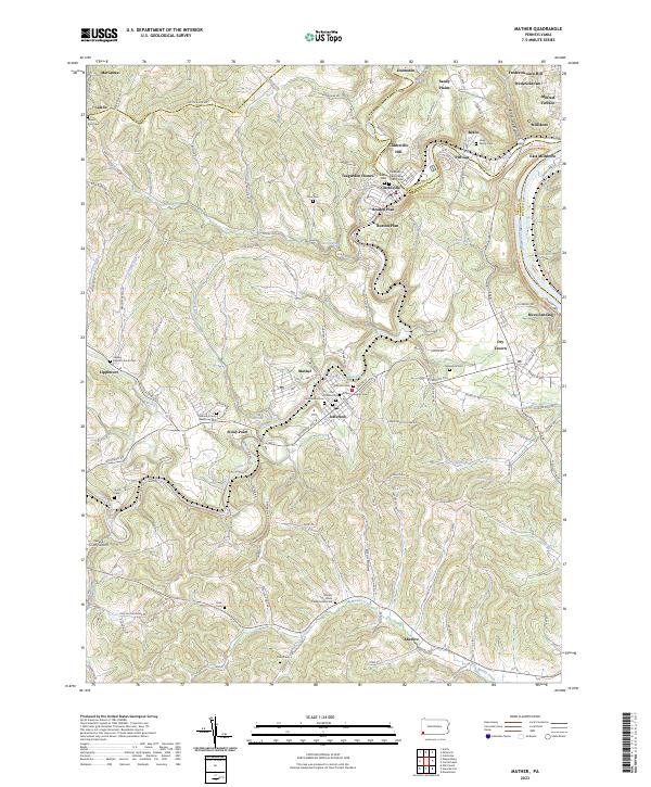 2023 Mather2023 Print · USGSThe Monongahela River valley and the Tenmile Creek forks define this southwestern Pennsylvania landscape in the twenty-first century. Researchers can trace family history through local landmarks like Moredock Cem, Rices Landing, and the Greene County Airport.
 - 2023 Map of Rogersville, 2023 Print
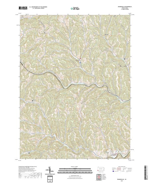 2023 Rogersville2023 Print · USGSModern Greene County remains deeply connected to its roots in this contemporary survey. Genealogists can trace family names through numerous burial sites like Rogersville Cem or locate old community hubs such as Swarts and Deer Lick.
 - 2023 Map of Wind Ridge, 2023 Print
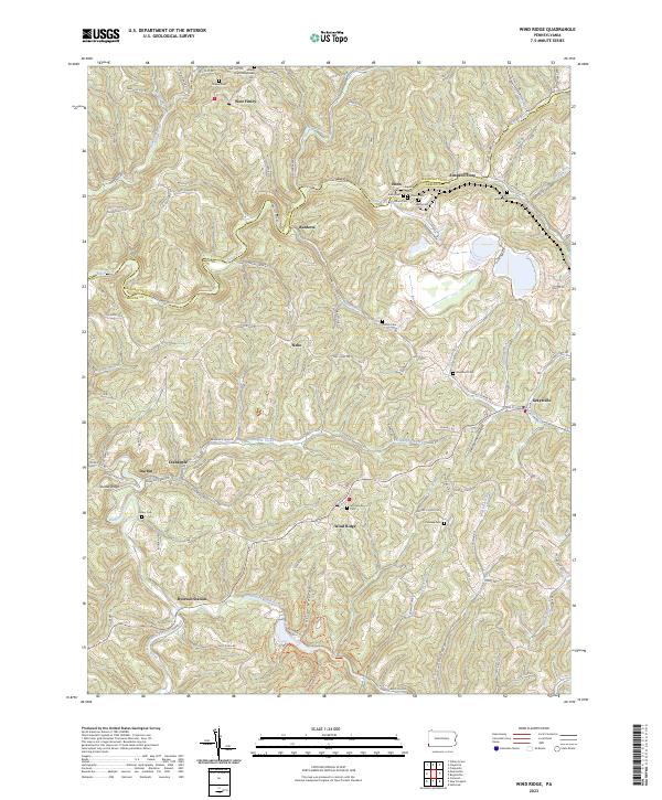 2023 Wind Ridge2023 Print · USGSThe Greene and Washington County borderlands are captured here in the early twenty-first century, showing a rural landscape shaped by coal and agriculture. Genealogists can locate family landmarks like Simpson Store, Zollars Cem, and the Bailey Mine.
 - 2023 Map of Midway, 2023 Print
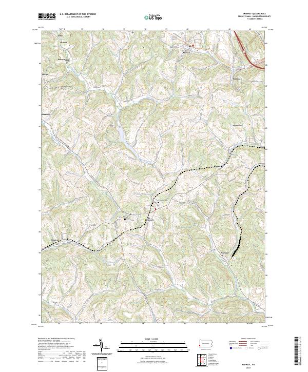 2023 Midway2023 Print · USGSWashington County’s hilly terrain and coal-country history are on full display in this recent survey. Genealogists can trace family roots at Mount Pleasant Cem or Cherry Valley Cem, while following the old rail grade along the Panhandle Trl.
 - 2023 Map of Ellsworth, 2023 Print
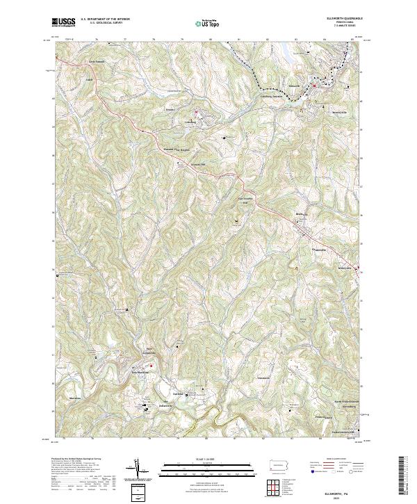 2023 Ellsworth2023 Print · USGSWashington County communities like Ellsworth and Marianna are documented here during a period of modern persistence. Genealogists can trace deep local roots through numerous family burial sites such as Crooks Cem and historic locations like Old Zollarsville.
 - 2023 Map of Burgettstown, 2023 Print
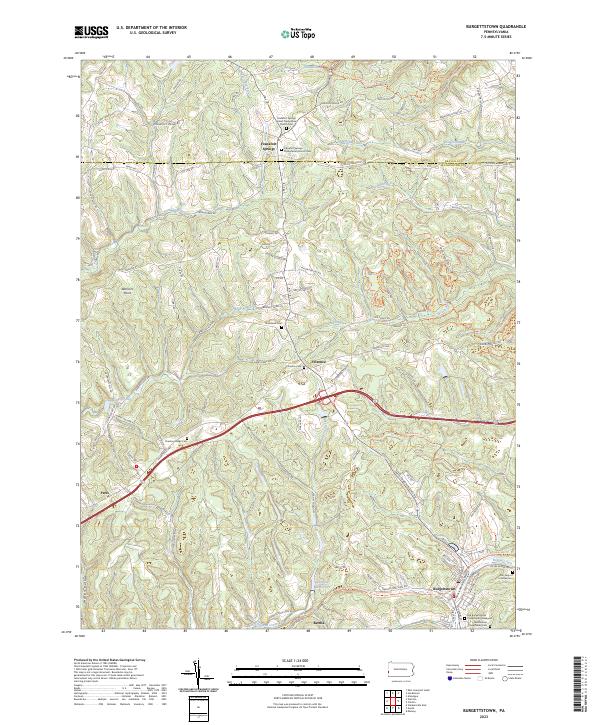 2023 Burgettstown2023 Print · USGSThe rolling hills of Washington County are shown here in the 2020s, revealing a landscape of historic cemeteries and quiet boroughs. Researchers can locate the Old Burgettstown Presbyterian Graveyard and trace the paths of Harmon Creek and Aunt Clara Fork.
 - 2023 Map of Carmichaels, 2023 Print
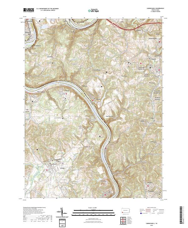 2023 Carmichaels2023 Print · USGSThe Monongahela River valley comes alive in this contemporary view of its historic coal towns and riverside landings. Genealogists and researchers can trace family lines through Greene Academy Cem or explore the layouts of Rices Landing and Crucible.
 - 2023 Map of Washington West, 2023 Print
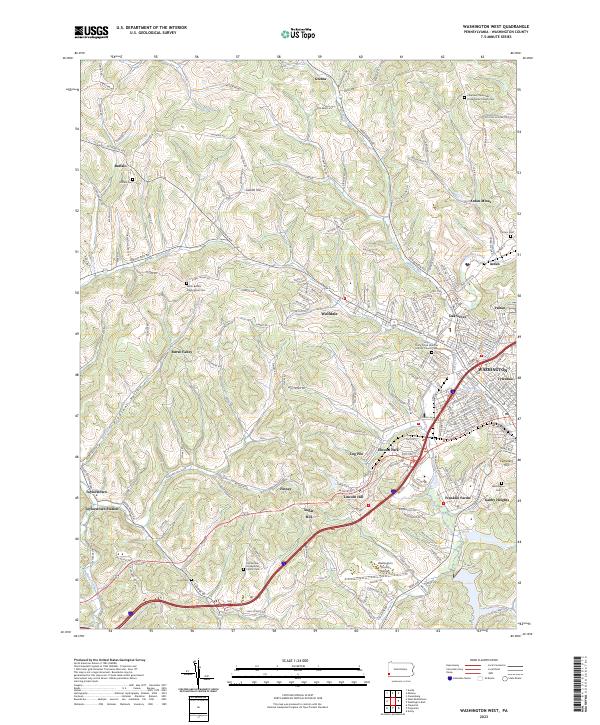 2023 Washington West2023 Print · USGSWestern Washington County during the early twenty-first century maintains its distinct coal-country and agricultural character. Genealogists can trace family names through several historic sites including Horn Cem, Arden Mines, and Buffalo Cem.
 - 2023 Map of Claysville, 2023 Print
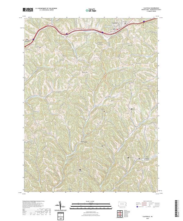 2023 Claysville2023 Print · USGSThe hills of Washington County are shown in detail during the early 2020s, centering on the historic corridor between Claysville and West Alexander. Family historians can trace local landmarks like Stoney Point Cem, Dogwood Grove Cem, and the high ground of Sampson Hill.
 - 2023 Map of Prosperity, 2023 Print
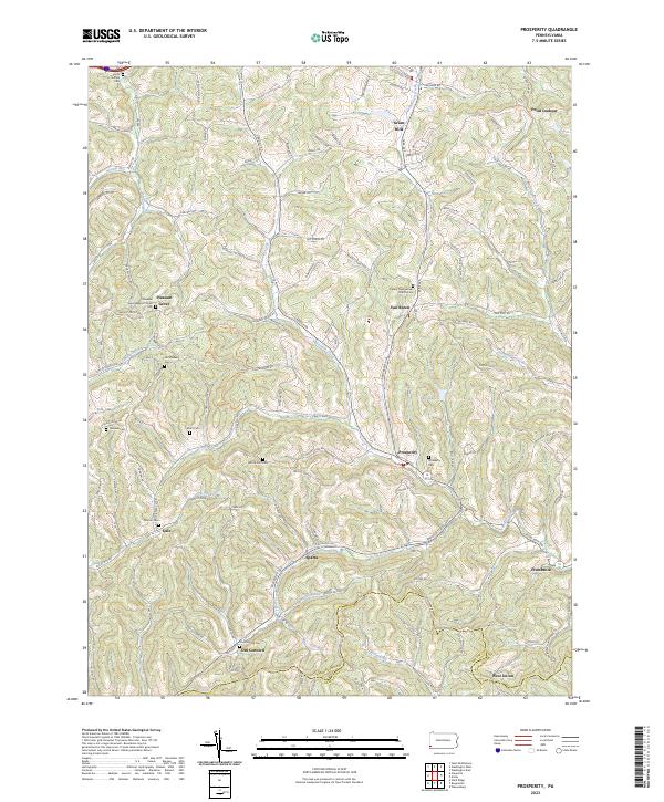 2023 Prosperity2023 Print · USGSWashington County's rural heritage is well-preserved in this study of the hills near Prosperity and Old Concord. Genealogists can trace family lineages through numerous local sites including Old Quaker Cem, Pleasant Grove Baptist Church, and Mount Zion Cem.
 - 2023 Map of West Middletown, 2023 Print
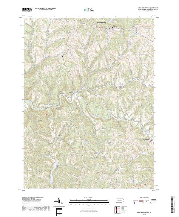 2023 West Middletown2023 Print · USGSWestern Washington County's ridge-and-hollow terrain is captured here in the modern era, showing the enduring footprint of historic hill towns. Genealogists and local historians can locate numerous rural burial sites like Miller Cem and Hupp Cem alongside settlements at West Middletown and Taylorstown.
 - 2023 Map of Avella, 2023 Print
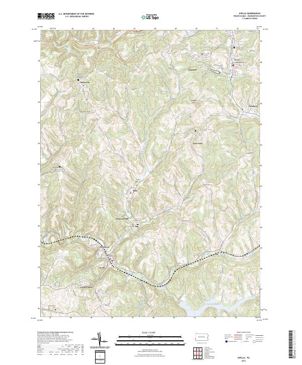 2023 Avella2023 Print · USGSThe rural valleys of Washington County are captured here in a period of transition between its industrial past and modern landscape. Genealogists can trace family names through numerous sites like Eldersville Methodist Church Cem, Pattersons Mill, and Browntown.
 - 2023 Map of Clinton, 2023 Print
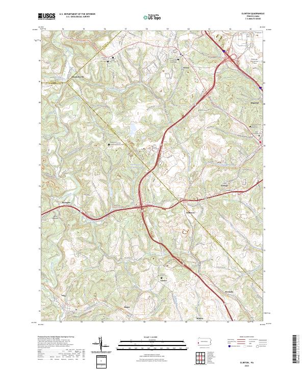 2023 Clinton2023 Print · USGSAllegheny and Washington Counties meet in this modern survey of western Pennsylvania's rolling hills and airport outskirts. Researchers can locate family sites like the James and Cecilia Henderson Family Cem and the historic Steubenville Pike.
 - 2023 Map of Canonsburg, 2023 Print
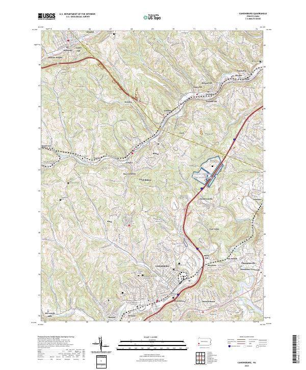 2023 Canonsburg2023 Print · USGSWashington County settlement patterns and the industrial geography of the Chartiers Valley are visible in this contemporary survey. Researchers can trace family history through a wealth of local landmarks like Millers Run Presbyterian Cem, McConnells Mills, and the National Cem of the Alleghenies.
 - 2023 Map of Washington East, 2023 Print
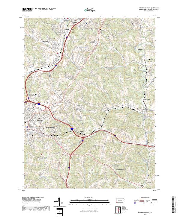 2023 Washington East2023 Print · USGSGreater WASHINGTON and its neighboring boroughs come to life in this contemporary survey of the Pennsylvania countryside. Researchers can trace historic local sites like Washington and Jefferson College, the Beth Israel Cem, and the uniquely named settlement of Eighty Four.
 - 2023 Map of Hackett, 2023 Print
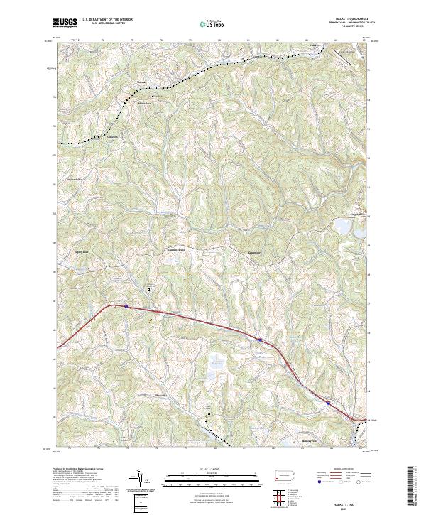 2023 Hackett2023 Print · USGSWashington County at the start of the 2020s shows a landscape where small rural settlements like Eighty Four and Dunningsville meet modern reservoirs and airfields. Researchers can trace local history through sites like Pigeon Creek Cem and the industrially named Mine Number Sixty Reservoir.
 - 2023 Map of Bridgeville, 2023 Print
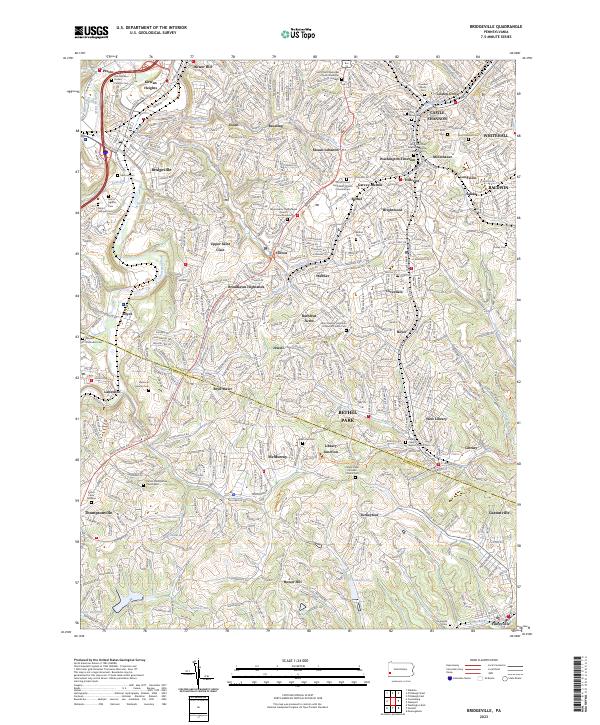 2023 Bridgeville2023 Print · USGSThe southern Pittsburgh suburbs and the Allegheny-Washington county line are shown here in modern detail. Researchers can trace family history through numerous churchyards and cemeteries like Queen of Heaven Cem and Saint Sava Cem, or explore older settlements such as Beadling and Mollenauer.
 - 2023 Map of Oakdale, 2023 Print
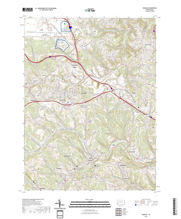 2023 Oakdale2023 Print · USGSThe valleys of western Allegheny County come into focus in this contemporary survey, showing the enduring geography of the Oakdale and McDonald areas. Genealogists and historians can trace the many family-named cemeteries and the converted rail route of the Panhandle Trl as it passes through Noblestown and Sturgeon.
 - 2023 Map of Amity, 2023 Print
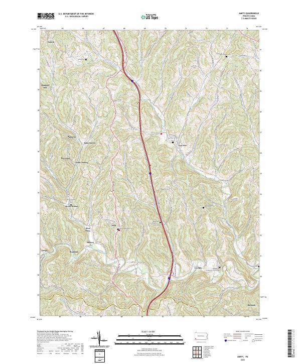 2023 Amity2023 Print · USGSThe rural uplands of Washington County are captured in this recent survey, showing the enduring pattern of valley settlements and ridge-top roads. Family historians can locate several burial grounds like Vankirk Cem or trace the early paths around Chambers Mill and Ten Mile.
 - 2023 Map of California, 2023 Print
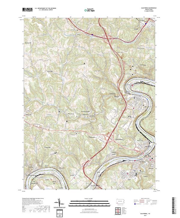 2023 California2023 Print · USGSThe Monongahela River valley comes to life in this detailed record of Washington and Fayette Counties during the early 21st century. Researchers can trace ancestral sites through dozens of local burial grounds like California Cem or explore the riverfront legacy of Coal Center and West Brownsville.
 - 2023 Map of Fayette City, 2023 Print
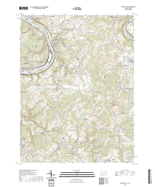 2023 Fayette City2023 Print · USGSFayette and Washington counties meet along the Monongahela River valley during a period of modern transition. Local historians can trace numerous pioneer burial sites and family plots, including the Providence Meeting House Cem, Havely Cem, and the riverside rail corridor of the Wheeling-Pitts RR.
 - 2023 Map of Donora, 2023 Print
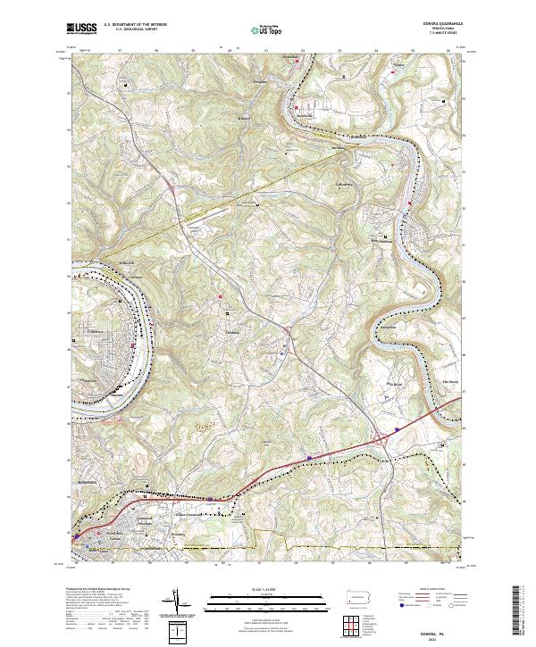 2023 Donora2023 Print · USGSThe industrial river valleys of Washington and Westmoreland counties are shown here in the early twenty-first century. Researchers can trace family sites at Round Hill Cem, the Plummer School, and many churches from Donora to West Newton.
 - 2023 Map of Glassport, 2023 Print
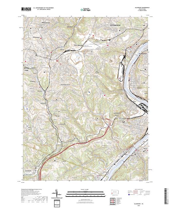 2023 Glassport2023 Print · USGSThe industrial river valleys south of Pittsburgh come into sharp focus in this detailed topographic study. Genealogists and local researchers can locate numerous historical burial sites like Lebanon Church Cem or trace the old rail and trail routes near Cochrans Mill and Coal Valley.
 - 2023 Map of Monongahela, 2023 Print
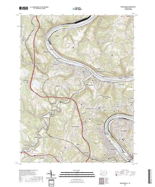 2023 Monongahela2023 Print · USGSThe Monongahela River valley shows its industrial character and deep family roots in the 2020s. Genealogists can trace decades of history through dozens of sites like the Horseshoe Bottom Presbyterian Church Cem and Sholom Cem.
 - 2023 Map of Bethany, 2023 Print
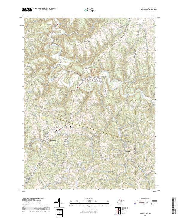 2023 Bethany2023 Print · USGSThe Northern Panhandle's academic and rural heritage is on display here during the early twenty-first century. Genealogists and local historians can locate family landmarks like Cox Cem and Morgan Cem or trace the early footprints of Bethany College and West Liberty University.
Showing maps 1-25 of 30
Top cities of Washington County
- Washington historical maps
- Cecil Township historical maps
- Canonsburg historical maps
- South Strabane Township historical maps
- California historical maps
- Charleroi historical maps
See more
Frequently asked questions
- What are the different types of historical maps available for Washington County?
- What is the oldest map of Washington County?
- Where can I purchase historical maps of Washington County for my home or office?
- Where can I download high-res historical maps of Washington County?
- Are there historical topographic maps available for Washington County?
- Is there historical aerial imagery available for Washington County?
- Where are historical maps of Washington County sourced from?