Old Maps of Rapid City, South Dakota for Hiking & Exploration
Hike through history with 39 historic maps of Rapid City. Explore old trails, ghost towns, and forgotten backroads — perfect for outdoor adventurers and local explorers.
- Rediscover forgotten places: Map out old mining camps, roads, and footpaths that no longer exist on modern maps.
- Layer with modern tools: Combine with LiDAR or satellite views to plan hikes through historical terrain.
- Made for exploration: Popular among hikers, overlanders, and local history lovers.
Use these maps to find adventure and explore the hidden past of Rapid City.
Rapid City, SD maps
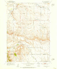
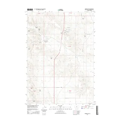
(39)- 1893 Map of Rapid
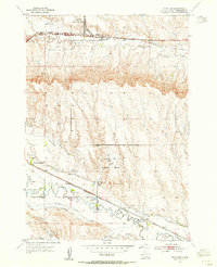
 1893 Rapid1893 Print · USGSThe Black Hills frontier comes alive in the late nineteenth century as rail lines and military outposts shape the territory. Genealogists and researchers can trace the early layout of Rapid, locate Fort Meade, and find family-named landmarks like Doe Dotie Ranch or Piedmont.2 unique versions available
 - 1894 Map of Hermosa
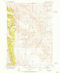
 1894 Hermosa1894 Print · USGSThe Black Hills gold and ranching frontier comes into focus during the late nineteenth century as mining camps and rail lines began to anchor the territory. Genealogists and historians can trace early families in Keystone, Rockerville, and around the Etta Mine.2 unique versions available
 - 1898 Map of Rapid
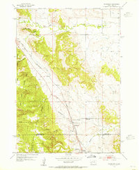
 1898 Rapid1898 Print · USGSThe Black Hills foothills come alive in the 1890s, where early railroads meet military outposts and pioneer settlements. Trace the early streets of Rapid City, the grounds of Fort Meade, and localized landmarks like Crystal Cave.2 unique versions available
 - 1901 Map of Hermosa
 1901 Hermosa1901 Print · USGSThe Black Hills frontier comes alive in this survey of Pennington and Custer counties during the height of the regional mining boom. Researchers can trace the early footprints of Keystone, Rockerville, and Wind Cave, along with vanished industrial sites like Etta Mill.4 unique versions available
 - 1903 Map of Rapid
 1903 Rapid1903 Print · USGSThe Black Hills transition from mountains to plains at the turn of the century, centered on the growing rail hub of Rapid. Researchers can trace the early rail corridor of the Fremont Elkhorn and Missouri Valley through Fort Meade and Piedmont.4 unique versions available
 - 1953 Map of Boxelder, 1954 Print
 1953 Boxelder1954 Print · USGSPennington County in the early fifties shows a landscape of expanding military aviation and complex prairie irrigation. Genealogists and local historians can trace rural school districts like White Eagle Sch and Lone Tree Sch alongside the tracks of the Chicago and North Western.4 unique versions available
 - 1953 Map of Hermosa NW, 1955 Print
 1953 Hermosa NW1955 Print · USGSPennington County, South Dakota, is captured here in the early fifties as a landscape of isolated homesteads and high plains railroading. Researchers can trace the Chicago and North Western line through Ajax and locate rural landmarks like Neely Sch.3 unique versions available
 - 1953 Map of Blackhawk, 1955 Print
 1953 Blackhawk1955 Print · USGSThe Black Hills eastern foothills meet the prairie in the early fifties, as the Chicago and North Western railroad dictates the pace of local life. Trace rural education and early roadside culture through Benoit Sch and the local Drive-in Theater.4 unique versions available
 - 1953 Map of Rapid City East, 1955 Print
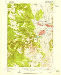
 1953 Rapid City East1955 Print · USGSRapid City and the surrounding Pennington County plains are captured here in the early fifties during a period of steady post-war expansion. Researchers can locate vanished landmarks like Halley Airport or trace the early campus of the South Dakota School of Mines.7 unique versions available
 - 1953 Map of Rapid City NW, 1955 Print
 1953 Rapid City NW1955 Print · USGSMeade and Pennington counties appear here in the early fifties, showing a rural landscape of scattered ranching and community schoolhouses. Researchers can locate the Elk Vale Cem, Holy Family Ch, and the site of School No 3 (Abandoned).3 unique versions available
 - 1953 Map of Rapid City West, 1955 Print
 1953 Rapid City West1955 Print · USGSRapid City was evolving from a Black Hills gateway into a modern regional center during the early fifties. Genealogists and historians can trace institutional roots at the Sioux Sanatorium or locate rural landmarks like Whispering Pine Sett and Red Brick Sch.4 unique versions available
 - 1953 Map of Rapid City, 1964 Print
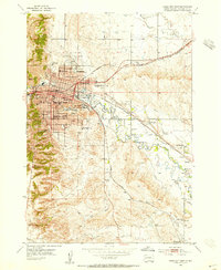
 1953 Rapid City1964 Print · USGSWestern South Dakota's transition from the Black Hills to the open prairie is captured here during the mid-fifties. Researchers can trace the development of Ellsworth Air Force Base alongside historic landmarks like Bear Butte and the Lower Alkali School.3 unique versions available
 - 1955 Map of Hot Springs, 1958 Print
 1955 Hot Springs1958 Print · USGSThe Black Hills and South Dakota badlands are captured here in the mid-fifties, during a peak of military and industrial activity. Researchers can locate the Black Hills Ordnance Depot, early Uranium Mines, and historic rail stops like Pringle or Oglala.5 unique versions available
 - 1957 Map of Rapid City
 1957 Rapid City1957 Print · USGSWestern South Dakota in the mid-fifties reveals a landscape of high-altitude forests and growing military installations. Researchers can trace the development of Ellsworth Air Force Base, locate the Theodore Roosevelt Monument, and find rural landmarks like Lower Alkali School.
 - 1977 Map of Mount Rushmore, 1978 Print
 1977 Mount Rushmore1978 Print · USGSThe Black Hills landscape of the late 1970s is shown here at a moment when historic mining and modern tourism converged. Genealogists and researchers can trace the rail lines of the Burlington Northern and find sites like Spokane Mine or the town of Pringle.2 unique versions available
 - 2012 Map of Hermosa NW, 2012 Print
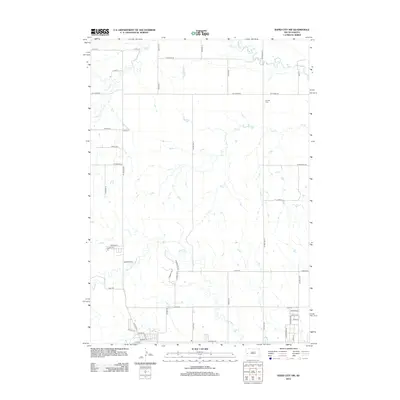
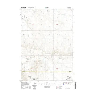
 2012 Hermosa NW2012 Print · USGSCovers Rapid City, including Ajax, Warbonnet, and other nearby areas
 - 2012 Map of Blackhawk, 2012 Print
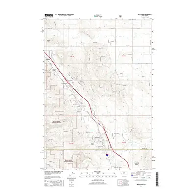
 2012 Blackhawk2012 Print · USGSCovers Rapid City, including Summerset, Piedmont, and other nearby areas
 - 2012 Map of Rapid City West, 2012 Print
 2012 Rapid City West2012 Print · USGSCovers Rapid City, including Clarkson Addition, Schaeferville, and other nearby areas
 - 2012 Map of Rapid City NW, 2012 Print
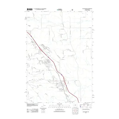
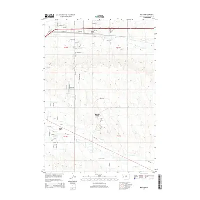
 2012 Rapid City NW2012 Print · USGSCovers Rapid City, including Box Elder, Pennington County, and other nearby areas
 - 2012 Map of Rapid City East, 2012 Print
 2012 Rapid City East2012 Print · USGSCovers Rapid City, including Box Elder, Twilight Hills Addition, and other nearby areas
 - 2012 Map of Box Elder, 2012 Print
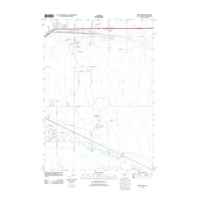 2012 Box Elder2012 Print · USGSCovers Rapid City, including Box Elder, Rapid Valley, and other nearby areas
 - 2015 Map of Rapid City NW, 2015 Print
 2015 Rapid City NW2015 Print · USGSCovers Rapid City, including Box Elder, Pennington County, and other nearby areas
 - 2015 Map of Blackhawk, 2015 Print
 2015 Blackhawk2015 Print · USGSCovers Rapid City, including Summerset, Piedmont, and other nearby areas
 - 2015 Map of Box Elder, 2015 Print
 2015 Box Elder2015 Print · USGSCovers Rapid City, including Box Elder, Rapid Valley, and other nearby areas
 - 2015 Map of Hermosa NW, 2015 Print
 2015 Hermosa NW2015 Print · USGSCovers Rapid City, including Ajax, Warbonnet, and other nearby areas
Showing maps 1-25 of 39
Top cities near Rapid City
Top neighborhoods of Rapid City
- Arrowhead Estates historical maps
- Sioux Village historical maps
- Twilight Hills Addition historical maps
- Broadmoor Subdivision historical maps
- Wildwood Addition historical maps
- Main Street Square historical maps
Frequently asked questions
- What are the different types of historical maps available for Rapid City?
- What is the oldest map of Rapid City?
- Where can I purchase historical maps of Rapid City for my home or office?
- Where can I download high-res historical maps of Rapid City?
- Are there historical topographic maps available for Rapid City?
- Is there historical aerial imagery available for Rapid City?
- Where are historical maps of Rapid City sourced from?