2020s Maps of Alvin, Texas
Explore 19 historic maps of Alvin from the 2020s. These maps offer a rare glimpse into what life looked like during the 2020s — showing old roads, neighborhoods, homes, and landmarks that have changed or disappeared over time.
Whether you're researching your family's past, planning a metal detecting trip, or studying how Alvin's landscape evolved across the 2020s, these high-resolution maps are a powerful tool for exploring the history of this region.
- Focus on a specific era: All maps on this page are from the 2020s, giving you a focused view of this time period.
- See what’s changed: Compare century-old streets, trails, and buildings to today's modern landscape using overlays and satellite layers.
- Research with precision: Use these maps for genealogy, historical research, land use analysis, or educational projects.
- View, download, or print: Maps are fully viewable online in high resolution, and can be downloaded or printed for your own records.
Start exploring Alvin's history through authentic maps from the 2020s. This is your window into the past.
Alvin, TX maps
(19)- 2022 Map of Mustang Bayou, 2022 Print
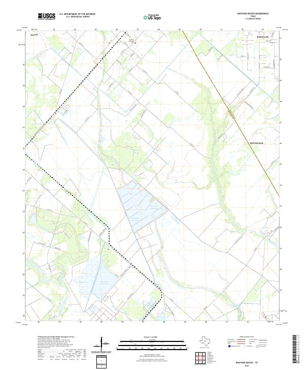 2022 Mustang Bayou2022 Print · USGSThe coastal prairies of Brazoria and Galveston counties are shown here in the 2020s, dominated by industrial sites and rice irrigation networks. Researchers can trace the drainage of Mustang Bayou and find local landmarks like the Mustang Lutheran Cem or the Monsanto Reservoir.
 - 2022 Map of Danbury, 2022 Print
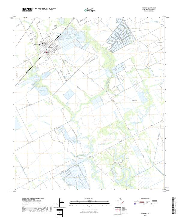 2022 Danbury2022 Print · USGSBrazoria County's coastal plains are captured in this recent survey, showcasing the intricate water management systems essential to the region. Researchers can locate family sites near Danbury Cem, trace the reaches of Austin Bayou, and explore the layout of McCormack Reservoir.
 - 2022 Map of Liverpool, 2022 Print
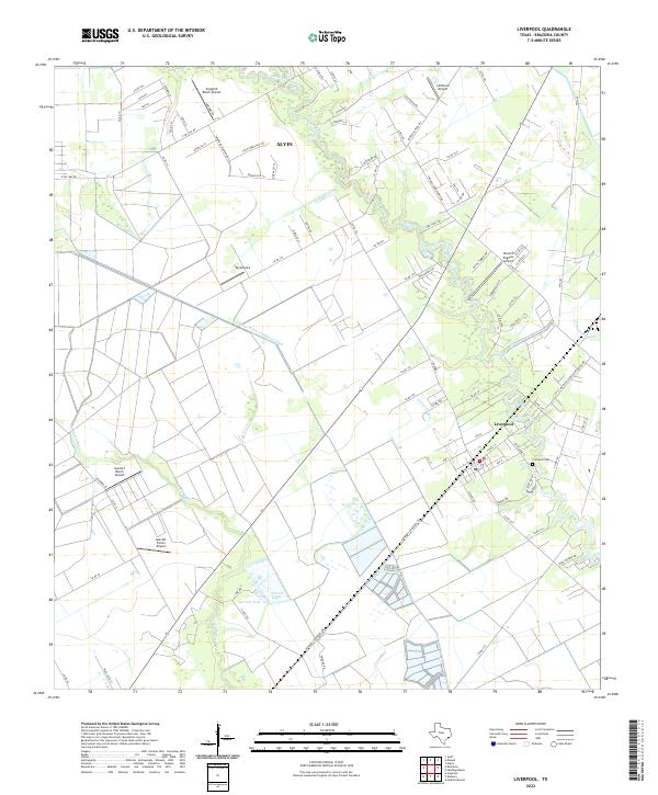 2022 Liverpool2022 Print · USGSBrazoria County's coastal prairies are documented here in the early twenty-first century, showing the rural community of Liverpool and its surrounding bayous. Genealogists and researchers can locate the Liverpool Cem and trace several family-named landmarks like Garrett Lake and Garrett Ranch Airport.
 - 2022 Map of Thompsons, 2022 Print
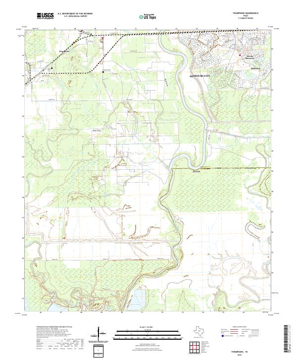 2022 Thompsons2022 Print · USGSFort Bend and Brazoria counties appear in this recent survey as the Brazos River corridor balances historical family lands with suburban growth. Genealogists can locate family burial sites at Jones Cem and the Mount Pilgrim Baptist Church Cem near Thompsons.
 - 2022 Map of Otey, 2022 Print
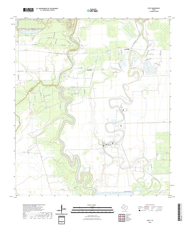 2022 Otey2022 Print · USGSThe Brazos River lowlands of Fort Bend and Brazoria counties are captured here in the early twenty-first century. Researchers can trace family history at Quarles Family Cem or explore the geography of Lochridge and Harris Reservoir.
 - 2022 Map of Algoa, 2022 Print
 2022 Algoa2022 Print · USGSCoastal Texas expansion meets established local history in this study of the Alvin and Santa Fe corridor. Genealogists and researchers can map out the residential growth around Dickinson Bayou and locate landmarks like the Confederate Cem or Alvin Community College.
 - 2022 Map of Rosharon, 2022 Print
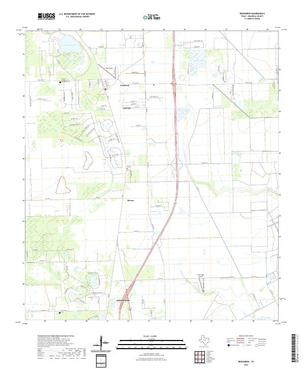 2022 Rosharon2022 Print · USGSBrazoria County's coastal prairie comes into focus in this recent survey of the lands between the growing outskirts of Alvin and Angleton. Genealogists and local historians can trace family locations near Rosharon or locate resting places at Pilgrims Knights-and- Daughters Cem and Providence Cem.
 - 2022 Map of Manvel, 2022 Print
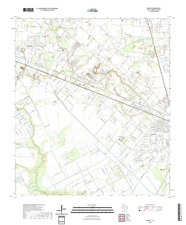 2022 Manvel2022 Print · USGSBrazoria County as it appeared recently shows the evolving landscape around Manvel and Alvin. Genealogists and local historians can trace family locations near Manvel Cem or follow the historic paths of Mustang Bayou and the Briscoe Canal.
 - 2022 Map of Christmas Point, 2022 Print
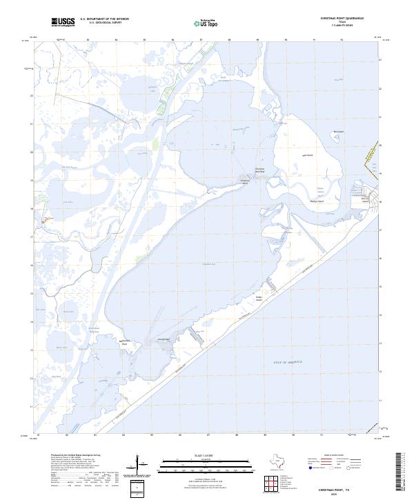
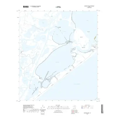 2022 Christmas Point2022 Print · USGSCovers Alvin, including Galveston, Treasure Island, and other nearby areas
 - 2022 Map of Hitchcock, 2022 Print
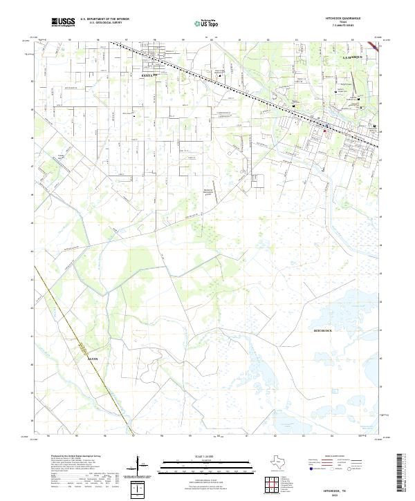 2022 Hitchcock2022 Print · USGSThe coastal plains of Galveston County come alive in this recent survey of the settlements between Santa Fe and Hitchcock. Genealogists and historians can trace local burial sites like Alta Loma Cem and Barbers Chapel Cem or locate the sprawling Hayes Grace Memorial Park.
 - 2022 Map of Juliff, 2022 Print
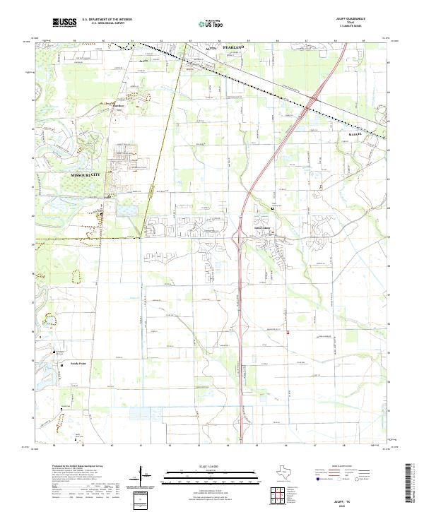 2022 Juliff2022 Print · USGSBrazoria County meets Fort Bend County in the early twenty-first century as suburban expansion reaches historic ranchlands. Researchers can locate several burial sites, including Iowa Colony Cem and Woods Cem, or trace the path of the Old Sugarland Railroad.
 - 2022 Map of Oyster Creek, 2022 Print
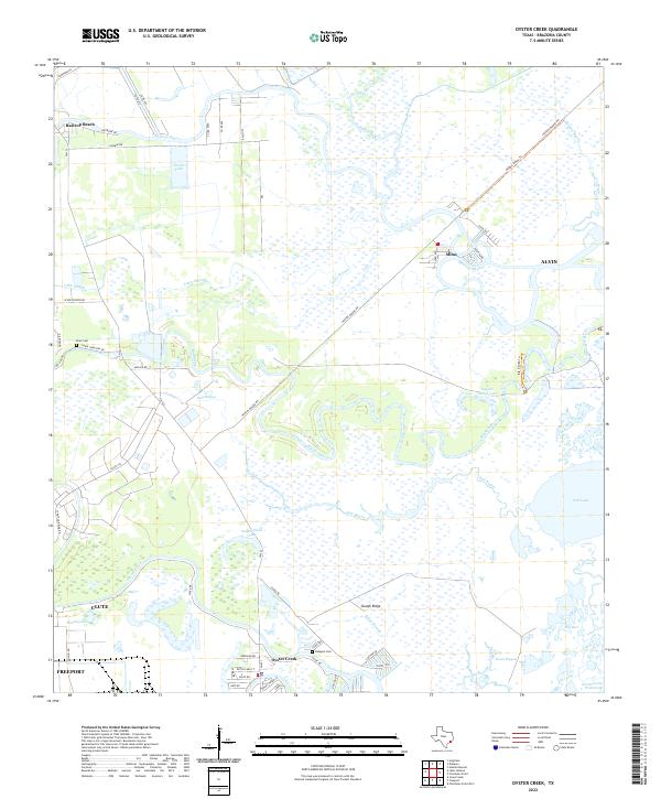 2022 Oyster Creek2022 Print · USGSCoastal Brazoria County is shown here in the 2020s, dominated by a intricate system of bayous and salt marshes. Researchers can trace family history at Phair Cem or explore the waterways around Bastrop Beach and Square Island Lake.
 - 2022 Map of San Luis Pass, 2022 Print
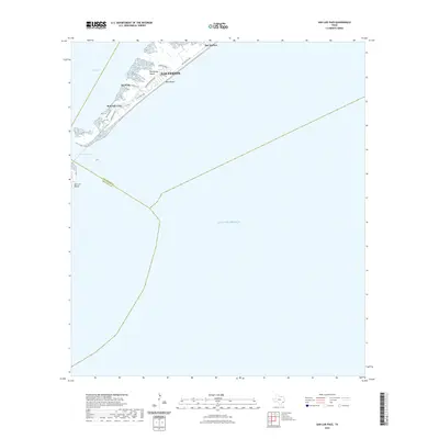 2022 San Luis Pass2022 Print · USGSCovers Alvin, including Galveston, Brazoria County, and other nearby areas
 - 2022 Map of Friendswood, 2022 Print
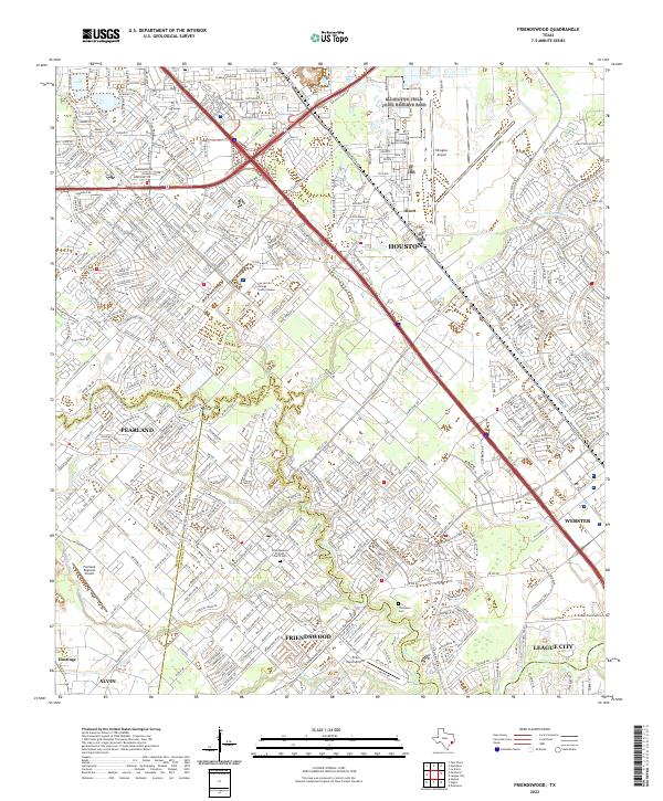 2022 Friendswood2022 Print · USGSThe Gulf Coast suburbs south of Houston were rapidly maturing by the early 2020s, dominated by modern aviation and intricate waterways. Researchers can trace local heritage at the Friendswood Friends Church Cemetery or explore the aviation footprints of Ellington Airport and Polly Ranch Airport.
 - 2022 Map of Sea Isle, 2022 Print
 2022 Sea Isle2022 Print · USGSCovers Alvin, including Galveston, Hitchcock, and other nearby areas
 - 2022 Map of Pearland, 2022 Print
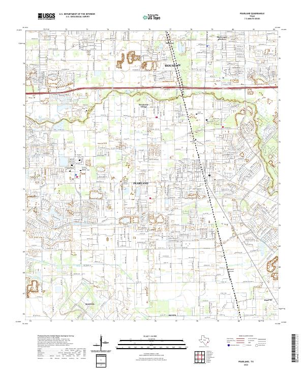 2022 Pearland2022 Print · USGSThe Pearland area in the early twenty-first century shows a landscape where historic burial grounds and small airfields meet modern suburban expansion. Genealogists can locate Old Settlers Cem and Southern Memorial Gardens among the newer developments.
 - 2025 Map of San Luis Pass, 2025 Print
 2025 San Luis Pass2025 Print · USGSThe southwestern tip of Galveston Island comes into focus in this contemporary study of the Texas coast. Researchers can trace development in Bay Harbor and West Beach or locate property near Red Fish Cove and San Luis Pass.
 - 2025 Map of Sea Isle, 2025 Print
 2025 Sea Isle2025 Print · USGSGalveston Island and the West Bay coastline come into focus in this contemporary survey of the Texas coast. Researchers can trace the development of coastal communities like Sea Isle and Bay Harbor or locate landmarks such as Rattlesnake Mound and Carancahua Point.
 - 2025 Map of Christmas Point, 2025 Print
 2025 Christmas Point2025 Print · USGSBrazoria County’s barrier islands and bayous are captured here in the mid-2020s, showing the intersection of coastal settlement and the Gulf of America. Trace the developed streets of San Luis Island and the shipping route of the Intracoastal Waterway.
End of results
Showing maps 1-19 of 19
Top cities near Alvin
- Pearland historical maps
- League City historical maps
- Missouri City historical maps
- Galveston historical maps
- Friendswood historical maps
- Lake Jackson historical maps
See more
Top neighborhoods of Alvin
Frequently asked questions
- What are the different types of historical maps available for Alvin?
- What is the oldest map of Alvin?
- Where can I purchase historical maps of Alvin for my home or office?
- Where can I download high-res historical maps of Alvin?
- Are there historical topographic maps available for Alvin?
- Is there historical aerial imagery available for Alvin?
- Where are historical maps of Alvin sourced from?