1960s Maps of Brown County, Texas
Explore 17 historic maps of Brown County from the 1960s. These maps offer a rare glimpse into what life looked like during the 1960s — showing old roads, neighborhoods, homes, and landmarks that have changed or disappeared over time.
Whether you're researching your family's past, planning a metal detecting trip, or studying how Brown County's landscape evolved across the 1960s, these high-resolution maps are a powerful tool for exploring the history of this region.
- Focus on a specific era: All maps on this page are from the 1960s, giving you a focused view of this time period.
- See what’s changed: Compare century-old streets, trails, and buildings to today's modern landscape using overlays and satellite layers.
- Research with precision: Use these maps for genealogy, historical research, land use analysis, or educational projects.
- View, download, or print: Maps are fully viewable online in high resolution, and can be downloaded or printed for your own records.
Start exploring Brown County's history through authentic maps from the 1960s. This is your window into the past.
Brown County, TX maps
(17)- 1960 Map of Burkett, 1962 Print
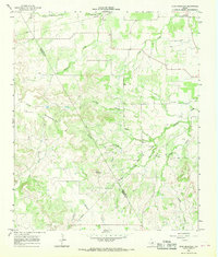
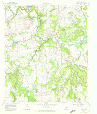
 1960 Burkett1962 Print · USGSSettlement and industry meet in this pocket of Central Texas at the dawn of the 1960s, showing the rural landscape before modern expansion. Researchers can locate the Burkett townsite, the Cem, and numerous Oil Wells scattered near the Holloway Mountains.
 - 1960 Map of Cross Cut, 1962 Print
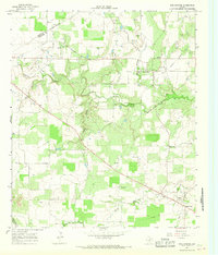
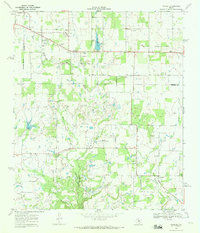
 1960 Cross Cut1962 Print · USGSMid-century Texas oil and ranching land come into focus here during the early 1960s. Genealogists and industrial historians can trace the Old Railroad Grade or locate family sites near Dressy Cem and the small community of Cross Cut.2 unique versions available
 - 1962 Map of Trickham, 1964 Print
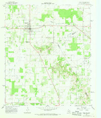
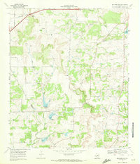
 1962 Trickham1964 Print · USGSEarly 1960s Brown County ranch land is captured here as the landscape transitioned with new water control measures. Genealogists can locate Lee Cem and Smith Cem or trace the path of the Old Railroad Grade near Shields.2 unique versions available
 - 1962 Map of Bangs East, 1964 Print
 1962 Bangs East1964 Print · USGSBrown County in the early sixties reveals a landscape of petroleum production and post-war growth near Bangs. Trace the expansive Brownwood Oil Field, locate family roots near Cedar Point Cem, or follow the Old Railroad Grade.3 unique versions available
 - 1962 Map of Bangs West, 1964 Print
 1962 Bangs West1964 Print · USGSThe central Texas landscape near Bangs is captured in the early sixties as a region of rural settlements and rail-line industry. Genealogists can trace family connections at Mukewater Cem and old locales like Liberty and Obregon.3 unique versions available
 - 1963 Map of Brooksmith, 1964 Print
 1963 Brooksmith1964 Print · USGSBrown County ranching and rural life in the early 1960s are centered here around the small community of Brookesmith. Genealogists and historians can trace the Old Railroad Grade, locate the settlement of Dulin, and find landmarks like Coggin Lake.2 unique versions available
 - 1966 Map of Owens, 1968 Print
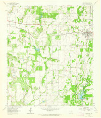
 1966 Owens1968 Print · USGSBrown County in the mid-sixties shows a landscape of growing infrastructure alongside deep-rooted rural landmarks. Genealogists can locate several burial sites like Heflin Cem and Roberts Cem, while researchers can trace the Atchison Topeka and Santa Fe rail line.2 unique versions available
 - 1966 Map of May, 1968 Print
 1966 May1968 Print · USGSNorthern Brown County during the mid-sixties reveals a landscape defined by small ranching communities and shifting infrastructure. Genealogists and historians can trace the Old Railroad Grade and locate family landmarks such as May Cem and Holder.2 unique versions available
 - 1966 Map of Star Mountain, 1968 Print
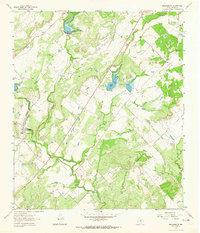
 1966 Star Mountain1968 Print · USGSThe Comanche and Brown County line comes alive in the mid-1960s, showing a rugged Texas landscape of ridges and ranchland. Trace family landmarks and local history near Star Mountain, the Stag Creek Community Center, and the early Gas Wells of the era.
 - 1966 Map of Sipe Springs, 1968 Print
 1966 Sipe Springs1968 Print · USGSSipe Springs and the surrounding Comanche County cattle and oil country are captured here in the mid-1960s. Researchers can trace the path of an Old Railroad Grade or locate family sites at Parker Cem and Sipe Springs Cem.2 unique versions available
 - 1966 Map of Rising Star, 1968 Print
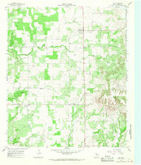
 1966 Rising Star1968 Print · USGSCentral Texas during the mid-sixties reveals a landscape of petroleum development and small crossroads settlements. Genealogists and historians can trace the Old Railroad Grade and locate local landmarks like Wolf Valley Ch and Amity.
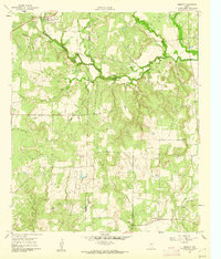
 - 1966 Map of Blanket, 1969 Print
 1966 Blanket1969 Print · USGSThe ranching and rail landscape of Brown and Comanche Counties is captured here in the mid-1960s. Genealogists and local historians can trace family locations through numerous rural burial sites like Logan Valley Cemetery and landmarks such as the Rodeo Ground.2 unique versions available
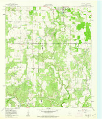
 - 1969 Map of Thrifty, 1972 Print
 1969 Thrifty1972 Print · USGSThe ranching and oil lands of Brown County are captured in the late sixties as the rural landscape underwent modern industrial shifts. Genealogists and historians can trace family locations near Eureka Ch, Salem Cem, and the settlement of Thrifty.
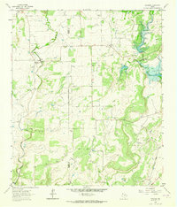
 - 1969 Map of Pioneer, 1972 Print
 1969 Pioneer1972 Print · USGSThe oil fields of Brown and Eastland Counties were in full production during the late sixties. Genealogists and historians can trace the rural communities of Pioneer and Williams, and locate sites like the Pioneer Cem, a local Drive-in Theater, and the Cross Cut Oil Field.2 unique versions available
 - 1969 Map of Mercers Gap, 1972 Print
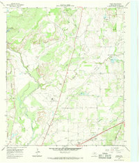
 1969 Mercers Gap1972 Print · USGSThe Comanche and Brown County borderlands come into focus in the late 1960s as a landscape of gaps and railroads. Researchers can trace the Atchison Topeka and Santa Fe line through Watson or locate rural landmarks like White Point Ch and Dudley Airfield.
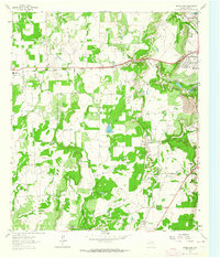
 - 1969 Map of Lake Brownwood, 1972 Print
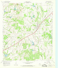
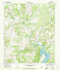
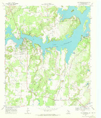 1969 Lake Brownwood1972 Print · USGSLake Brownwood's sprawling shoreline is captured here in the late sixties, showing a transition toward recreation and residential development. Trace family roots at Macedonia Cem or explore the early footprints of Shamrock Shores and Lake Shore.3 unique versions available
 - 1969 Map of Byrds, 1972 Print
 1969 Byrds1972 Print · USGSBrown County's rural landscape is captured here in the late sixties, just as the petroleum industry and water resources shaped local growth. Family historians can trace ancestral roots near Grosvenor, the Hog Creek Cem, and the small settlement at Byrds.2 unique versions available
End of results
Showing maps 1-17 of 17
Top cities of Brown County
Frequently asked questions
- What are the different types of historical maps available for Brown County?
- What is the oldest map of Brown County?
- Where can I purchase historical maps of Brown County for my home or office?
- Where can I download high-res historical maps of Brown County?
- Are there historical topographic maps available for Brown County?
- Is there historical aerial imagery available for Brown County?
- Where are historical maps of Brown County sourced from?