Old Maps of Kent County, Texas for Metal Detecting
Plan your next treasure hunt with 159 historic maps of Kent County. Find old homesites, ghost towns, trails, and gathering spots that may be lost to time — perfect for identifying promising metal detecting locations.
- Locate forgotten sites: Uncover places like long-lost settlements, abandoned rail lines, or gathering spots.
- Plan better hunts: Use map overlays combined with LiDAR or satellite views to narrow in on historically rich areas.
- Made for detectorists: Thousands of hobbyists use these maps to discover relics, coins, and hidden history.
Use these historic maps to boost your research and find new opportunities beneath the surface of Kent County.
Kent County, TX maps
(159)- 1926 Map of Snyder 1-a
 1926 Snyder 1-a1926 Print · USGSWest Texas ranching country and the Brazos watershed are captured here in the mid-twenties, showing where three counties converge. Researchers can trace early roads like the Canadian Highway and locate rural landmarks such as the County Line School.
 - 1932 Map of Camp Springs
 1932 Camp Springs1932 Print · USGSIn the 1930s, the borderlands of Kent and Fisher Counties featured a deeply dissected landscape carved by the Double Mountain Fork Brazos River. Local historians can trace the rural landscape of the era through landmarks like the County Line Sch and the expanse of Longhorn Valley.2 unique versions available
 - 1954 Map of Lubbock, 1958 Print
 1954 Lubbock1958 Print · USGSThe High Plains and Caprock region of West Texas come alive in the mid-1950s, showing a landscape defined by oil discovery and the Brazos River headwaters. Genealogists and historians can trace rail-connected towns like Roaring Springs, find the Pleasant Valley church, or locate family-named landmarks such as Soldier Mound.4 unique versions available
 - 1954 Map of Big Spring, 1965 Print
 1954 Big Spring1965 Print · USGSWest Texas in the mid-1950s shows a landscape of growing oil towns and vital rail links along the Texas and Pacific RR. Researchers can trace the development of Big Spring, find smaller settlements like Knott and Lomax, or locate landmarks such as Boyds Chapel and Signal Mountain.4 unique versions available
 - 1958 Map of Big Spring
 1958 Big Spring1958 Print · USGSThe West Texas oil boom was in full swing during the late fifties, transforming the landscape around Howard and Mitchell counties. Genealogists and historians can trace the growth of Big Spring and Snyder alongside industrial landmarks like the Kelly-Snyder Oil Field and the Santa Fe rail lines.
 - 1958 Map of Pursley House, 1959 Print
 1958 Pursley House1959 Print · USGSThe West Texas ranchlands at the junction of four counties are captured here in the late fifties. Researchers can trace remote homesteads and cattle operations like Pursley House, Beggs Ranch, and Kellar Field Camp.2 unique versions available
 - 1958 Map of Jayton, 1960 Print
 1958 Jayton1960 Print · USGSJayton and the West Texas canyonlands are captured here in the late fifties, just as the local rail and road networks were established. Trace the Fort Worth and Denver (Burlington) line past Jayton Cem and the northern Airstrip.2 unique versions available
 - 1959 Map of Gilpin
 1959 Gilpin1959 Print · USGSThe West Texas ranchlands of Dickens and Kent counties are captured here in the late fifties, centered on the railroad siding of Gilpin. Researchers can trace the path of the Fort Worth and Denver line through the breaks of Duck Creek and Red Hill.
 - 1959 Map of Girard, 1960 Print
 1959 Girard1960 Print · USGSGirard and the surrounding Kent County ranchlands are captured here in the late fifties as the local economy balanced rail transport with oil exploration. Researchers can locate the Rising Star Sch, trace the Fort Worth and Denver (Burlington) line, and identify family-named landmarks like the North Whatley Windmill.2 unique versions available
 - 1962 Map of Twomile Creek, 1963 Print
 1962 Twomile Creek1963 Print · USGSThe ranchlands along the Brazos and White Rivers are captured here in the early sixties, showing the isolated schoolhouses and cattle tanks of West Texas. Genealogists can locate Swenson Ranch and the Upper Red Mud Sch near the Salt Fork Brazos River.
 - 1962 Map of Smith Tank, 1963 Print
 1962 Smith Tank1963 Print · USGSThe High Plains of West Texas are captured here in the early sixties during a period of major hydrological change. Researchers can trace the new shoreline of the White River Reservoir and locate landmarks like the White River Dam and Smith Tank.2 unique versions available
 - 1967 Map of Spur, 1970 Print
 1967 Spur1970 Print · USGSSpur was a thriving West Texas hub in the late 1960s, showing its fully developed town grid and infrastructure. Researchers can trace local landmarks like Swenson Park, the town Cem, and the path of the Aqueduct crossing Spade Draw.
 - 1967 Map of Spur NW, 1971 Print
 1967 Spur NW1971 Print · USGSThe West Texas landscape at the Dickens and Kent County line reveals a sophisticated network of 1960s water infrastructure. Researchers can trace the path of an AQUEDUCT near the Rolling Plains Research Station and locate landmarks like Red Mud Creek.
 - 1968 Map of Spur SW, 1970 Print
 1968 Spur SW1970 Print · USGSThe ranching country of Kent County comes into focus in the late 1960s, showing a landscape defined by the Salt Fork Brazos River. Researchers can trace old family operations like Godfrey Ranch and follow the development of local energy at various Oil Wells.
 - 1968 Map of White Camp, 1970 Print
 1968 White Camp1970 Print · USGSKent County ranch lands come into focus during the late sixties, showing a landscape shaped by the Salt Fork Brazos River. Genealogists and researchers can trace the vicinity of White Camp and locate rural landmarks like Antelope Ch.
 - 1969 Map of Cottonwood Creek, 1971 Print
 1969 Cottonwood Creek1971 Print · USGSRanching life on the Texas plains comes into focus in the late sixties as the Brazos River forks wind through Garza and Kent counties. Genealogists and historians can trace family-named sites like Beggs Ranch, the Schoolhouse Windmill, and the community of Kent.
 - 1969 Map of Justiceburg SE, 1971 Print
 1969 Justiceburg SE1971 Print · USGSKent County was a center of intensive oil exploration in the late 1960s, defined by its rugged river breaks and energy industry. Researchers can trace the development of the Dorward Oil Field and Birdwell alongside the Double Mountain Fork Brazos River.
 - 1969 Map of A B C Creek, 1972 Print
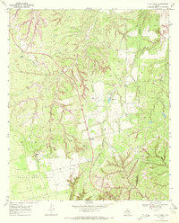 1969 A B C Creek1972 Print · USGSThe West Texas ranchlands of Kent and Stonewall Counties are captured here during the late sixties oil boom. Genealogists and researchers can trace the rural communities of ABC and Harmony alongside landmarks like the Devils Backbone and SoRelle Lake.
 - 1969 Map of Maverick Creek, 1972 Print
 1969 Maverick Creek1972 Print · USGSThe Scurry and Kent County line area comes into focus during the late sixties, highlighting the industrial expansion of the Cogdell Oil Field. Local researchers can trace old energy infrastructure and landmarks like Church Peak, Criswell, and the Pumping Sta.
 - 1969 Map of Hudd, 1972 Print
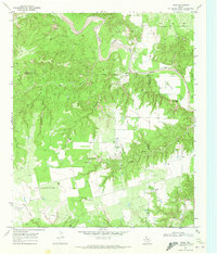 1969 Hudd1972 Print · USGSScurry County ranching and river breaks are documented here in the late sixties, showing the transition from canyonlands to agricultural flats. Researchers can locate the Cottonwood Flat Cem, Criswell Ranch, and landmarks like Sugar Loaf.
 - 1969 Map of Cooper Mountain, 1972 Print
 1969 Cooper Mountain1972 Print · USGSKent County ranching and energy production intersect in the late 1960s as the river carves through the Texas plains. Researchers can trace the extensive operations of the Cogdell Oil Field and locate family landmarks like Parr Ranch and Cooper Mountain.
 - 1969 Map of Clairemont East, 1972 Print
 1969 Clairemont East1972 Print · USGSKent County ranching and petroleum production intersect in the late sixties near the Salt Fork Brazos River. Researchers can locate the historic Clairemont townsite, the County Fairground, and the O Bar O Ranch amidst an active landscape of oil wells and pipelines.2 unique versions available
 - 1969 Map of Clairemont West, 1972 Print
 1969 Clairemont West1972 Print · USGSThe West Texas petroleum landscape around Clairemont is captured here in the late sixties, a period of active expansion. Researchers can trace the industrial footprint of the Salt Creek Oil Field and the winding course of the Salt Fork Brazos River.
 - 1969 Map of Jayton South, 1972 Print
 1969 Jayton South1972 Print · USGSKent County settlement and the West Texas plains are captured here in the late sixties as the local infrastructure evolved. Researchers can trace the path of the Old Railroad Grade, locate the town AQUEDUCT, and find the riverbanks of the Salt Fork Brazos River.
 - 1969 Map of Tige Canyon, 1972 Print
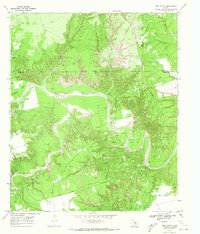 1969 Tige Canyon1972 Print · USGSThe West Texas ranchlands and oil fields of Fisher, Kent, and Stonewall counties are revealed here in the late sixties. Genealogists and land researchers can trace the winding Double Mountain Fork Brazos River and find isolated landmarks like Devils Backbone and Tige Canyon.
Showing maps 1-25 of 159
Top cities of Kent County
Frequently asked questions
- What are the different types of historical maps available for Kent County?
- What is the oldest map of Kent County?
- Where can I purchase historical maps of Kent County for my home or office?
- Where can I download high-res historical maps of Kent County?
- Are there historical topographic maps available for Kent County?
- Is there historical aerial imagery available for Kent County?
- Where are historical maps of Kent County sourced from?