
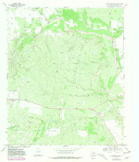
1969 Map of Clairemont East
USGS Topo · Published 1972About this map
The Clairemont Oil Field and its neighboring Clairemont East Field dominate this 1960s landscape in Kent County, characterized by a dense network of pipelines and wells cutting through the ranching terrain. The small community of Clairemont is visible along the western edge, adjacent to the County Fairground and the Clairemont Cem, serving as a focal point for the surrounding rural territory.
Find a feature on this map
22 named features on this map. Tap any name to fly to it.
Don’t see what you’re looking for? This feature index may not catch every label — zoom into the map to look around manually.
Map Details
Editions of this 1969 Clairemont East Map
2 editions found
Other maps of this area

1954 · Lubbock
USGS Topo · 1:250,000

1958 · Jayton
USGS Topo · 1:24,000

1959 · Girard
USGS Topo · 1:24,000

1968 · White Camp
USGS Topo · 1:24,000
1969 · A B C Creek
USGS Topo · 1:24,000

1969 · Cooper Mountain
USGS Topo · 1:24,000

1969 · Clairemont West
USGS Topo · 1:24,000

1969 · Jayton South
USGS Topo · 1:24,000
1969 · Gant Hills
USGS Topo · 1:24,000
1985 · Aspermont
USGS Topo · 1:100,000