1900s (20th Century) Maps of Motley County, Texas
Explore 32 historic maps of Motley County from the 1900s (20th Century). These maps offer a rare glimpse into what life looked like during the 1900s — showing old roads, neighborhoods, homes, and landmarks that have changed or disappeared over time.
Whether you're researching your family's past, planning a metal detecting trip, or studying how Motley County's landscape evolved across the 1900s, these high-resolution maps are a powerful tool for exploring the history of this region.
- Focus on a specific era: All maps on this page are from the 1900s, giving you a focused view of this time period.
- See what’s changed: Compare century-old streets, trails, and buildings to today's modern landscape using overlays and satellite layers.
- Research with precision: Use these maps for genealogy, historical research, land use analysis, or educational projects.
- View, download, or print: Maps are fully viewable online in high resolution, and can be downloaded or printed for your own records.
Start exploring Motley County's history through authentic maps from the 1900s. This is your window into the past.
Motley County, TX maps
(32)- 1954 Map of Lubbock, 1958 Print
 1954 Lubbock1958 Print · USGSThe High Plains and Caprock region of West Texas come alive in the mid-1950s, showing a landscape defined by oil discovery and the Brazos River headwaters. Genealogists and historians can trace rail-connected towns like Roaring Springs, find the Pleasant Valley church, or locate family-named landmarks such as Soldier Mound.4 unique versions available
 - 1954 Map of Plainview, 1966 Print
 1954 Plainview1966 Print · USGSThe Texas Panhandle and the rugged Caprock Escarpment appear in detail as the region's agricultural and rail networks reached their mid-century peak. Trace family roots and old land patterns through the canyons and plains near Plainview, Palo Duro State Park, and Childress.3 unique versions available
 - 1958 Map of Plainview
 1958 Plainview1958 Print · USGSThe High Plains and Caprock Escarpment meet in the late fifties, showcasing the ranching and rail networks of the Texas Panhandle. Trace family roots and vanished stops along the Panhandle and Santa Fe railroad through Plainview, Silverton, and Matador.
 - 1965 Map of Wake, 1968 Print
 1965 Wake1968 Print · USGSCrosby County and its neighbors meet on the edge of the Caprock in the mid-1960s, showing a landscape defined by ranching and groundwater. Genealogists and local historians can locate the Wake settlement, trace the Rustler Creek breaks, and find Antelope Cem.
 - 1966 Map of Fields Canyon
 1966 Fields Canyon1966 Print · USGSThe ranchlands and river breaks of the Texas Panhandle are captured here during the mid-1960s. Genealogists and local historians can trace family-named landmarks like Leary Flat, the Lucky Knob Windmill, and the expanse of the Matador Wildlife Management Area.2 unique versions available
 - 1966 Map of Matador, 1968 Print
 1966 Matador1968 Print · USGSMotley County at the height of the 1960s reveals a focused ranching community centered on the town of Matador. Genealogists and local historians can trace the town's footprint, including the High Sch and East Mound Cem, alongside the waters of Ballard Creek.2 unique versions available
 - 1966 Map of Ballard Camp, 1968 Print
 1966 Ballard Camp1968 Print · USGSMotley County ranching life is preserved here during the mid-sixties, showing a landscape defined by the Middle Pease River and isolated camps. Researchers can trace family-named landmarks like Beauchum Windmill, Stotts Windmill, and the Ballard Camp settlement.2 unique versions available
 - 1966 Map of Tee Pee City, 1968 Print
 1966 Tee Pee City1968 Print · USGSThe ranching country of the Texas Rolling Plains is captured here in the mid-1960s, centered on the historic site of Tee Pee City. Researchers can trace the ranching infrastructure of the era, from the Quanah Acme and Pacific rail line to isolated features like the Historical Marker and Schweitzer Windmill.2 unique versions available
 - 1967 Map of Quitaque, 1969 Print
 1967 Quitaque1969 Print · USGSQuitaque stood as a vital rail and ranching hub in the late sixties, where the plains meet the rugged breaks of the Caprock. Genealogists and local historians can trace the diagonal Fort Worth and Denver line, the remote Gray Mule Cem, and the quiet settlement of Fairmont.
 - 1967 Map of North Windmill, 1969 Print
 1967 North Windmill1969 Print · USGSThe rolling canyonlands of Motley and Hall County are captured in the late 1960s, a time when ranching life centered on the vital water of Turkey Creek. Genealogists can locate Dreamland Cem and remote landmarks like Dogtown Windmill or the settlement at Kent.2 unique versions available
 - 1967 Map of Cottonwood Camp, 1969 Print
 1967 Cottonwood Camp1969 Print · USGSMotley and Hall counties are shown during the late sixties as a network of cattle camps and vital water points. Genealogists and historians can trace local landmarks like Turkey Creek Ranch and the namesake Cottonwood Camp along the North Pease River.2 unique versions available
 - 1967 Map of Quitaque Peaks, 1969 Print
 1967 Quitaque Peaks1969 Print · USGSFloyd and Motley Counties are captured in the late sixties as the high plains transition into deep canyon country. Genealogists and hikers can locate the isolated Keeter Graves or trace the many forks of the North Pease River and Brushy Creek.
 - 1967 Map of Dick Moore Canyon, 1969 Print
 1967 Dick Moore Canyon1969 Print · USGSFloyd and Motley counties are captured here in the late sixties as the cattle and water economy shaped the West Texas plains. Trace ranching landmarks like Mott Camp and Waybourn Windmill alongside the rugged path of Dick Moore Canyon.
 - 1967 Map of Hornica Creek, 1969 Print
 1967 Hornica Creek1969 Print · USGSMotley County's ranching landscape is captured here in the late sixties as the high plains drop into the breaks of the North Pease River. Researchers can locate specific water landmarks like the Walker Canyon Windmill, Dugout Windmill, and the winding course of Tom Ball Creek.2 unique versions available
 - 1967 Map of Turtle Hole Camp, 1969 Print
 1967 Turtle Hole Camp1969 Print · USGSMotley County ranching country is captured here in the late sixties, showing a landscape of remote camps and vital water sources. Genealogists and historians can trace family-named landmarks like Berryman Windmill and the specific outposts at Turtle Hole Camp or Lucky Knob Camp.2 unique versions available
 - 1967 Map of Flomot, 1969 Print
 1967 Flomot1969 Print · USGSThe High Plains of Motley County meet the rugged Caprock breaks in the late sixties. Genealogists and local historians can trace the town of Flomot, locate Memorial Park (Cem), and follow the winding course of the North Pease River.2 unique versions available
 - 1967 Map of Northfield, 1969 Print
 1967 Northfield1969 Print · USGSThe West Texas Panhandle near the North Pease River is shown in the late 1960s as a landscape of ranching and river canyons. Genealogists and historians can trace the rural settlement of Northfield or locate family landmarks like Lake Joe and Cheney Mountain.2 unique versions available
 - 1967 Map of Whiteflat, 1970 Print
 1967 Whiteflat1970 Print · USGSThe ranching country of Motley County is captured here in the late sixties as the community of Whiteflat remained a local hub. Researchers can locate numerous family-named landmarks and water sources like Stokes Windmill, Whiteflat Cem, and Boone Mtn.2 unique versions available
 - 1967 Map of Folley, 1970 Print
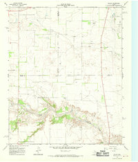 1967 Folley1970 Print · USGSThe ranching country of Motley County comes alive in the late sixties as the Quitaque Creek canyons cut through the high plains. Genealogists and historians can locate Folley, the Turkey Airfield, and the vintage Drive-in Theater near the Briscoe county line.2 unique versions available
 - 1968 Map of Mac Bain, 1970 Print
 1968 Mac Bain1970 Print · USGSThe West Texas plains of Motley County come alive in the late sixties, showcasing a landscape of isolated rail stops and deep creek draws. Trace the historic Quanah Acme and Pacific line through Mac Bain or locate reliable water at Dripping Springs.2 unique versions available
 - 1968 Map of Roaring Springs, 1970 Print
 1968 Roaring Springs1970 Print · USGSRoaring Springs and the surrounding Motley County ranchlands are captured here in the late 1960s, showing a landscape shaped by the Quanah Acme and Pacific railroad. Genealogists and local historians can locate the Roaring Springs Cemetery, the Drive-in Theater, and the Buzz Landing Field.2 unique versions available
 - 1968 Map of Russellville, 1970 Print
 1968 Russellville1970 Print · USGSThe Motley County ranchlands are captured in the late sixties, centered on the Russellville community. Researchers can trace the Quanah Acme and Pacific rail line and family-named landmarks like Bird Ranch and Darden.2 unique versions available
 - 1968 Map of Dumont, 1970 Print
 1968 Dumont1970 Print · USGSThe West Texas ranching country near the Dickens and King county line was a network of seasonal draws and vital water sources in the late sixties. Trace the distribution of livestock windmills like Threeway Windmill and the settlement at Dumont near the North Wichita River.2 unique versions available
 - 1968 Map of China Canyon, 1971 Print
 1968 China Canyon1971 Print · USGSRanching operations and railroad transit define this Panhandle landscape in the late sixties as it straddles the Motley and Cottle county lines. Genealogists and historians can locate family-named landmarks like Swenson Ranch and the Quanah Acme and Pacific rail line.2 unique versions available
 - 1968 Map of Rustler Camp, 1971 Print
 1968 Rustler Camp1971 Print · USGSDickens and Motley Counties were still primarily ranching territory in the late 1960s, marked by intermittent creeks and cattle camps. Genealogists and historians can trace the Quanah Acme and Pacific rail line and local landmarks like Rustler Camp or Wolf Springs.2 unique versions available
Showing maps 1-25 of 32
Top cities of Motley County
Frequently asked questions
- What are the different types of historical maps available for Motley County?
- What is the oldest map of Motley County?
- Where can I purchase historical maps of Motley County for my home or office?
- Where can I download high-res historical maps of Motley County?
- Are there historical topographic maps available for Motley County?
- Is there historical aerial imagery available for Motley County?
- Where are historical maps of Motley County sourced from?