1960s Maps of Oldham County, Texas
Explore 24 historic maps of Oldham County from the 1960s. These maps offer a rare glimpse into what life looked like during the 1960s — showing old roads, neighborhoods, homes, and landmarks that have changed or disappeared over time.
Whether you're researching your family's past, planning a metal detecting trip, or studying how Oldham County's landscape evolved across the 1960s, these high-resolution maps are a powerful tool for exploring the history of this region.
- Focus on a specific era: All maps on this page are from the 1960s, giving you a focused view of this time period.
- See what’s changed: Compare century-old streets, trails, and buildings to today's modern landscape using overlays and satellite layers.
- Research with precision: Use these maps for genealogy, historical research, land use analysis, or educational projects.
- View, download, or print: Maps are fully viewable online in high resolution, and can be downloaded or printed for your own records.
Start exploring Oldham County's history through authentic maps from the 1960s. This is your window into the past.
Oldham County, TX maps
(24)- 1962 Map of Wildorado, 1964 Print
 1962 Wildorado1964 Print · USGSThe Texas Panhandle comes into focus during the early sixties, showing the rail-and-ranch life along the Chicago Rock Island and Pacific line. Genealogists and historians can trace local landmarks like Palo Duro Ch, Highland Sch, and the Bynum Ranch.
 - 1965 Map of Everett, 1969 Print
 1965 Everett1969 Print · USGSThe High Plains of the Texas Panhandle are captured here in the mid-sixties at the intersection of rail and road history. Genealogists and historians can trace the early shipping infrastructure at Everett, from the Grain Elevator along the CHICAGO ROCK ISLAND AND PACIFIC rail line to the path of the original U.S. 66.
 - 1966 Map of Moser Ranch, 1968 Print
 1966 Moser Ranch1968 Print · USGSThe Texas Panhandle near the Oldham and Deaf Smith county line comes into focus in the mid-1960s. Researchers can locate family landmarks like Moser Ranch and trace the path of the Chicago Rock Island and Pacific railroad.
 - 1966 Map of Signal Spring, 1968 Print
 1966 Signal Spring1968 Print · USGSOldham County ranching country is captured here in the mid-sixties, showing a landscape defined by seasonal water and wide-open plains. Genealogists and researchers can locate the Windham Ranch and trace the paths of Trujillo Creek and Signal Spring.
 - 1966 Map of Boise, 1968 Print
 1966 Boise1968 Print · USGSThe Texas Panhandle in the mid-sixties reveals a landscape shaped by the rail and ranching economy. Researchers can trace the path of the Chicago Rock Island and Pacific railroad past Boise and the sprawling Bridwell Ranch.
 - 1966 Map of Alamocitos Camp, 1968 Print
 1966 Alamocitos Camp1968 Print · USGSThe Texas panhandle ranching landscape comes into focus during the mid-sixties, centering on Alamocitos Camp. Trace old water systems and ranch infrastructure through named landmarks like Goodnight Tank and the Deep Well Windmill.
 - 1966 Map of Simms NW, 1968 Print
 1966 Simms NW1968 Print · USGSThe Texas Panhandle comes into focus during the mid-sixties, revealing the remote utility corridors and ranching boundaries of the High Plains. Trace the path of Slaughterhouse Draw and locate historic landmarks like Slaughterhouse Well and the Pumping Sta.
 - 1966 Map of Simms NE, 1969 Print
 1966 Simms NE1969 Print · USGSThe High Plains of the Texas Panhandle are captured here in the mid-1960s, where the rangelands of Oldham Co meet Deaf Smith Co. Trace the natural drainage of Cottonwood Creek and locate early energy infrastructure like the central Pipeline and isolated Well sites.
 - 1966 Map of Adrian, 1969 Print
 1966 Adrian1969 Print · USGSThe Texas Panhandle township of Adrian and the nearby siding of Gruhlkey are shown here during the mid-1960s. Researchers can trace the Rock Island railroad line and locate ranching landmarks like the Rodeo Ground, Wimberly Place, and Randall Lake.
 - 1966 Map of Jay Taylor Ranch, 1969 Print
 1966 Jay Taylor Ranch1969 Print · USGSTexas Panhandle ranching life comes into focus in the mid-1960s, showing a landscape of working cattle operations and water management. Genealogists and historians can locate family-named sites like Jay Taylor Ranch, Binford Ranch, and Morgan Windmill.
 - 1966 Map of Halfway Creek, 1969 Print
 1966 Halfway Creek1969 Print · USGSOldham County ranching culture is preserved in this mid-sixties survey of the Texas Panhandle. Trace family-named landmarks and water infrastructure like Mansfield Ranch, Parker Camp, and the Leaning Tower Windmill.
 - 1966 Map of Ady, 1969 Print
 1966 Ady1969 Print · USGSThe ranching country of the Texas Panhandle comes alive in this mid-1960s survey of the Canadian River valley. Researchers can trace the legacy of the LS Ranch, locate the settlement of Ady, and find remote water sources like Lost Tubs Springs and Eagle Camp.
 - 1966 Map of Signal Spring SE, 1969 Print
 1966 Signal Spring SE1969 Print · USGSOldham County ranch lands in the mid-1960s are defined by deep creek drainages and the southern reach of the CHICAGO ROCK ISLAND AND PACIFIC railroad. Researchers can trace historic water infrastructure at Deep Well Windmill and Red Gate Windmill or locate landmarks like Paint Rock.
 - 1966 Map of Big George Tank, 1969 Print
 1966 Big George Tank1969 Print · USGSOldham County ranching operations are meticulously documented in the mid-1960s, showing a landscape reliant on managed water and isolated camps. Researchers can trace the water infrastructure of the day through 4 Way Windmill, George Camp, and Joaquin Springs.
 - 1966 Map of Rotten Hill, 1969 Print
 1966 Rotten Hill1969 Print · USGSThe High Plains of the Texas Panhandle are captured here in the mid-1960s, showing a landscape shaped by ranching and vital water landmarks. Researchers can trace the ranching economy through names like Wildorado Camp, the Shipping Pasture Windmill, and Five Fingers.
 - 1966 Map of Landergin, 1969 Print
 1966 Landergin1969 Print · USGSThe Texas Panhandle ranching country of the mid-sixties is captured here, centered on the Landergin rail siding. Researchers can locate remote ranching infrastructure like Scharbauer Ranch, the Landing Strip, and numerous water sources including Chugwater Windmill.
 - 1966 Map of Vega South, 1969 Print
 1966 Vega South1969 Print · USGSThe High Plains of the Texas Panhandle come into focus in the mid-1960s, showing the intersection of ranching life and rail transport. Genealogists and researchers can trace local landmarks like Memorial Park (Cem), the High Sch in Vega, and the waters of Dodson Lake.
 - 1966 Map of Vat Camp, 1969 Print
 1966 Vat Camp1969 Print · USGSOldham County ranching country is captured here in the mid-1960s, showing the intersection of natural springs and windmills. Trace the cattle landscape from the Canadian River to Vat Camp and High Lonesome Windmill.
 - 1966 Map of Trujillo Camp, 1969 Print
 1966 Trujillo Camp1969 Print · USGSThe Texas Panhandle ranchlands are surveyed here in the mid-sixties, dominated by the winding path of the Canadian River. Researchers can trace old settlement sites like Trujillo Camp and the Chavez City Ruins or locate landmarks like the Boydstun Windmill.
 - 1966 Map of Torrea Peak, 1970 Print
 1966 Torrea Peak1970 Print · USGSOldham County ranching country is mapped here in the mid-sixties, showing a landscape shaped by deep creek canyons and essential water infrastructure. Researchers can trace historic grazing lands and family-named landmarks like Lost Cabin Windmill, The Cedar Brakes, and Torrea Peak.2 unique versions available
 - 1966 Map of Vega North, 1970 Print
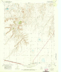 1966 Vega North1970 Print · USGSTexas Panhandle ranching and transit converge in the 1960s as the storied Route 66 passes through the town of Vega. Genealogists and historians can trace the Chicago Rock Island and Pacific rail line and local landmarks like Milkweed Lake or the High Sch.
 - 1968 Map of Glenrio, 1971 Print
 1968 Glenrio1971 Print · USGSThe High Plains border of New Mexico and Texas comes alive in the late sixties at the crossing of the Mother Road and the rail line. Trace the evolution of Glenrio and the nearby Endee Cem along the winding banks of Trujillo Creek.2 unique versions available
 - 1968 Map of Sanchez Springs, 1971 Print
 1968 Sanchez Springs1971 Print · USGSThe New Mexico and Texas borderlands in the late sixties remain a landscape defined by ranching outposts and isolated water holes. Genealogists and historians can trace livestock routes through Dean Ranch, Coggins Camp, and numerous named landmarks like Sanchez Springs.2 unique versions available
 - 1968 Map of Martin Draw, 1972 Print
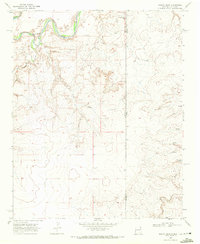 1968 Martin Draw1972 Print · USGSRanching life on the High Plains comes into focus in this late 1960s survey along the New Mexico and Texas border. Genealogists and historians can trace family-named water sources like Sissy Windmill and Buffalo Windmill near the Howdy Ranch.
End of results
Showing maps 1-24 of 24
Top cities of Oldham County
Frequently asked questions
- What are the different types of historical maps available for Oldham County?
- What is the oldest map of Oldham County?
- Where can I purchase historical maps of Oldham County for my home or office?
- Where can I download high-res historical maps of Oldham County?
- Are there historical topographic maps available for Oldham County?
- Is there historical aerial imagery available for Oldham County?
- Where are historical maps of Oldham County sourced from?