1960s Maps of Reeves County, Texas
Explore 22 historic maps of Reeves County from the 1960s. These maps offer a rare glimpse into what life looked like during the 1960s — showing old roads, neighborhoods, homes, and landmarks that have changed or disappeared over time.
Whether you're researching your family's past, planning a metal detecting trip, or studying how Reeves County's landscape evolved across the 1960s, these high-resolution maps are a powerful tool for exploring the history of this region.
- Focus on a specific era: All maps on this page are from the 1960s, giving you a focused view of this time period.
- See what’s changed: Compare century-old streets, trails, and buildings to today's modern landscape using overlays and satellite layers.
- Research with precision: Use these maps for genealogy, historical research, land use analysis, or educational projects.
- View, download, or print: Maps are fully viewable online in high resolution, and can be downloaded or printed for your own records.
Start exploring Reeves County's history through authentic maps from the 1960s. This is your window into the past.
Reeves County, TX maps
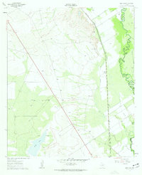
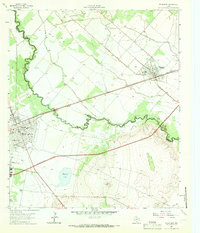
(22)- 1961 Map of Soda Lake, 1963 Print
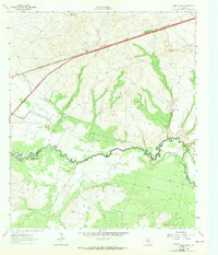
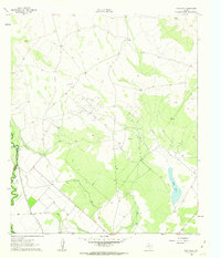 1961 Soda Lake1963 Print · USGSThe Pecos River valley in the early sixties was a place where irrigation and oil extraction met. You can trace the path of the Barstow Canal, find the Dunegan Ranch, and locate the isolated Grave north of the Cedarvale Canal.3 unique versions available
 - 1961 Map of Mentone, 1963 Print
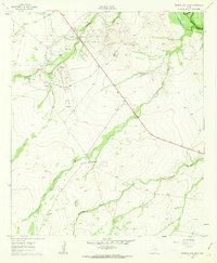
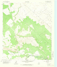
 1961 Mentone1963 Print · USGSMentone and the surrounding West Texas plains are captured here in the early sixties as the local economy balanced ranching with an intensive oil boom. Researchers can trace the industrial layout of the Wheat Oil Field alongside family landmarks like Moorehead Ranch and the Panhandle and Santa Fe railroad.2 unique versions available
 - 1961 Map of Anderson Ranch, 1963 Print
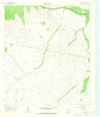
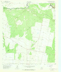
 1961 Anderson Ranch1963 Print · USGSThe Pecos River frontier in the early sixties reveals a landscape shaped by petroleum and ranching at the border of Reeves and Loving counties. Researchers can trace the mid-century industrial footprint of the Dixieland Oil Field and the rail sidings at Arno.2 unique versions available
 - 1961 Map of Orla SE, 1963 Print
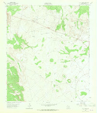
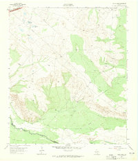
 1961 Orla SE1963 Print · USGSThe Pecos Valley in the early 1960s reveals a West Texas landscape dominated by the petroleum industry and the winding river boundary. Researchers can trace the rail-and-oil economy through the Tunstill Oil Field, the river stop at Riverton, and the refinery near Mason Station.2 unique versions available
 - 1961 Map of Sand Lake, 1963 Print
 1961 Sand Lake1963 Print · USGSThe Pecos River valley at the Reeves and Ward county line shows a landscape of rail and industry in the early sixties. Genealogists and historians can locate the Lara Cem, Patrole Sch, and the winding route of the Panhandle and Santa Fe railroad.3 unique versions available
 - 1961 Map of Narrow Bow Draw, 1963 Print
 1961 Narrow Bow Draw1963 Print · USGSReeves and Loving counties are shown here during the early 1960s oil boom, where the desert landscape is densely marked by petroleum extraction. Researchers can trace the industrial footprint of the South Orla Oil Field and the path of the Panhandle and Santa Fe (AT & SF) railroad near the Pecos River.2 unique versions available
 - 1963 Map of Ligon Ranch, 1965 Print
 1963 Ligon Ranch1965 Print · USGSThe Pecos River valley and the expanding West Texas oil fields define this mid-century landscape. Researchers can trace the layout of the Automotive Proving Ground and remote outposts like Ligon Ranch and Alberts Well.2 unique versions available
 - 1963 Map of Old X Ranch, 1965 Print
 1963 Old X Ranch1965 Print · USGSReeves County ranching and industry meet in the early sixties as traditional cattle operations shared the high desert with new technological facilities. Researchers can trace the layout of the Old X Ranch and the expansive Automotive Proving Ground.2 unique versions available
 - 1963 Map of Quito Draw, 1965 Print
 1963 Quito Draw1965 Print · USGSThe Pecos River valley in the early sixties reveals a landscape of industrial expansion and water management. Researchers can trace the path of the Texas and Pacific RR or locate family-named sites like Turner Well and Barstow Well.2 unique versions available
 - 1963 Map of China Lake NE, 1965 Print
 1963 China Lake NE1965 Print · USGSWest Texas ranching and irrigation systems are in full view during the early sixties as they snake across the Ward County line. Researchers can trace the paths of the Grand Falls Canal and family-named water sources like Lochaboy Well 2633.3 unique versions available
 - 1963 Map of Rio Pecos Ranch, 1965 Print
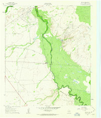
 1963 Rio Pecos Ranch1965 Print · USGSWest Texas ranching and petroleum production meet along the river in the early sixties. Researchers can trace the layout of the Waha Oil Field, the remote Rio Pecos Ranch, and irrigation works like the Grand Canal.3 unique versions available
 - 1963 Map of China Lake, 1965 Print
 1963 China Lake1965 Print · USGSThe Pecos River corridor in the mid-sixties reveals a landscape of industrial development and desert hydrology. Genealogists and historians can trace the boundary of Ward Co and Reeves Co, following the Texas and Pacific railroad past China Lake.2 unique versions available
 - 1963 Map of Pecos East, 1966 Print
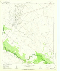
 1963 Pecos East1966 Print · USGSReeves and Ward Counties appear in the early sixties as the irrigation and rail infrastructure of the Trans-Pecos reaches its peak. Genealogists can trace family plots at Barstow Cem or locate community centers like Mt Zion Ch and the Pecos Sch.2 unique versions available
 - 1963 Map of Toyah Lake, 1966 Print
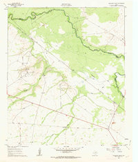
 1963 Toyah Lake1966 Print · USGSReeves County in the early sixties was defined by its vast alkali basins and remote ranching outposts. Researchers can trace the hydrology of Toyah Lake and Dry Salt Lake, or locate industry markers like the Lake Ranch and scattered Oil Wells.
 - 1968 Map of Threemile Draw, 1971 Print
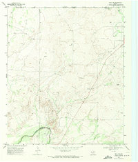
 1968 Threemile Draw1971 Print · USGSReeves County ranching and early oil exploration are documented here in the late sixties. Researchers can locate named water improvements and windmills like Charlie Ross Tank, Orla Windmill, and Threemile Draw.
 - 1968 Map of Orla, 1971 Print
 1968 Orla1971 Print · USGSReeves County at the end of the sixties shows a landscape of rail-centered industry and remote ranching outposts. Researchers can trace the development of the Oil Field and find scattered landmarks like Arroyo Bonito Windmill and the Roadside Park near Orla.
 - 1968 Map of Orla NE, 1971 Print
 1968 Orla NE1971 Print · USGSLoving County ranching and energy production intersect in the late sixties as industry expanded across the state line. Trace the remote infrastructure of the era through Boyd Ranch, the Pecos River, and the Gyp Windmill.
 - 1968 Map of Red Bluff, 1971 Print
 1968 Red Bluff1971 Print · USGSThe Texas-New Mexico borderlands in the late sixties were defined by the massive Red Bluff Reservoir and the Pecos River. Trace the industrial footprint of the Sullivan Oil Field and the Atchison Topeka and Santa Fe rail line.
 - 1968 Map of W T Ranch, 1971 Print
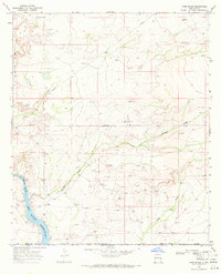
 1968 W T Ranch1971 Print · USGSReeves County ranching life is captured in the late sixties, showing a landscape defined by cattle and water. Researchers can trace the infrastructure of the range through labels like W T Ranch, High Lonesome Windmill, and Seven Up Tank.
 - 1968 Map of Halamicek Ranch, 1971 Print
 1968 Halamicek Ranch1971 Print · USGSReeves County ranching life is preserved here during the late sixties, showing a landscape defined by seasonal water and remote outposts. Researchers can trace land holdings like Halamicek Ranch and the Burehard Place or locate early aviation sites like the Landing Area.
 - 1968 Map of Mentone SW, 1971 Print
 1968 Mentone SW1971 Print · USGSReeves County ranchlands in the late sixties show a landscape defined by water management and early oil exploration. Trace family-named landmarks and water sources like Simmons Windmill, Halamicek Draw, and Eightfoot Windmill.
 - 1968 Map of Ross Ranch, 1971 Print
 1968 Ross Ranch1971 Print · USGSEddy County ranching and energy extraction are captured here in the late sixties, just as the regional pipeline network was expanding. Researchers can trace the layout of the Ross Ranch and the industrial activity near Rustler and the Pecos River Red Bluff Reservoir.
End of results
Showing maps 1-22 of 22
Top cities of Reeves County
Frequently asked questions
- What are the different types of historical maps available for Reeves County?
- What is the oldest map of Reeves County?
- Where can I purchase historical maps of Reeves County for my home or office?
- Where can I download high-res historical maps of Reeves County?
- Are there historical topographic maps available for Reeves County?
- Is there historical aerial imagery available for Reeves County?
- Where are historical maps of Reeves County sourced from?