1970s Maps of Reeves County, Texas
Explore 39 historic maps of Reeves County from the 1970s. These maps offer a rare glimpse into what life looked like during the 1970s — showing old roads, neighborhoods, homes, and landmarks that have changed or disappeared over time.
Whether you're researching your family's past, planning a metal detecting trip, or studying how Reeves County's landscape evolved across the 1970s, these high-resolution maps are a powerful tool for exploring the history of this region.
- Focus on a specific era: All maps on this page are from the 1970s, giving you a focused view of this time period.
- See what’s changed: Compare century-old streets, trails, and buildings to today's modern landscape using overlays and satellite layers.
- Research with precision: Use these maps for genealogy, historical research, land use analysis, or educational projects.
- View, download, or print: Maps are fully viewable online in high resolution, and can be downloaded or printed for your own records.
Start exploring Reeves County's history through authentic maps from the 1970s. This is your window into the past.
Reeves County, TX maps
(39)- 1970 Map of Hermosa SW, 1973 Print
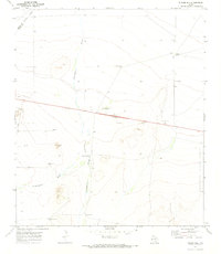
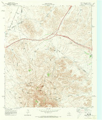
 1970 Hermosa SW1973 Print · USGSReeves County at the start of the 1970s shows a landscape of utility and transit across the West Texas desert. Researchers can trace the path of the Texas and Pacific railroad and locate local industry sites like the Cotton Gin and a rural Landing Strip.
 - 1970 Map of Tucker Hill, 1973 Print
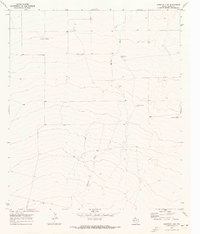
 1970 Tucker Hill1973 Print · USGSThe West Texas ranchlands near the Pecos and Reeves county line appear here as they were in the early seventies, defined by water-rights and resource extraction. Researchers can locate the Schoolhouse, several Gravel Pits, and a series of named landmarks like Metzger Windmill and Hayter Hill.
 - 1970 Map of Deep Well Ranch, 1973 Print
 1970 Deep Well Ranch1973 Print · USGSRanching life in West Texas during the early seventies was shaped by the desert draws and isolated outposts like Deep Well Ranch. Genealogists and historians can trace the Reeves Co Pecos Co line past the Dutch Windmill and a solitary Grave.
 - 1970 Map of Florenzo Hill, 1973 Print
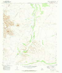
 1970 Florenzo Hill1973 Print · USGSReeves County at the dawn of the 1970s reveals a desert landscape shaped by water scarcity and ranching infrastructure. Trace the essential desert water sources at Ninemile Spring, Sparks Windmill, and Jones Well.
 - 1970 Map of Big Hill, 1973 Print
 1970 Big Hill1973 Print · USGSRanching and early energy exploration define this corner of Reeves County in the early seventies. Genealogists and historians can locate family-named sites like Johnson Hill and trace water resources from McIlvain Tank to the High Lonesome Windmill.
 - 1970 Map of Toyah, 1973 Print
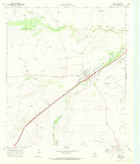 1970 Toyah1973 Print · USGSSettled on the Texas and Pacific rail line in the 1970s, Toyah serves as a focal point for this Reeves County study. Genealogists and historians can trace local landmarks like Toyah Old Cem, Bullington Hill, and the Mexican Corl.
 - 1970 Map of Barstow 3 SW, 1973 Print
 1970 Barstow 3 SW1973 Print · USGSReeves County ranching country is captured here in the early seventies, showing a landscape defined by water and wide-open space. Genealogists can trace family-named landmarks like Hoefs Ranch and several historic windmills, including Hugh Moore Windmill.2 unique versions available
 - 1970 Map of San Martine, 1973 Print
 1970 San Martine1973 Print · USGSThe West Texas ranchlands and the Culberson-Reeves county line come into focus during the early seventies. Researchers can trace the infrastructure of the desert economy through landmarks like the T Diamond Ranch, Seven Heart Crossing, and the Texas and Pacific railroad.
 - 1970 Map of Hermosa, 1973 Print
 1970 Hermosa1973 Print · USGSReeves County at the start of the 1970s reveals a landscape transitioning from open range to a busy energy corridor. Researchers can trace the industrial footprint of the Gas Plant, the Texas and Pacific railroad, and the small settlement of Hermosa.
 - 1970 Map of Gozar, 1973 Print
 1970 Gozar1973 Print · USGSReeves County, Texas, was a land of iron rails and ephemeral water during the early seventies. Trace the path of the Texas and Pacific railroad past ranching landmarks like the Three Inch Windmill and the settlement of Gozar.
 - 1970 Map of Toyah SW, 1973 Print
 1970 Toyah SW1973 Print · USGSReeves County ranchlands and water sources are captured here in the early seventies before modern changes. Researchers can trace the legacy of remote holdings and desert infrastructure through Moody Ranch, Kelley Wells, and Pelican Spring.
 - 1970 Map of Gomez Peak, 1973 Print
 1970 Gomez Peak1973 Print · USGSThe High Desert ranchlands of West Texas are captured here at the start of the 1970s. Trace old family outfits and remote outposts like Dyer Camp, Cowden Ranch, and the Cowan Homestead among the peaks and springs.2 unique versions available
 - 1970 Map of Sotol Hill, 1973 Print
 1970 Sotol Hill1973 Print · USGSReeves and Jeff Davis counties are shown here as they appeared in the early 1970s, defined by the isolated ranching outposts of West Texas. Researchers can trace historic land use through cattle-rearing infrastructure like Lether Ranch, Canyon Windmill, and Highway Tank.
 - 1970 Map of Barstow 3 SE, 1973 Print
 1970 Barstow 3 SE1973 Print · USGSIn the arid West Texas desert during the early seventies, the borderlands of the Trans-Pecos reveal a landscape of isolated ranching and oil extraction. Trace the locations of family-named landmarks like McCarmack Windmill and the Blue Ridge Farm alongside industrial Oil Wells.2 unique versions available
 - 1970 Map of Barstow 3 NE, 1973 Print
 1970 Barstow 3 NE1973 Print · USGSReeves County at the dawn of the seventies shows a desert landscape shaped by the energy industry and specialized testing. Researchers can trace the infrastructure of the Toro Gas Field alongside rural outposts like Flat Top Farm and Hereford.2 unique versions available
 - 1970 Map of Verhalen South, 1973 Print
 1970 Verhalen South1973 Print · USGSThe Pecos Valley Southern rail corridor through Reeves County is captured here in the early seventies. Trace the rural footprint of Verhalen and Saragosa, and locate specific landmarks like the Cotton Gin and several named watercourses including Toyah Creek.
 - 1970 Map of Deep Well Ranch NW, 1973 Print
 1970 Deep Well Ranch NW1973 Print · USGSThe West Texas ranchlands at the Reeves and Pecos county line are captured here during the early seventies. Genealogists and historians can trace the remote Graef Ranch and Hayter Ranch or locate water sources like Chapo Windmill.
 - 1970 Map of Saragosa NW, 1973 Print
 1970 Saragosa NW1973 Print · USGSReeves County, Texas, was a landscape of remote industrial and agricultural outposts in the late sixties. Researchers can trace the infrastructure of the era through a Cotton Gin, a local LANDING STRIP, and several family-owned or commercial Well sites.
 - 1970 Map of Barstow 3 NW, 1973 Print
 1970 Barstow 3 NW1973 Print · USGSReeves County at the start of the 1970s reveals a West Texas landscape defined by resource extraction and desert hydrology. Genealogists and local historians can trace the Davidson Farm and follow the path of Barrilla Draw past several Oil Wells.2 unique versions available
 - 1970 Map of Toyah NW, 1973 Print
 1970 Toyah NW1973 Print · USGSReeves County ranching and water management are frozen in time during the late sixties and early seventies. Genealogists and historians can trace essential desert landmarks like Johnson Spring, Willis Tank, and the prominent Round Mountain.
 - 1970 Map of Saragosa, 1974 Print
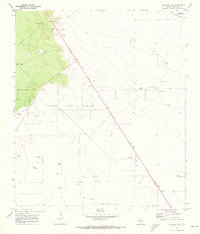
 1970 Saragosa1974 Print · USGSIn the Pecos Valley during the 1970s, the irrigation-dependent settlement of Saragosa remained a focal point of West Texas ranching and transit. Researchers can trace the Southern rail line through Saragosa Siding and locate the Cem and the Water Improvement Canal.
 - 1970 Map of Meier Hills, 1974 Print
 1970 Meier Hills1974 Print · USGSReeves County at the start of the 1970s reveals a high-desert landscape focused on water management and ranching. Genealogists and historians can trace essential water sources and landmarks like Cotton Springs, the Fiorenzo Windmill, and the long Aqueduct across the terrain.
 - 1971 Map of Verhalen North, 1973 Print
 1971 Verhalen North1973 Print · USGSReeves County at the start of the seventies shows a landscape defined by the Pecos Valley Southern railroad. Genealogists and historians can trace rail-side settlements like Hoban, Collier, and Verhalen along with numerous wells and local Gravel Pits.
 - 1971 Map of Worsham, 1973 Print
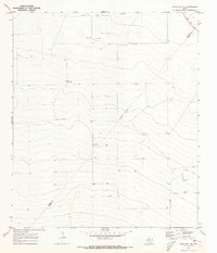
 1971 Worsham1973 Print · USGSReeves County agriculture and aviation come into focus in the early seventies along the Pecos Valley Southern rail line. Researchers can locate specialized sites like the Texas Agricultural Experiment Station and the Worsham Airfield.
 - 1971 Map of Pecos West, 1973 Print
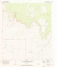
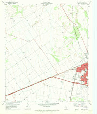 1971 Pecos West1973 Print · USGSReeves County at the start of the 1970s reveals a bustling rail hub and growing community. Local researchers can trace the development of Pecos neighborhoods, locate family plots at Mount Evergreen Cem, or identify landmarks like the Drive-in Theater.2 unique versions available
Showing maps 1-25 of 39
Top cities of Reeves County
Frequently asked questions
- What are the different types of historical maps available for Reeves County?
- What is the oldest map of Reeves County?
- Where can I purchase historical maps of Reeves County for my home or office?
- Where can I download high-res historical maps of Reeves County?
- Are there historical topographic maps available for Reeves County?
- Is there historical aerial imagery available for Reeves County?
- Where are historical maps of Reeves County sourced from?