Old Maps of Reeves County, Texas for Hiking & Exploration
Hike through history with 164 historic maps of Reeves County. Explore old trails, ghost towns, and forgotten backroads — perfect for outdoor adventurers and local explorers.
- Rediscover forgotten places: Map out old mining camps, roads, and footpaths that no longer exist on modern maps.
- Layer with modern tools: Combine with LiDAR or satellite views to plan hikes through historical terrain.
- Made for exploration: Popular among hikers, overlanders, and local history lovers.
Use these maps to find adventure and explore the hidden past of Reeves County.
Reeves County, TX maps
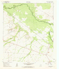
(164)- 1894 Map of Fort Davis, 1961 Print
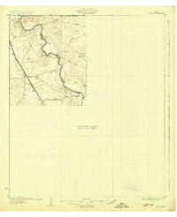
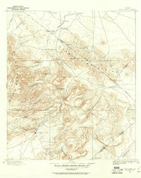 1894 Fort Davis1961 Print · USGSWest Texas in the late nineteenth century was a frontier of family ranching and vital springs. Genealogists and historians can trace the early locations of Fort Davis and numerous homesteads like Wards Ranch, Mahle's Ranch, and Huelster.
 - 1897 Map of Fort Davis
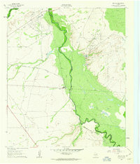
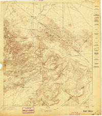 1897 Fort Davis1897 Print · USGSWest Texas ranching life and mountain topography are preserved in this 1890s survey centered on the frontier outpost of Fort Davis. Researchers can trace early family landholdings and essential water sites like Wards Ranch, Toyahvale, and Phantom Lake.3 unique versions available
 - 1921 Map of Toyah
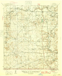
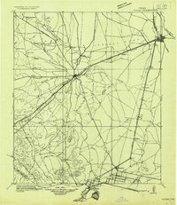 1921 Toyah1921 Print · USGSReeves County at the dawn of the highway era is documented here, showing the junction of major rail lines and early transcontinental motor routes. Researchers can trace family ranching history and railroad development through Toyah, Saragosa, and the VR Ranch.
 - 1925 Map of Orla 2-b
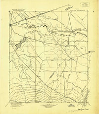
 1925 Orla 2-b1925 Print · USGSThe Pecos River valley at the Texas and New Mexico border comes to life in this mid-1920s survey. Researchers can trace the early rail corridor of the Panhandle and Santa Fe or locate landmarks like the Orla School and Olds Ranch.
 - 1928 Map of Kent
 1928 Kent1928 Print · USGSWest Texas ranching and rail life at the end of the 1920s are captured here as the region transitioned toward modern highway travel. Genealogists and historians can trace early outposts like Kent, family ranch sites such as Diamond Ranch, and the route of the Old Spanish Trail.
 - 1929 Map of Hovey
 1929 Hovey1929 Print · USGSIn the Trans-Pecos during the late twenties, the railroad and early motor trails dictated the rhythm of life across the mesa country. Researchers can trace the path of the Old Spanish Trail, locate rural stops like Chancellor, and identify family landmarks like Hayter and Williams.
 - 1931 Map of Barstow
 1931 Barstow1931 Print · USGSWest Texas ranching and early oil exploration meet along the Pecos River during the early thirties. Trace family ranch sites like Eclipse Ranch and Courtney Ranch or locate early rural education hubs at Welcome School.
 - 1931 Map of Orla
 1931 Orla1931 Print · USGSThe Pecos River valley at the Texas-New Mexico border appears here in the early thirties. Trace the route of the Panhandle and Santa Fe railroad past Angeles and the ranching homestead at Olds Ranch.2 unique versions available
 - 1945 Map of Malaga, 1970 Print
 1945 Malaga1970 Print · USGSEddy County ranchlands and river valleys are captured here at the end of the war, as the rail-and-ranch economy shaped southern New Mexico. Genealogists and historians can locate specific family holdings like the Delaware Ranch and Welch Ranch, alongside a vintage Bombing Target.
 - 1946 Map of Malaga
 1946 Malaga1946 Print · USGSSouthern New Mexico ranching and river life are frozen in time just after the war. Researchers can trace family ranch lands like Cottonwood Ranch and Reeves Ranch or locate unique landmarks like the Bombing Target and Harkey Double Mills.
 - 1954 Map of Carlsbad, 1963 Print
 1954 Carlsbad1963 Print · USGSSoutheastern New Mexico's desert peaks and river valleys appear in this mid-century study of the borderlands. Researchers can locate vanished sites like Sacramento City, trace the Pecos River reservoirs, and explore Carlsbad Caverns.3 unique versions available
 - 1954 Map of Hobbs, 1963 Print
 1954 Hobbs1963 Print · USGSThe High Plains and Permian Basin transition is captured here at the height of the mid-century energy boom. Genealogists and industrial historians can trace the foundations of Humble City, locate the Potash Mine and Plant, and follow the Texas-New Mexico RR.2 unique versions available
 - 1954 Map of Van Horn, 1964 Print
 1954 Van Horn1964 Print · USGSThe Trans-Pecos region of West Texas comes into focus in the mid-1950s as a vital corridor of rail and desert commerce. Researchers can trace the path of the Texas and Pacific through Van Horn or locate remote rail sidings like Borracho and Laska Siding.2 unique versions available
 - 1954 Map of Pecos, 1964 Print
 1954 Pecos1964 Print · USGSMid-century West Texas reveals a landscape of expanding oil fields and cattle ranching along the winding Pecos River. Local historians can trace family ranch lands like Goodrich Ranch, follow the Texas and Pacific rails, or locate the historic Horsehead Crossing.3 unique versions available
 - 1954 Map of Fort Stockton, 1965 Print
 1954 Fort Stockton1965 Print · USGSWest Texas ranching and the early energy industry converge in this mid-century survey of the Trans-Pecos. Genealogists and historians can locate specific family lands like Graef Brothers Ranch and trace the paths of the Old Spanish Trail and the Southern Pacific railroad.3 unique versions available
 - 1955 Map of Saragosa, 1984 Print
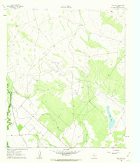
 1955 Saragosa1984 Print · USGSSoutheast Texas oil and timber culture thrives in the mid-1950s at the junction of the Big Thicket and the coastal plain. Genealogists and historians can trace family burial sites like Griffin Cem and the industrial layout of the Saratoga Oil Field and Gulf Colorado and Santa Fe Railroad.
 - 1957 Map of Pecos
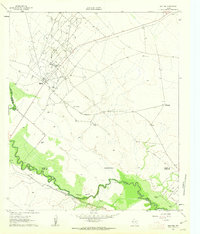
 1957 Pecos1957 Print · USGSWest Texas in the mid-fifties is a landscape of desert oil fields and vital rail corridors. Researchers can trace the sprawling Pyote Air Force Base, the historic Horsehead Crossing, and the rail stops at Mentone and Saragosa.
 - 1958 Map of Van Horn
 1958 Van Horn1958 Print · USGSWest Texas ranching and rail history come alive in this 1950s survey of the Trans-Pecos desert during the era of major steam-to-diesel transition. Genealogists and historians can trace family-named outposts like Mayfield Ranch or locate the ruins of Presidio Viejo along the Rio Grande.
 - 1958 Map of Carlsbad
 1958 Carlsbad1958 Print · USGSSoutheastern New Mexico in the mid-1950s shows a landscape of deep desert basins and high forest ranges during a period of steady ranching and early tourism. Researchers can trace the path of the Atchison Topeka and Santa Fe railroad or find vanished locales like Sacramento City (abandoned) and Whites City.2 unique versions available
 - 1958 Map of Fort Stockton
 1958 Fort Stockton1958 Print · USGSThe Trans-Pecos region of West Texas in the late fifties is a landscape of vast mesas and isolated ranching hubs. Genealogists and historians can trace the paths of the Texas and New Orleans RR through Alpine or locate early settlements like Bakersfield and Sanderson.
 - 1958 Map of Hobbs
 1958 Hobbs1958 Print · USGSThe High Plains of the Texas-New Mexico border are shown here during the height of the mid-century oil boom. Genealogists and historians can trace the development of Hobbs, Lovington, and Jal, alongside ranching landmarks like James Ranch and the early Texas-New Mexico Railway.
 - 1961 Map of Soda Lake, 1963 Print
 1961 Soda Lake1963 Print · USGSThe Pecos River valley in the early sixties was a place where irrigation and oil extraction met. You can trace the path of the Barstow Canal, find the Dunegan Ranch, and locate the isolated Grave north of the Cedarvale Canal.3 unique versions available
 - 1961 Map of Mentone, 1963 Print
 1961 Mentone1963 Print · USGSMentone and the surrounding West Texas plains are captured here in the early sixties as the local economy balanced ranching with an intensive oil boom. Researchers can trace the industrial layout of the Wheat Oil Field alongside family landmarks like Moorehead Ranch and the Panhandle and Santa Fe railroad.2 unique versions available
 - 1961 Map of Anderson Ranch, 1963 Print
 1961 Anderson Ranch1963 Print · USGSThe Pecos River frontier in the early sixties reveals a landscape shaped by petroleum and ranching at the border of Reeves and Loving counties. Researchers can trace the mid-century industrial footprint of the Dixieland Oil Field and the rail sidings at Arno.2 unique versions available
 - 1961 Map of Orla SE, 1963 Print
 1961 Orla SE1963 Print · USGSThe Pecos Valley in the early 1960s reveals a West Texas landscape dominated by the petroleum industry and the winding river boundary. Researchers can trace the rail-and-oil economy through the Tunstill Oil Field, the river stop at Riverton, and the refinery near Mason Station.2 unique versions available
Showing maps 1-25 of 164
Top cities of Reeves County
Frequently asked questions
- What are the different types of historical maps available for Reeves County?
- What is the oldest map of Reeves County?
- Where can I purchase historical maps of Reeves County for my home or office?
- Where can I download high-res historical maps of Reeves County?
- Are there historical topographic maps available for Reeves County?
- Is there historical aerial imagery available for Reeves County?
- Where are historical maps of Reeves County sourced from?