Old Maps of Sterling County, Texas for Genealogy
Trace your family roots with 161 historic maps of Sterling County. These high-res maps reveal old neighborhoods, homesites, landmarks, and streets — helping you uncover where your ancestors lived and how the area evolved over time.
- Explore historic neighborhoods: Identify where your relatives may have lived in the 1800s or 1900s.
- Compare maps over time: Trace the changes in streets, buildings, and landmarks for multi-generational research.
- Perfect for genealogy & ancestry research: Used by family historians and researchers to map out lineage and migration.
These maps are an incredible resource for exploring your personal connection to Sterling County's past.
Sterling County, TX maps
(161)- 1941 Map of Big Spring South, 1949 Print
 1941 Big Spring South1949 Print · USGSHoward County ranching and early oil development are captured here in the late thirties. Genealogists can trace family holdings like W T Roberts Ranch and find rural landmarks such as Chalk Sch or the remote Hollis siding.2 unique versions available
 - 1942 Map of Big Spring South
 1942 Big Spring South1942 Print · USGSThe West Texas ranchlands south of Big Spring come alive in this late Depression-era survey. Genealogists and historians can locate family landmarks like the Wasson Ranch, Panther Draw Sch, and the early oil-era settlement of Forsan.
 - 1954 Map of Big Spring, 1965 Print
 1954 Big Spring1965 Print · USGSWest Texas in the mid-1950s shows a landscape of growing oil towns and vital rail links along the Texas and Pacific RR. Researchers can trace the development of Big Spring, find smaller settlements like Knott and Lomax, or locate landmarks such as Boyds Chapel and Signal Mountain.4 unique versions available
 - 1954 Map of San Angelo, 1967 Print
 1954 San Angelo1967 Print · USGSThe Concho Valley and eastern Permian Basin transition from ranching to a burgeoning oil economy during the mid-twentieth century. Trace the expansion of San Angelo near Goodfellow AFB and locate old crossroads like Stiles, Texon, and Barnhart along the SANTA FE railroad.2 unique versions available
 - 1958 Map of San Angelo
 1958 San Angelo1958 Print · USGSWest Texas in the late fifties centers on the growing hub of San Angelo and its vital river confluences. Genealogists and historians can trace the paths of the Santa Fe railroad to outposts like Fort Chadbourne, Big Lake, and the specialized community of Sanatorium.
 - 1958 Map of Big Spring
 1958 Big Spring1958 Print · USGSThe West Texas oil boom was in full swing during the late fifties, transforming the landscape around Howard and Mitchell counties. Genealogists and historians can trace the growth of Big Spring and Snyder alongside industrial landmarks like the Kelly-Snyder Oil Field and the Santa Fe rail lines.
 - 1959 Map of McWhorter Mountain, 1960 Print
 1959 McWhorter Mountain1960 Print · USGSThe Mitchell and Sterling County line was a landscape of remote sheep camps and critical water management in the late fifties. Genealogists and historians can trace ranching heritage through dozens of named stock tanks like Old Boatright Tank and the isolated Powell Sheep Camp.
 - 1959 Map of Dead Indian Mountain, 1960 Print
 1959 Dead Indian Mountain1960 Print · USGSThe West Texas oil boom is in full swing at the end of the fifties as petroleum pipelines and wells spread across the Coke County line. Trace family ranching roots and industrial history through landmarks like Perkins Plant, Dead Indian Mountain, and the Old McWhorter Tank.
 - 1963 Map of Cumbie Draw, 1964 Print
 1963 Cumbie Draw1964 Print · USGSSterling County ranching and petroleum development are captured here in the early sixties as the North Concho River bisects the land. Researchers can find the Foster Cem, an Old RR Grade, and the family-named Foster Ranch.
 - 1963 Map of Glass Ranch, 1964 Print
 1963 Glass Ranch1964 Print · USGSSterling County ranch lands and petroleum interests are captured here in the early 1960s. Genealogists and researchers can trace family holdings like Glass Ranch and Bobs Creek Ranch or locate early industrial sites including the Herrell Oil Field.2 unique versions available
 - 1963 Map of Cumbie Draw NE, 1964 Print
 1963 Cumbie Draw NE1964 Print · USGSThe North Concho River valley in the early 1960s was a landscape of ranching and emerging energy infrastructure. Researchers can trace family-run operations at Reed Ranch and locate industrial landmarks like the regional PIPELINES and several Prospects.2 unique versions available
 - 1963 Map of Buffalo Draw, 1964 Print
 1963 Buffalo Draw1964 Print · USGSThe West Texas rangeland along the Mitchell and Sterling County line is captured here in the early sixties, showing a landscape defined by deep draws and cattle ranching. Trace early landmarks like Knobhill Cem and seasonal water sources like Hyman Tank and Mustang Creek.
 - 1963 Map of Hayrick Mountain, 1964 Print
 1963 Hayrick Mountain1964 Print · USGSWest Texas ranching and energy interests intersect at the turn of the sixties where Howard, Mitchell, and Sterling Counties meet. Trace the lineage of local landmarks like Dipping Vat Tank, Rockwater Hole, and Patsy Windmill.
 - 1963 Map of Currie Reservoir, 1965 Print
 1963 Currie Reservoir1965 Print · USGSThe West Texas ranchlands along the Glasscock and Sterling County line are captured here in the early 1960s. Researchers can trace the local oil economy and family holdings through the Clyde Reynolds Oil Field, Currie Ranch, and Currie Reservoir.
 - 1963 Map of Garden City NE, 1965 Print
 1963 Garden City NE1965 Print · USGSThe Glasscock County cattle and oil country of the early sixties is preserved here, showing the remote ranchlands of the Permian Basin. Researchers can trace the industrial landscape of the Clyde Reynolds Oil Field and old ranching outposts like Lester and Hilltop Ranch.2 unique versions available
 - 1963 Map of Sand Bluff Draw, 1965 Print
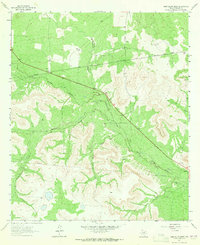 1963 Sand Bluff Draw1965 Print · USGSSterling County ranchlands are defined by the North Concho River and wide draws in the early sixties. Genealogists and historians can locate family holdings like Cole Ranch and McEntire Ranch along with landmarks like Sand Bluff.2 unique versions available
 - 1965 Map of San Angelo
 1965 San Angelo1965 Print · USGSWest Texas in the mid-sixties reveals a landscape shaped by the petroleum industry and strategic water management. Genealogists and historians can trace the rail corridor through Texon and Big Lake, or locate military landmarks like Goodfellow AFB and Broome Air Force Auxiliary Airfield.
 - 1971 Map of Forsan, 1974 Print
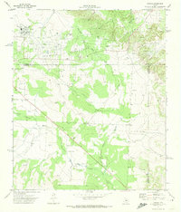 1971 Forsan1974 Print · USGSSettled along the Howard and Glasscock county lines in the early 1970s, this area shows a landscape defined by the North Concho River. Researchers can trace the local infrastructure of Forsan and Ross City, locating the High Sch and Cem.
 - 1972 Map of Sterling City, 1974 Print
 1972 Sterling City1974 Print · USGSSterling City is shown in the early 1970s at the junction of the North Concho River and Mackenzie Draw. Researchers can trace old property lines and local landmarks like Montvale Cem, the Gaging Sta, and numerous scattered Oil Wells.
 - 1972 Map of Dog Creek NE, 1974 Print
 1972 Dog Creek NE1974 Print · USGSWest Texas ranch and oil country come into focus during the early 1970s, where the three-way border of Tom Green, Coke, and Sterling Counties meets. Researchers can trace the extensive Water Valley Oil Field and Oil Wells along the North Concho River.2 unique versions available
 - 1972 Map of Dog Creek SW, 1974 Print
 1972 Dog Creek SW1974 Print · USGSWest Texas ranch country and oil exploration are documented in this early 1970s survey of the Sterling and Tom Green county lines. Researchers can trace the drainage of Little Mulberry Creek or locate remote work sites like an isolated Oil Well and a rural Landing Strip.
 - 1972 Map of Broome, 1974 Print
 1972 Broome1974 Print · USGSBroome and the Coke County ranchlands are captured here in the early 1970s, showing a landscape defined by water and oil. Researchers can trace rural infrastructure from the China Valley Road to landmarks like Shelving Rock Bluff and the North Concho River.
 - 1972 Map of Crawford Slide, 1974 Print
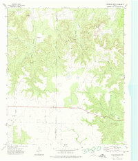 1972 Crawford Slide1974 Print · USGSCoke and Sterling County oil country is captured in the early seventies as the energy industry transformed the landscape. Trace the infrastructure of Jameson Field alongside local landmarks like Crawford Slide, Goat Mountain, and a quiet country Cem.2 unique versions available
 - 1972 Map of Sterling City NW, 1974 Print
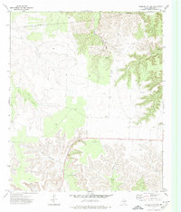 1972 Sterling City NW1974 Print · USGSSterling County’s ranching and energy landscape is captured here in the early 1970s. Researchers can trace historic water sources and property improvements like the Garrett Windmill, Elliott Well, and the winding Mackenzie Draw.2 unique versions available
 - 1972 Map of Dog Creek NW, 1975 Print
 1972 Dog Creek NW1975 Print · USGSSterling County ranching and energy extraction come into focus in the early 1970s. Trace the boundaries of the McClure Ranch, locate private Landing Strips, and find active oil wells along the breaks of Coyote Creek.
Showing maps 1-25 of 161
Top cities of Sterling County
Frequently asked questions
- What are the different types of historical maps available for Sterling County?
- What is the oldest map of Sterling County?
- Where can I purchase historical maps of Sterling County for my home or office?
- Where can I download high-res historical maps of Sterling County?
- Are there historical topographic maps available for Sterling County?
- Is there historical aerial imagery available for Sterling County?
- Where are historical maps of Sterling County sourced from?