1960s Maps of Stonewall County, Texas
Explore 24 historic maps of Stonewall County from the 1960s. These maps offer a rare glimpse into what life looked like during the 1960s — showing old roads, neighborhoods, homes, and landmarks that have changed or disappeared over time.
Whether you're researching your family's past, planning a metal detecting trip, or studying how Stonewall County's landscape evolved across the 1960s, these high-resolution maps are a powerful tool for exploring the history of this region.
- Focus on a specific era: All maps on this page are from the 1960s, giving you a focused view of this time period.
- See what’s changed: Compare century-old streets, trails, and buildings to today's modern landscape using overlays and satellite layers.
- Research with precision: Use these maps for genealogy, historical research, land use analysis, or educational projects.
- View, download, or print: Maps are fully viewable online in high resolution, and can be downloaded or printed for your own records.
Start exploring Stonewall County's history through authentic maps from the 1960s. This is your window into the past.
Stonewall County, TX maps
(24)- 1962 Map of Kiowa Peak, 1966 Print
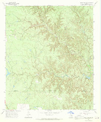
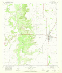
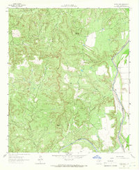 1962 Kiowa Peak1966 Print · USGSStonewall County at the start of the sixties shows a landscape defined by the meeting of major river forks. You can trace the confluence of the Double Mountain Fork and Salt Fork Brazos River near landmarks like Kiowa Peak and Two F Crossing.2 unique versions available
 - 1962 Map of Frog Mountain, 1966 Print
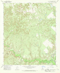
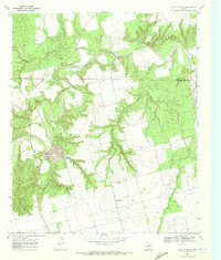
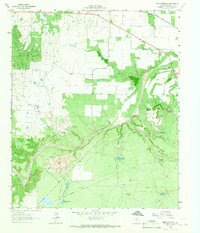 1962 Frog Mountain1966 Print · USGSStonewall County in the early 1960s shows a landscape of ranching and oil extraction along the winding Double Mountain Fork Brazos River. Researchers can locate family landmarks such as Rayner Cem and the Fort Worth and Denver rail line.2 unique versions available
 - 1964 Map of Sagerton, 1966 Print
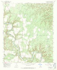
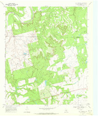
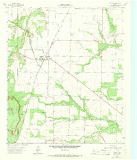 1964 Sagerton1966 Print · USGSHaskell and Stonewall Counties are captured in the mid-sixties as the rural landscape centered on the rail junction at Sagerton. Researchers can trace the dual rail lines of the Atchison Topeka and Santa Fe and landmarks like Flat Top Mountain.
 - 1965 Map of Jud, 1966 Print
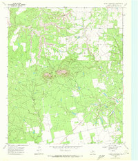
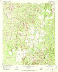
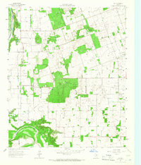 1965 Jud1966 Print · USGSHaskell County ranch lands and river breaks met the growing petroleum industry in the mid-1960s. Genealogists and historians can trace family roots at Idella Cem or study the extensive energy infrastructure surrounding Jud and the Jud Oil Field.
 - 1965 Map of Tuxedo, 1967 Print
 1965 Tuxedo1967 Print · USGSThe rural landscape of Jones and Haskell Counties is captured here in the mid-1960s, a time when rail lines and oil fields dominated the local economy. Genealogists and historians can trace family locations near Tuxedo, Capron Cem, and the Flat Top Ranch.2 unique versions available
 - 1965 Map of Hamlin NE, 1967 Print
 1965 Hamlin NE1967 Print · USGSThe West Texas ranching and oil country around Hamlin is captured here in the mid-sixties, showing a landscape defined by rail lines and resource extraction. Researchers can trace the legacy of the Atchison Topeka and Santa Fe, the East Cem, and the high ground of Flat Top Mountain.
 - 1965 Map of Hamlin NW, 1967 Print
 1965 Hamlin NW1967 Print · USGSFisher and Stonewall Counties in the mid-sixties reveal a landscape defined by petroleum production and rural community life. Researchers can trace family history at Afton Cem or locate vanished landmarks like Pardue Camp and Hitson.
 - 1967 Map of Knox City NW, 1970 Print
 1967 Knox City NW1970 Print · USGSThe Brazos River valley in the late sixties reveals a landscape of petroleum exploration and winding creek beds along the Knox and King county lines. Genealogists and researchers can locate the settlement of Hamilton, trace the route of Mc Faddin Lane, and identify numerous early Oil Wells.
 - 1967 Map of Kiowa Peak NW, 1970 Print
 1967 Kiowa Peak NW1970 Print · USGSKing and Stonewall counties appear as a network of rugged canyons and ranch lands in the late sixties. Trace the early industrial footprint of the region through labeled Oil Wells, the J M A Ranch, and seasonal water at Pen Branch Tank.2 unique versions available
 - 1967 Map of Kiowa Peak NE, 1970 Print
 1967 Kiowa Peak NE1970 Print · USGSThe King and Stonewall County line in the late sixties reveals a landscape of industrial energy expansion along the Brazos River. Researchers can trace the mid-century oil infrastructure through a Refinery, a Pumping Sta, and a remote Landing Strip.2 unique versions available
 - 1967 Map of Kiowa Peak SW, 1971 Print
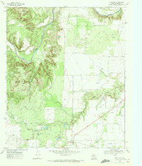
 1967 Kiowa Peak SW1971 Print · USGSStonewall County in the late sixties reveals a landscape where the river and ranching define the pace of life. Genealogists and historians can trace local ties at Mt Olive Cem and explore the industrial footprint of the Bissett Ranch Oil Field near Easy and Baker.2 unique versions available
 - 1968 Map of Double Mountains, 1972 Print
 1968 Double Mountains1972 Print · USGSStonewall County's ranching and oil country is captured in the late sixties, centered on the unmistakable peaks of the Double Mountains. Researchers can trace the industrial footprint of the era through numerous Oil Wells, a prominent Pipeline, and the winding course of the Salt Fork.
 - 1968 Map of Aspermont, 1972 Print
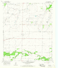
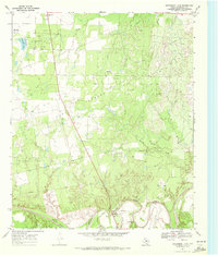
 1968 Aspermont1972 Print · USGSAspermont sits at the intersection of West Texas ranching and the petroleum industry during the late sixties. Researchers can trace the town's development through its High Sch and Rodeo Ground or locate the Shadle Cem and the Boyd Oil Field.
 - 1968 Map of Coon Hollow, 1972 Print
 1968 Coon Hollow1972 Print · USGSWest Texas in the late sixties shows a landscape shaped by petroleum and aviation near the winding Double Mountain Fork Brazos River. Genealogists and historians can trace family-named sites like Johnson Cem and Johnson Ch alongside the industrial footprint of the Frankirk Oil Field.
 - 1968 Map of Peacock, 1972 Print
 1968 Peacock1972 Print · USGSStonewall County in the late sixties reveals a landscape of shifting settlements and early industry along the Salt Fork Brazos River. Researchers can trace the Old Railroad Grade and locate family sites like Oriana (Site) and the Oriana Cem.
 - 1968 Map of Swenson, 1972 Print
 1968 Swenson1972 Print · USGSStonewall County at the end of the 1960s was an area of ranching and oil production centered around the settlement of Swenson. Researchers can trace the legacy of local families at Shadle Cem and follow the path of the Old Railroad Grade.
 - 1968 Map of Rule, 1972 Print
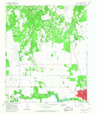
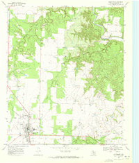
 1968 Rule1972 Print · USGSHaskell County agriculture and the regional rail economy define this West Texas landscape in the late sixties. Researchers can trace the town grid of Rule, find the Fairview Cem, and locate mid-century landmarks like the local Drive-in Theater.
 - 1969 Map of White Canyon, 1972 Print
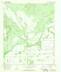
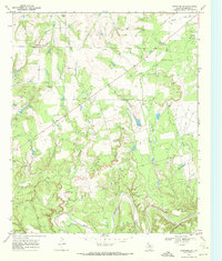
 1969 White Canyon1972 Print · USGSFisher and Stonewall counties in the late sixties were centers of extraction and rural community life. Genealogists and historians can trace the Double Mountain Fork Brazos River past family landmarks like McWhirter, the Highland Home Ch, and Dowell Cem.
 - 1969 Map of Poke Mountain, 1972 Print
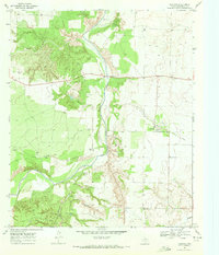
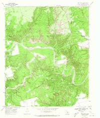
 1969 Poke Mountain1972 Print · USGSThe rugged breaks of the Brazos River frontier in West Texas are captured here at the close of the 1960s. Genealogists and historians can locate family landmarks like Mount Zion Cem, Sacred Heart Ch, and the sprawling Crescent Ranch.2 unique versions available
 - 1969 Map of A B C Creek, 1972 Print
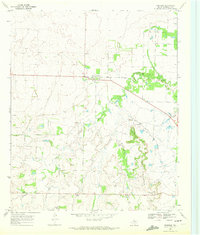
 1969 A B C Creek1972 Print · USGSThe West Texas ranchlands of Kent and Stonewall Counties are captured here during the late sixties oil boom. Genealogists and researchers can trace the rural communities of ABC and Harmony alongside landmarks like the Devils Backbone and SoRelle Lake.
 - 1969 Map of Aspermont Lake, 1972 Print
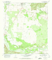
 1969 Aspermont Lake1972 Print · USGSStonewall County at the end of the sixties reveals a landscape shaped by petroleum and the winding Brazos River. Trace the development of Frankirk Oil Field, find the old Aspermont Landing Field, and locate family landmarks near Guest.2 unique versions available
 - 1969 Map of Jayton South, 1972 Print
 1969 Jayton South1972 Print · USGSKent County settlement and the West Texas plains are captured here in the late sixties as the local infrastructure evolved. Researchers can trace the path of the Old Railroad Grade, locate the town AQUEDUCT, and find the riverbanks of the Salt Fork Brazos River.
 - 1969 Map of Old Glory, 1972 Print
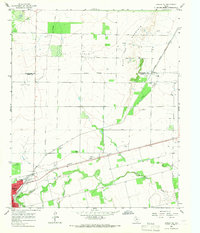
 1969 Old Glory1972 Print · USGSIn the late 1960s, this portion of Stonewall County was a hub of petroleum activity centered on the town of Old Glory. Researchers can trace the extensive Old Glory Oil Field, locate the Hooker Cem, and follow the Old Railroad Grade.
 - 1969 Map of Tige Canyon, 1972 Print
 1969 Tige Canyon1972 Print · USGSThe West Texas ranchlands and oil fields of Fisher, Kent, and Stonewall counties are revealed here in the late sixties. Genealogists and land researchers can trace the winding Double Mountain Fork Brazos River and find isolated landmarks like Devils Backbone and Tige Canyon.
End of results
Showing maps 1-24 of 24
Top cities of Stonewall County
Frequently asked questions
- What are the different types of historical maps available for Stonewall County?
- What is the oldest map of Stonewall County?
- Where can I purchase historical maps of Stonewall County for my home or office?
- Where can I download high-res historical maps of Stonewall County?
- Are there historical topographic maps available for Stonewall County?
- Is there historical aerial imagery available for Stonewall County?
- Where are historical maps of Stonewall County sourced from?