Old Maps of Stonewall County, Texas for Hiking & Exploration
Hike through history with 201 historic maps of Stonewall County. Explore old trails, ghost towns, and forgotten backroads — perfect for outdoor adventurers and local explorers.
- Rediscover forgotten places: Map out old mining camps, roads, and footpaths that no longer exist on modern maps.
- Layer with modern tools: Combine with LiDAR or satellite views to plan hikes through historical terrain.
- Made for exploration: Popular among hikers, overlanders, and local history lovers.
Use these maps to find adventure and explore the hidden past of Stonewall County.
Stonewall County, TX maps
(201)- 1891 Map of Anson
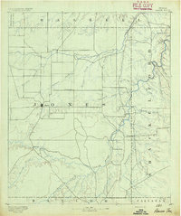 1891 Anson1891 Print · USGSJones County was still a frontier of small settlements and river crossings in the early 1890s. Genealogists and researchers can trace the early footprints of Anson alongside forgotten locales like Sandersville, Phantom Hill, and Rising Sun.
 - 1893 Map of Roby
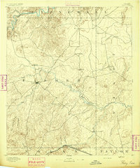 1893 Roby1893 Print · USGSFisher and Jones Counties come alive in the 1890s as early ranching settlements and rail sidings begin to dot the West Texas plains. Researchers can trace the early layout of Roby and locate lost community sites like Swedonia, Taopi, or the Winters Chapel congregation.4 unique versions available
 - 1893 Map of Anson
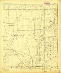 1893 Anson1893 Print · USGSCentral West Texas in the early 1890s shows a landscape of cattle ranches and early outposts. Genealogists can locate family-named settlements like Sandersville and Newsom or trace the early community at Phantom Hill.5 unique versions available
 - 1925 Map of Aspermont 4-a
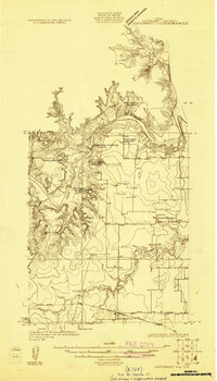 1925 Aspermont 4-a1925 Print · USGSThe community of Old Glory and the banks of the Salt Fork of Brazos River are captured here during the mid-1920s. Genealogists can trace rural family life through the locations of the Grand View Church, New Hope School, and Hooker School.
 - 1925 Map of Haskell 3-b
 1925 Haskell 3-b1925 Print · USGSSettlement in West Texas during the mid-twenties is centered on the railroad town of Rule and the winding Brazos River. Researchers can trace rural school locations like Rhody School and Cook Springs School or the old path of the Kansas City Mexico and Orient rail line.
 - 1926 Map of Snyder 1-a
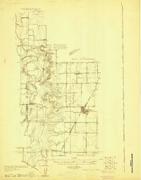
 1926 Snyder 1-a1926 Print · USGSWest Texas ranching country and the Brazos watershed are captured here in the mid-twenties, showing where three counties converge. Researchers can trace early roads like the Canadian Highway and locate rural landmarks such as the County Line School.
 - 1926 Map of Roby 2-b
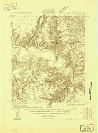
 1926 Roby 2-b1926 Print · USGSFisher and Stonewall Counties in the late 1920s are defined by the winding forks of the Brazos River and the remote schoolhouses of the West Texas plains. Researchers can locate family landmarks like the Dowell Cemetery, Wright School, and the rural Dowell Church.
 - 1931 Map of Rotan
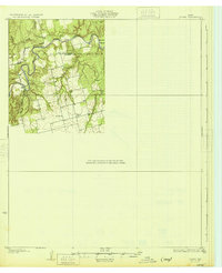 1931 Rotan1931 Print · USGSNorthwest Texas cattle and farming country comes into focus in the early 1930s as regional highways began to trace the hills. Genealogists can locate family landmarks like Dowell Ch and the neighboring Dorras Sch near the Stonewall and Fisher County line.2 unique versions available
 - 1931 Map of Aspermont
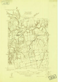
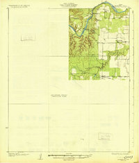 1931 Aspermont1931 Print · USGSStonewall County in the mid-1920s was a landscape of river breaks and quiet prairie crossroads. You can trace early family settlements and rural life through named landmarks like Old Glory, Grand View Ch, and the many river crossings such as Redhorse Crossing.2 unique versions available
 - 1932 Map of Camp Springs
 1932 Camp Springs1932 Print · USGSIn the 1930s, the borderlands of Kent and Fisher Counties featured a deeply dissected landscape carved by the Double Mountain Fork Brazos River. Local historians can trace the rural landscape of the era through landmarks like the County Line Sch and the expanse of Longhorn Valley.2 unique versions available
 - 1954 Map of Lubbock, 1958 Print
 1954 Lubbock1958 Print · USGSThe High Plains and Caprock region of West Texas come alive in the mid-1950s, showing a landscape defined by oil discovery and the Brazos River headwaters. Genealogists and historians can trace rail-connected towns like Roaring Springs, find the Pleasant Valley church, or locate family-named landmarks such as Soldier Mound.4 unique versions available
 - 1954 Map of Big Spring, 1965 Print
 1954 Big Spring1965 Print · USGSWest Texas in the mid-1950s shows a landscape of growing oil towns and vital rail links along the Texas and Pacific RR. Researchers can trace the development of Big Spring, find smaller settlements like Knott and Lomax, or locate landmarks such as Boyds Chapel and Signal Mountain.4 unique versions available
 - 1954 Map of Abilene, 1966 Print
 1954 Abilene1966 Print · USGSThe Texas Big Country comes into focus in the mid-1950s as petroleum and new water projects reshape the landscape. Local historians can trace the Butterfield Trail, find the Fort Phantom Hill Ruins, and locate numerous small communities along the Texas & Pacific line.2 unique versions available
 - 1954 Map of Wichita Falls, 1966 Print
 1954 Wichita Falls1966 Print · USGSNorth Texas in the mid-fifties is captured here as a landscape of expanding oil fields and vital rail corridors. Genealogists and historians can trace family roots through rural landmarks like Bacon Chapel and the rail-side growth of Seymour and Archer City.3 unique versions available
 - 1958 Map of Big Spring
 1958 Big Spring1958 Print · USGSThe West Texas oil boom was in full swing during the late fifties, transforming the landscape around Howard and Mitchell counties. Genealogists and historians can trace the growth of Big Spring and Snyder alongside industrial landmarks like the Kelly-Snyder Oil Field and the Santa Fe rail lines.
 - 1958 Map of Wichita Falls
 1958 Wichita Falls1958 Print · USGSNorth Texas during the late fifties reveals a landscape defined by the booming petroleum industry and established rail hubs. Researchers can trace the development of Wichita Falls and discover rural landmarks like Barton's Chapel or the Hull-Silk Oil Field.
 - 1958 Map of Abilene
 1958 Abilene1958 Print · USGSMid-century West Texas comes alive in this survey of the Abilene and Stephenville region during a period of steady oil expansion and military growth. Genealogists and local historians can trace the paths of the Texas & Pacific RR through historic towns, locate the Fort Griffin Ruins, and find smaller settlements like Desdemona and Lueders.
 - 1958 Map of Pursley House, 1959 Print
 1958 Pursley House1959 Print · USGSThe West Texas ranchlands at the junction of four counties are captured here in the late fifties. Researchers can trace remote homesteads and cattle operations like Pursley House, Beggs Ranch, and Kellar Field Camp.2 unique versions available
 - 1958 Map of Southerland Canyon, 1959 Print
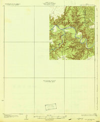
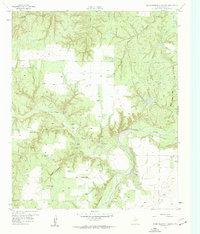
 1958 Southerland Canyon1959 Print · USGSCattle ranching in the late fifties defines this rugged boundary between King and Stonewall counties. Researchers can trace historic fence lines and cattle infrastructure around the Bar S Ranch and local landmarks like Haystack Mountain and Southerland Canyon.2 unique versions available
 - 1958 Map of Seven Diamond L Canyon, 1959 Print
 1958 Seven Diamond L Canyon1959 Print · USGSStonewall County ranching life is frozen in time here during the late fifties, centered on the winding Salt Fork Brazos River. Genealogists and historians can trace the foundations of rural life at Golden Pond Sch or locate family-named landmarks like Starcher Windmill and Ellis Pens.3 unique versions available
 - 1958 Map of Lovers Resort, 1959 Print
 1958 Lovers Resort1959 Print · USGSStonewall County in the late fifties was a landscape of river bends and oil derricks along the Salt Fork Brazos River. Researchers can locate rural landmarks like the Shinnery Lake Community Hall and the Brazos Valley Cemetery.2 unique versions available
 - 1958 Map of Jayton, 1960 Print
 1958 Jayton1960 Print · USGSJayton and the West Texas canyonlands are captured here in the late fifties, just as the local rail and road networks were established. Trace the Fort Worth and Denver (Burlington) line past Jayton Cem and the northern Airstrip.2 unique versions available
 - 1959 Map of Bob Creek, 1960 Print
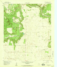
 1959 Bob Creek1960 Print · USGSThe King and Stonewall County borderlands are documented here in the late fifties, capturing a period of transition for West Texas ranching. Researchers can locate the Gilberton Cem and trace the Salt Fork Brazos River past the Martin Ranch.2 unique versions available
 - 1962 Map of Kiowa Peak, 1966 Print
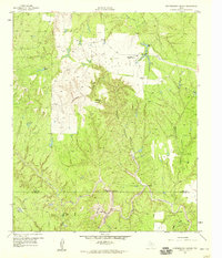
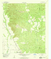
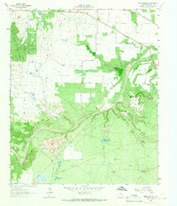
 1962 Kiowa Peak1966 Print · USGSStonewall County at the start of the sixties shows a landscape defined by the meeting of major river forks. You can trace the confluence of the Double Mountain Fork and Salt Fork Brazos River near landmarks like Kiowa Peak and Two F Crossing.2 unique versions available
 - 1962 Map of Frog Mountain, 1966 Print
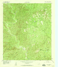
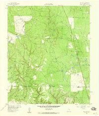
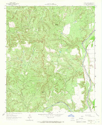
 1962 Frog Mountain1966 Print · USGSStonewall County in the early 1960s shows a landscape of ranching and oil extraction along the winding Double Mountain Fork Brazos River. Researchers can locate family landmarks such as Rayner Cem and the Fort Worth and Denver rail line.2 unique versions available
Showing maps 1-25 of 201
Top cities of Stonewall County
Frequently asked questions
- What are the different types of historical maps available for Stonewall County?
- What is the oldest map of Stonewall County?
- Where can I purchase historical maps of Stonewall County for my home or office?
- Where can I download high-res historical maps of Stonewall County?
- Are there historical topographic maps available for Stonewall County?
- Is there historical aerial imagery available for Stonewall County?
- Where are historical maps of Stonewall County sourced from?