1900s (20th Century) Maps of Utah
Explore 2,683 historic maps of Utah from the 1900s (20th Century). These maps offer a rare glimpse into what life looked like during the 1900s — showing old roads, neighborhoods, homes, and landmarks that have changed or disappeared over time.
Whether you're researching your family's past, planning a metal detecting trip, or studying how Utah's landscape evolved across the 1900s, these high-resolution maps are a powerful tool for exploring the history of this region.
- Focus on a specific era: All maps on this page are from the 1900s, giving you a focused view of this time period.
- See what’s changed: Compare century-old streets, trails, and buildings to today's modern landscape using overlays and satellite layers.
- Research with precision: Use these maps for genealogy, historical research, land use analysis, or educational projects.
- View, download, or print: Maps are fully viewable online in high resolution, and can be downloaded or printed for your own records.
Start exploring Utah's history through authentic maps from the 1900s. This is your window into the past.
Utah maps
(2,683)- 1900 Map of Coalville, 1955 Print
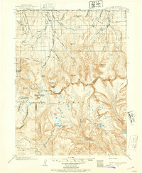
 1900 Coalville1955 Print · USGSThe high valleys of Summit and Wasatch counties are captured at the turn of the century as the silver and coal industries flourished. Researchers can trace early settlements like Rockport and Hailstone or locate the industrial Ontario Drain Tunnel near Park City.2 unique versions available
 - 1901 Map of Hayden Peak
 1901 Hayden Peak1901 Print · USGSThe high Uintas at the turn of the century appear here as a pristine wilderness of alpine peaks and glacial lakes. Genealogists and researchers can trace the headwaters of the Bear River and Provo River or locate early landmarks like Holiday Park and Grandaddy Lake.2 unique versions available
 - 1903 Map of Hayden Peak
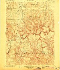 1903 Hayden Peak1903 Print · USGSThe high Uintas at the beginning of the twentieth century reveal a landscape split between the Uinta Forest Reserve and the Uinta Indian Reservation. Researchers can trace the original Utah-Wyoming Boundary Line and the headwaters of the Bear River and Duchesne River.6 unique versions available
 - 1903 Map of Coalville, 1921 Print
 1903 Coalville1921 Print · USGSUpper Utah at the turn of the century reveals a landscape defined by mining corridors and valley settlements. Genealogists and historians can trace the early path of the Union Pacific R. R. through Coalville or locate family-named sites like Rigby's Ranch and the Ontario Drain Tunnel.2 unique versions available
 - 1905 Map of Gilbert Peak, 1953 Print
 1905 Gilbert Peak1953 Print · USGSThe High Uintas at the turn of the century show a wilderness of massive peaks and early mountain ranching. Genealogists and researchers can trace the locations of isolated outposts like Smiths Ranch or Edwards Ranch and name specific summits like Mt Emmons.2 unique versions available
 - 1906 Map of Gilbert Peak
 1906 Gilbert Peak1906 Print · USGSThe high Uinta Mountains are captured in the early 1900s, showing a remote wilderness of glacial lakes and pioneer outposts. Local historians can trace early mountain life through Smiths Ranch, Gilbert Meadows, and Edwards Ranch.4 unique versions available
 - 1906 Map of Marsh Peak
 1906 Marsh Peak1906 Print · USGSThe Uinta Mountains and the winding Green River corridor come alive in this survey from the early 1900s. Genealogists and historians can trace the foundations of high-country industry at Dyer Mine or locate early outposts like Dodds Cabin and Manila.2 unique versions available
 - 1907 Map of Strawberry Valley, 1955 Print
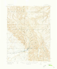
 1907 Strawberry Valley1955 Print · USGSIn the early 1900s, this high-mountain territory was defined by the ranching and rail connections of the Uinta region. Researchers can trace family-named outposts like Averetts Ranch, the Diamond Battle Monument, and the early route of the D and R G RR.2 unique versions available
 - 1907 Map of Jensen, 1957 Print
 1907 Jensen1957 Print · USGSEastern Utah and the Colorado borderlands are shown here at the turn of the century as a frontier of river crossings and ranching outposts. Trace the early Stage Road to Dragon or locate the historic Ferry at Jensen near Dinosaur National Monument.
 - 1908 Map of Fish Springs
 1908 Fish Springs1908 Print · USGSWestern Utah at the turn of the century is a land of remote mining camps and desert outposts. Trace family history and early industry at Utah Mine, Joy P.O., and the isolated Butson's Ranch near the Confusion Range.
 - 1908 Map of Marsh Peak
 1908 Marsh Peak1908 Print · USGSThe high Uinta wilderness along the Utah and Wyoming border is captured here during the first decade of the 1900s. Researchers can trace early industry and remote dwellings such as the Dyer Mine, Johnsons Mill, and Dodds Cabin.2 unique versions available
 - 1909 Map of Strawberry Valley
 1909 Strawberry Valley1909 Print · USGSWasatch County at the dawn of the twentieth century shows a landscape of mountain ranches and early settlements before the major dams. Genealogists and historians can trace family locations at Averetts Ranch, locate the Diamond Battle Monument, and follow the old D and R G RR line.2 unique versions available
 - 1909 Map of Montpelier, 1957 Print
 1909 Montpelier1957 Print · USGSBear Lake County at the turn of the century shows a landscape defined by the arrival of the Oregon Short Line RR and early irrigation. Researchers can trace the original footprints of Montpelier and Paris or locate the historic Hot Springs Turnpike along the lake's eastern shore.
 - 1910 Map of Jensen
 1910 Jensen1910 Print · USGSThe Utah-Colorado borderlands come alive in the first decade of the twentieth century, showing the early development of the Uinta Basin. Genealogists and historians can locate early river crossings at the ferry sites near Jensen or trace the road to Dragon Stage Road.2 unique versions available
 - 1910 Map of Fish Springs
 1910 Fish Springs1910 Print · USGSWestern Utah's high desert and isolated mining districts are mapped here in the early twentieth century, showing a landscape of remote ranching and rugged mineral claims. Local historians can trace family-named outposts like Meecham's Ranch and Thomas' Ranch or locate the Queen of Sheba Mine and Fish Springs.6 unique versions available
 - 1911 Map of Montpelier
 1911 Montpelier1911 Print · USGSThe Bear Lake Valley at the start of the twentieth century was a vital rail and ranching corridor. Trace the Oregon Short Line RR through Montpelier and Paris, or locate early lakeside settlements like Fish Haven and St Charles.3 unique versions available
 - 1912 Map of Randolph
 1912 Randolph1912 Print · USGSThe high valley ranching country of the Utah-Wyoming border is captured here in the early twentieth century. Genealogists and historians can trace family land holdings such as Rex Ranch or Sixmile Ranch and find old routes like the Ogden Road.3 unique versions available
 - 1914 Map of Logan, 1957 Print
 1914 Logan1957 Print · USGSCache Valley thrives in the early nineteen-hundreds as a hub of rail travel and sugar beet processing. Genealogists can locate family homesteads near Stephenson School, trace the Oregon Short Line, or find remote operations like the Amazon Mine.
 - 1914 Map of Castle Gate, 1968 Print
 1914 Castle Gate1968 Print · USGSCarbon County’s coal and rail corridor comes to life in this early-century survey of the rugged Book Cliffs region. Genealogists and historians can trace the foundations of mining towns like Standardville and Kenilworth or locate the Aberdeen Mine and Carbonville School.
 - 1915 Map of Sunnyside
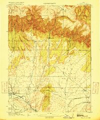
 1915 Sunnyside1915 Print · USGSCarbon County’s industrial and ranching roots are laid bare in this early twentieth-century survey of the rugged Book Cliffs. Researchers can trace the Denver and Rio Grande Western rail lines serving Sunnyside or locate family landmarks like Pierson Ranch and the PUMPING STATION.4 unique versions available
 - 1915 Map of Wellington
 1915 Wellington1915 Print · USGSCarbon County ranching and railroading are captured here just before the First World War, as early settlements followed the canyons. You can trace family-named outposts like Youngs Ranch and Edwards Ranch or follow the path of the Sunnyside Branch railroad.3 unique versions available
 - 1915 Map of Fairfield, 1957 Print
 1915 Fairfield1957 Print · USGSThe Oquirrh Mountains and Cedar Valley come alive in this early twentieth-century survey of Utah's mining and military landscapes. Genealogists and historians can trace rail stops at Fairfield Sta, mining claims at Queen Mine, and the National Cemetery.
 - 1916 Map of Logan
 1916 Logan1916 Print · USGSCache Valley and the northern Wasatch Range come alive in this mid-1910s survey, showing the peak of the local rail-and-sugar economy. Genealogists can locate family holdings like Hardware Ranch, early rural sites like Stephenson School, and the industrial Sugar Factory.4 unique versions available
 - 1916 Map of Castle Gate, 1938 Print
 1916 Castle Gate1938 Print · USGSCarbon County’s coal industry and rail networks are captured here during the height of the early 20th-century mining boom. Trace the vanished spurs of the Southern Utah Railroad and locate remote camps like Standardville, Kenilworth, and the Aberdeen Mine.2 unique versions available
 - 1917 Map of Fairfield
 1917 Fairfield1917 Print · USGSThe Oquirrh Mountains and Cedar Valley appear here just before the close of the first World War. Genealogists and industrial historians can trace the mining networks of Ophir, Mercur, and the Chloride Point Mine alongside the early Fairfield settlement.2 unique versions available
Showing maps 1-25 of 2,683
Top cities of Utah
- Salt Lake City historical maps
- West Valley City historical maps
- West Jordan historical maps
- Provo historical maps
- Orem historical maps
- Sandy historical maps
See more
Top counties of Utah
- Salt Lake County historical maps
- Utah County historical maps
- Davis County historical maps
- Weber County historical maps
- Washington County historical maps
- Cache County historical maps
See more
Frequently asked questions
- What are the different types of historical maps available for Utah?
- What is the oldest map of Utah?
- Where can I purchase historical maps of Utah for my home or office?
- Where can I download high-res historical maps of Utah?
- Are there historical topographic maps available for Utah?
- Is there historical aerial imagery available for Utah?
- Where are historical maps of Utah sourced from?