1980s Maps of Utah
Explore 794 historic maps of Utah from the 1980s. These maps offer a rare glimpse into what life looked like during the 1980s — showing old roads, neighborhoods, homes, and landmarks that have changed or disappeared over time.
Whether you're researching your family's past, planning a metal detecting trip, or studying how Utah's landscape evolved across the 1980s, these high-resolution maps are a powerful tool for exploring the history of this region.
- Focus on a specific era: All maps on this page are from the 1980s, giving you a focused view of this time period.
- See what’s changed: Compare century-old streets, trails, and buildings to today's modern landscape using overlays and satellite layers.
- Research with precision: Use these maps for genealogy, historical research, land use analysis, or educational projects.
- View, download, or print: Maps are fully viewable online in high resolution, and can be downloaded or printed for your own records.
Start exploring Utah's history through authentic maps from the 1980s. This is your window into the past.
Utah maps
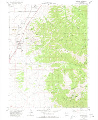
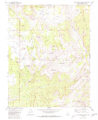
- 1980 Map of Kolob Arch
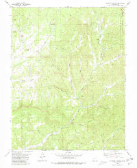
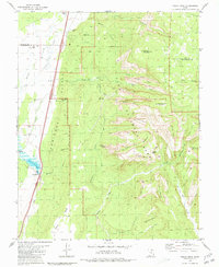 1980 Kolob Arch1980 Print · USGSThe high plateau country of Washington County is captured here in the early eighties as it transitions from wild canyons to the arid west. Trace the historic Fort Harmony Monument, find the remote Kolob Arch, and follow the Lee Pass Trail through the backcountry.2 unique versions available
 - 1980 Map of Saint John
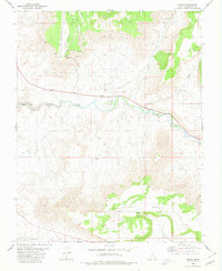
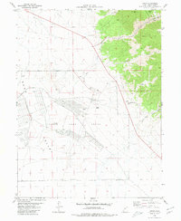
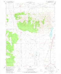
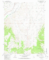
 1980 Saint John1980 Print · USGSRush Valley in the early 1980s reveals a unique intersection of military infrastructure and rural ranching life. Researchers can trace the Union Pacific line through Saint John Sta to the Tooele Army Depot and the settlement of Clover.
 - 1980 Map of Virgin
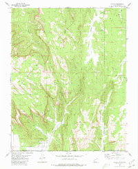
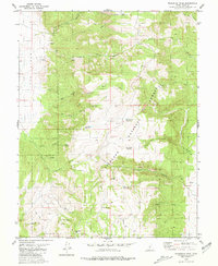
 1980 Virgin1980 Print · USGSThe Virgin River valley in the late seventies and early eighties shows a landscape of mesa-top technology and river-bottom settlement. Trace the course of the Hurricane Canal and locate the Test Track and Observation Tower on the high plateaus.
 - 1980 Map of Clear Creek Mountain
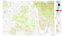
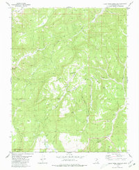 1980 Clear Creek Mountain1980 Print · USGSKane County's high canyon country is documented in the 1980s, revealing a landscape of steep plateaus and remote springs. Genealogists and hikers can trace old routes to Graves near Waterpocket or explore the upper reaches of Orderville Gulch.2 unique versions available
 - 1980 Map of Hildale
 1980 Hildale1980 Print · USGSThe borderlands of Utah and Arizona are captured here in the late seventies, showing the development of Hildale against the Vermilion Cliffs. Follow old routes like the Pack Trail to find backcountry water sources like Cappies Rock Spring and Goat Springs.2 unique versions available
 - 1980 Map of Stockton
 1980 Stockton1980 Print · USGSThe northern Oquirrh Mountains near the turn of the 1980s show a landscape shaped by mining and military industry. Trace family history at Stockton, or locate high-country mining claims like the Calumet Mine and Hidden Treasure Mine.2 unique versions available
 - 1980 Map of Springdale East
 1980 Springdale East1980 Print · USGSWashington and Kane Counties are captured here in the early eighties, showcasing the intersection of pioneer settlement and canyon land preservation. Researchers can trace the layout of Springdale and Shunesburg, or locate historic sites like Wylie Retreat and the Zion-Mount Carmel Tunnel.3 unique versions available
 - 1980 Map of Elephant Butte
 1980 Elephant Butte1980 Print · USGSThe Utah and Arizona borderlands come into focus in the 1970s, showing a high-desert landscape divided by the Kaibab Indian Reservation Bdy. Researchers can locate vital water sources like Wyatt Spring and trace travel routes along a Jeep Trail through Elephant Gap.
 - 1980 Map of Salt Lake City
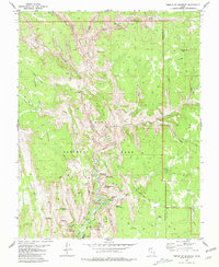
 1980 Salt Lake City1980 Print · USGSSalt Lake City and the surrounding Wasatch Range are shown in the early eighties during a period of rapid suburban growth. Genealogists and historians can trace old mining operations like the Ontario Mine and Wasatch Mine or follow the path of the Union Pacific through the canyons.3 unique versions available
 - 1980 Map of Ophir
 1980 Ophir1980 Print · USGSOphir and the surrounding Oquirrh Mountains are shown in the late 1970s as a landscape of intensive mining and military operations. Researchers can locate the Montana Mine and the extensive grounds of the Tooele Army Depot alongside local landmarks like Bates Ranch.2 unique versions available
 - 1980 Map of Springdale West
 1980 Springdale West1980 Print · USGSThe Virgin River valley in the early 1980s reveals a landscape of isolated settlements and towering sandstone formations. Genealogists and historians can trace the foundations of Grafton and Rockville, or locate the historic Cem and old irrigation washes.2 unique versions available
 - 1980 Map of Straight Canyon
 1980 Straight Canyon1980 Print · USGSSouthern Utah's high canyon country is documented here during the 1970s, showcasing the complex drainages of the North Fork Virgin River. Trace the remote water sources and high points like Bulloch Spring, Millet Point, and the rugged Pink Cliffs.2 unique versions available
 - 1980 Map of South Mountain
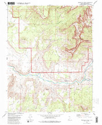
 1980 South Mountain1980 Print · USGSRush Valley and the high-desert terrain of Tooele County are captured here in the late twentieth century. Researchers can trace the industrial footprint of the Tooele Army Depot and follow the Union Pacific line as it passes Rush Lake.2 unique versions available
 - 1980 Map of Temple of Sinawava
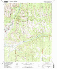
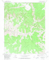
 1980 Temple of Sinawava1980 Print · USGSZion National Park's main canyon and plateau systems are meticulously detailed in this late twentieth-century survey of the Utah landscape. Trace the footpaths and geologic landmarks of the era, from the Zion Lodge to the heights of Angels Landing and The Great White Throne.3 unique versions available
 - 1980 Map of The Barracks
 1980 The Barracks1980 Print · USGSThe canyon country of southern Utah is recorded here in the early 1980s, centered on the East Fork Virgin River and the eastern edge of Zion National Park. Researchers can trace remote routes across Poverty Flat or follow the deep cut of Parunuweap Can.2 unique versions available
 - 1980 Map of The Guardian Angels
 1980 The Guardian Angels1980 Print · USGSZion's high backcountry plateau and canyon systems are documented here in the early 1980s. Researchers can trace remote pack routes like the Hop Valley Trail past geological landmarks including North Guardian Angel, Tabernacle Dome, and The Bishopric.3 unique versions available
 - 1980 Map of Loa
 1980 Loa1980 Print · USGSCentral Utah's high plateaus and the Fremont River corridor are captured here during the 1980s, showcasing a landscape of high-elevation reservoirs and remote ranching outposts. Genealogists can trace family names and early settlements from Loa and Teasdale to the orchards of Fruita.2 unique versions available
 - 1980 Map of Smith Mesa
 1980 Smith Mesa1980 Print · USGSWashington County high country in the early eighties reveals a unique mix of canyonlands and technical testing grounds. Researchers can trace the specialized Test Track on Hurricane Mesa alongside older landmarks like Pintura and Smith Creek.
 - 1980 Map of Antelope Range, 1981 Print
 1980 Antelope Range1981 Print · USGSThe Sevier River valley in the early 1980s shows a landscape of rail-fed settlements and mountain mining. Trace family roots in Joseph and Sevier, or locate historic workings like the Antelope Mine and the irrigation network of Bertlesen Ditch.2 unique versions available
 - 1980 Map of Little Creek Mountain, 1981 Print
 1980 Little Creek Mountain1981 Print · USGSThe high plateaus of southern Utah are captured here in the early 1980s, revealing a landscape of cinder pits and isolated springs. Researchers can trace the drainages of Gould Wash or locate specific landmarks like Abs Clearing and Gray Knoll.
 - 1980 Map of Kolob Reservoir, 1981 Print
 1980 Kolob Reservoir1981 Print · USGSHigh-country canyons and reservoirs dominate this southwestern Utah landscape as it appeared in the early 1980s. Researchers can trace the borders of Zion National Park and find specific landmarks like Kolob Reservoir, Lava Point, and The Pillars.2 unique versions available
 - 1980 Map of Mahustan Peak, 1981 Print
 1980 Mahustan Peak1981 Print · USGSThe high ridges of Piute County are captured here in the early 1980s, showcasing a network of upland reservoirs and ranching landmarks. Researchers can trace land use through prospects and water features like Hell Hole Reservoir, Sevy Spring, and Dead Horse Reservoir.2 unique versions available
 - 1980 Map of Beaver, 1981 Print
 1980 Beaver1981 Print · USGSSouthern Utah at the start of the 1980s reveals a rugged landscape of high mountain plateaus and essential desert irrigation networks. Researchers can trace the path of the Denver and Rio Grande Western through Marysvale or locate local landmarks like the Deer Trail Mine and Puffer Lake.2 unique versions available
 - 1980 Map of Huntington, 1981 Print
 1980 Huntington1981 Print · USGSEmery and Carbon County landscapes are captured here during the early eighties, showcasing a region defined by high plateaus and mining towns. Researchers can trace the Denver and Rio Grande Western Railroad corridor and locate landmarks like the Cleveland-Lloyd Dinosaur Quarry and Hiawatha.
 - 1980 Map of Panguitch, 1981 Print
 1980 Panguitch1981 Print · USGSThe high plateau country of Southern Utah is captured here in the early eighties, centered on the Sevier River and the gateway town of Panguitch. Researchers can trace the boundaries of Bryce Canyon National Park and find local landmarks like Ruby's Inn, Panguitch Lake, and Hatch.2 unique versions available
Showing maps 1-25
Top cities of Utah
- Salt Lake City historical maps
- West Valley City historical maps
- West Jordan historical maps
- Provo historical maps
- Orem historical maps
- Sandy historical maps
See more
Top counties of Utah
- Salt Lake County historical maps
- Utah County historical maps
- Davis County historical maps
- Weber County historical maps
- Washington County historical maps
- Cache County historical maps
See more
Frequently asked questions
- What are the different types of historical maps available for Utah?
- What is the oldest map of Utah?
- Where can I purchase historical maps of Utah for my home or office?
- Where can I download high-res historical maps of Utah?
- Are there historical topographic maps available for Utah?
- Is there historical aerial imagery available for Utah?
- Where are historical maps of Utah sourced from?