Old Maps of Rich County, Utah for Metal Detecting
Plan your next treasure hunt with 249 historic maps of Rich County. Find old homesites, ghost towns, trails, and gathering spots that may be lost to time — perfect for identifying promising metal detecting locations.
- Locate forgotten sites: Uncover places like long-lost settlements, abandoned rail lines, or gathering spots.
- Plan better hunts: Use map overlays combined with LiDAR or satellite views to narrow in on historically rich areas.
- Made for detectorists: Thousands of hobbyists use these maps to discover relics, coins, and hidden history.
Use these historic maps to boost your research and find new opportunities beneath the surface of Rich County.
Rich County, UT maps
(249)- 1909 Map of Montpelier, 1957 Print
 1909 Montpelier1957 Print · USGSBear Lake County at the turn of the century shows a landscape defined by the arrival of the Oregon Short Line RR and early irrigation. Researchers can trace the original footprints of Montpelier and Paris or locate the historic Hot Springs Turnpike along the lake's eastern shore.
 - 1911 Map of Montpelier
 1911 Montpelier1911 Print · USGSThe Bear Lake Valley at the start of the twentieth century was a vital rail and ranching corridor. Trace the Oregon Short Line RR through Montpelier and Paris, or locate early lakeside settlements like Fish Haven and St Charles.3 unique versions available
 - 1912 Map of Randolph
 1912 Randolph1912 Print · USGSThe high valley ranching country of the Utah-Wyoming border is captured here in the early twentieth century. Genealogists and historians can trace family land holdings such as Rex Ranch or Sixmile Ranch and find old routes like the Ogden Road.3 unique versions available
 - 1914 Map of Logan, 1957 Print
 1914 Logan1957 Print · USGSCache Valley thrives in the early nineteen-hundreds as a hub of rail travel and sugar beet processing. Genealogists can locate family homesteads near Stephenson School, trace the Oregon Short Line, or find remote operations like the Amazon Mine.
 - 1916 Map of Logan
 1916 Logan1916 Print · USGSCache Valley and the northern Wasatch Range come alive in this mid-1910s survey, showing the peak of the local rail-and-sugar economy. Genealogists can locate family holdings like Hardware Ranch, early rural sites like Stephenson School, and the industrial Sugar Factory.4 unique versions available
 - 1954 Map of Ogden, 1967 Print
 1954 Ogden1967 Print · USGSThe northern Utah corridor and Wyoming borderlands are captured here in the mid-1950s, showing the region's transition from mountain wilderness to settled valleys. Researchers can trace historic institutions like Utah State University or locate vanished points like Church Butte Station and the Trappist Monastery.3 unique versions available
 - 1955 Map of Preston, 1968 Print
 1955 Preston1968 Print · USGSSoutheast Idaho and western Wyoming are shown in detail during the mid-fifties, from the high Bear River Range to the Green River Basin. Genealogists and collectors can trace the Union Pacific RR through historic towns like Preston, Montpelier, and Afton.3 unique versions available
 - 1958 Map of Ogden
 1958 Ogden1958 Print · USGSNorthern Utah and southwestern Wyoming are captured here during a period of steady growth and military expansion. You can trace the Union Pacific rail lines and early road networks connecting Ogden and Logan to Bear Lake and Evanston.
 - 1958 Map of Preston
 1958 Preston1958 Print · USGSThe high valleys of the Idaho and Wyoming borderlands are captured here in the late fifties, showcasing a landscape of mountain ranching and phosphate mining. Genealogists and historians can locate early settlements like Chesterfield and Bedford or trace the Union Pacific rail lines serving Cokeville.2 unique versions available
 - 1960 Map of Ogden
 1960 Ogden1960 Print · USGSIn the mid-1950s, this region of the American West balanced military expansion with frontier history along the Union Pacific RR. Genealogists and historians can trace old settlements like Fort Bridger, the residential growth of Washington Terrace, and industrial sites from the Hill AFB complex to the coal mines of Kemmerer.
 - 1962 Map of Preston
 1962 Preston1962 Print · USGSSoutheast Idaho and the Wyoming borderlands are captured here in the early sixties, a time of thriving agricultural valleys and mountain ranching. Researchers can trace the Union Pacific rail lines and find legacy settlements like Montpelier, Afton, and Preston.
 - 1964 Map of Monte Cristo PK, 1965 Print
 1964 Monte Cristo PK1965 Print · USGSThe northern Utah highlands and the Cache National Forest are shown here in the mid-1960s at a moment of intense topographic detail. Researchers can trace remote high-country water sources and landmarks like Monte Cristo Peak, Dry Bread Pond, and Bullpecker Spring.2 unique versions available
 - 1964 Map of Francis Canyon, 1966 Print
 1964 Francis Canyon1966 Print · USGSThe high mountain country of northern Utah is documented here during the mid-sixties, where Morgan, Rich, and Summit counties meet. Genealogists and historians can trace the drainages and primitive routes of Doc Dorlands Hollow and Francis Canyon.3 unique versions available
 - 1968 Map of Rex Peak, 1970 Print
 1968 Rex Peak1970 Print · USGSThe high-desert borderlands of Utah and Wyoming come alive in the late 1960s, showing a landscape defined by mountain mining and river valley irrigation. Researchers can trace the legacy of resource extraction and ranching at the Cherokee Mine, Kearl Ranch, and the Beckwith Quinn Canal.2 unique versions available
 - 1968 Map of Wahsatch, 1970 Print
 1968 Wahsatch1970 Print · USGSThe high mountain pass at Wahsatch is shown here in the late sixties, where the steel of the Union Pacific meets the historic tracks of the Emigrant Trail. Genealogists and historians can trace the topography of Echo Canyon and locate landmarks like The Needles and Barker Reservoir.2 unique versions available
 - 1968 Map of Horse Ridge, 1970 Print
 1968 Horse Ridge1970 Print · USGSThe high Wasatch backcountry of Weber and Rich counties comes into focus in this late 1960s survey. Researchers can trace historic access routes via Jeep Trails and Pack Trails across Horse Ridge and near the headwaters of the South Fork Ogden River.3 unique versions available
 - 1968 Map of Dairy Ridge, 1970 Print
 1968 Dairy Ridge1970 Print · USGSThe high ridges of the Cache National Forest come into focus in the late sixties, showing a landscape managed for timber and range. Researchers can locate remote landmarks like the Monte Cristo Guard Sta, Woodruff Road, and dozens of named water sources like Neponset Spring.3 unique versions available
 - 1968 Map of Randolph, 1970 Print
 1968 Randolph1970 Print · USGSRich County ranching and water history come alive in this late 1960s study of the Randolph area. Genealogists and historians can trace the town's footprint from the Cem and South Rich High Sch to the Randolph Camp Historical Mon.2 unique versions available
 - 1968 Map of Shearing Corral, 1970 Print
 1968 Shearing Corral1970 Print · USGSRich County ranching and the high-country rail corridor are captured here in the late sixties as the mountain landscape supported both industry and livestock. Researchers can trace the Union Pacific line through Echo Canyon or locate landmarks like Cache Cave and the Shearing Corral settlement.2 unique versions available
 - 1968 Map of Woodruff, 1970 Print
 1968 Woodruff1970 Print · USGSRich County ranching and irrigation are in clear focus in the late sixties as the town of Woodruff manages the waters of the Bear River. Researchers can trace the extensive canal systems and locate the Woodruff Cem alongside landmarks like Limestone Peak.2 unique versions available
 - 1968 Map of Mc Kay Hollow, 1971 Print
 1968 Mc Kay Hollow1971 Print · USGSRich County in the late sixties shows a landscape of highland ranching and water management. Researchers can trace land use through named springs and reservoirs like Negro Dan Spring, Saleratus Reservoir No 1, and McKay Ridge.2 unique versions available
 - 1968 Map of Neponset Reservoir NE, 1971 Print
 1968 Neponset Reservoir NE1971 Print · USGSThe Utah-Wyoming borderlands come alive in the late sixties, showing a landscape defined by high-altitude water management and the meandering Bear River. Local historians and researchers can trace the engineering of the Christensen Tunnel and the vital Chapman Canal.2 unique versions available
 - 1968 Map of Meachum Ridge, 1971 Print
 1968 Meachum Ridge1971 Print · USGSIn the high-country drainages of Rich County during the late sixties, this survey shows the land just as it was being managed for forest resources and water. Trace the early utility of the area through the Woodruff Creek Dam, the Gaging Station on Birch Creek, and the many winding routes of the Pack Trail network.3 unique versions available
 - 1968 Map of Peck Canyon, 1971 Print
 1968 Peck Canyon1971 Print · USGSHigh mountain ridges along the Morgan and Rich County border define this late-sixties Utah landscape. Map collectors and researchers can trace the network of Jeep Trails and remote water sources like Sawmill Creek and Bull Nelson Creek.3 unique versions available
 - 1968 Map of Woodruff Narrows, 1971 Print
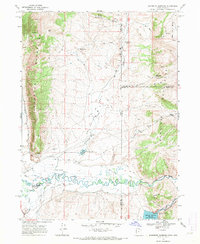 1968 Woodruff Narrows1971 Print · USGSThe Bear River valley at the Utah-Wyoming border reveals a landscape shaped by water engineering in the late sixties. Trace the intricate path of the Neville Canal and Booth Canal or locate remote sites like Rees Well and Uinta Well.3 unique versions available
Showing maps 1-25 of 249
Top cities of Rich County
Frequently asked questions
- What are the different types of historical maps available for Rich County?
- What is the oldest map of Rich County?
- Where can I purchase historical maps of Rich County for my home or office?
- Where can I download high-res historical maps of Rich County?
- Are there historical topographic maps available for Rich County?
- Is there historical aerial imagery available for Rich County?
- Where are historical maps of Rich County sourced from?