Old Maps of Colville, Washington for Genealogy
Trace your family roots with 19 historic maps of Colville. These high-res maps reveal old neighborhoods, homesites, landmarks, and streets — helping you uncover where your ancestors lived and how the area evolved over time.
- Explore historic neighborhoods: Identify where your relatives may have lived in the 1800s or 1900s.
- Compare maps over time: Trace the changes in streets, buildings, and landmarks for multi-generational research.
- Perfect for genealogy & ancestry research: Used by family historians and researchers to map out lineage and migration.
These maps are an incredible resource for exploring your personal connection to Colville's past.
Colville, WA maps
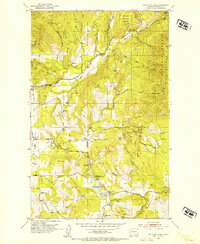
(19)- 1929 Map of Colville, 1958 Print
 1929 Colville1958 Print · USGSNorthern Washington's mining and timber country is captured here in the late 1920s. Researchers can trace dozens of mountain workings like Electric Point Mine and local landmarks including Old Fort Colville and Evergreen Cem.2 unique versions available
 - 1933 Map of Colville
 1933 Colville1933 Print · USGSIn the early thirties, this corner of Washington was a powerhouse of mining and timber activity along the Columbia River. Local historians can trace the foundations of Colville and Northport, and locate historic landmarks like Old Fort Colville or the Electric Point Mine.2 unique versions available
 - 1952 Map of White Mud Lake, 1954 Print
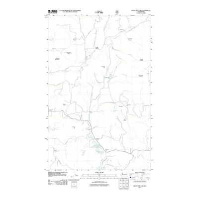
 1952 White Mud Lake1954 Print · USGSThe northern reaches of Stevens County in the 1950s show a rugged frontier landscape of active mining and early settlement sites. Genealogists and historians can trace the foundations of Pinkney City or locate rural landmarks like the Fort Colville Grange and the Old Dominion Mine.4 unique versions available
 - 1952 Map of Colville, 1954 Print
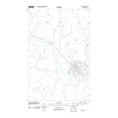
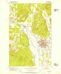 1952 Colville1954 Print · USGSIn the early fifties, Colville was a thriving hub of the Pacific Northwest, balancing its role as a county seat with heavy rail and timber industries. Genealogists can trace the Phipps Homestead or search for family sites near the Highland Sch and Evergreen Cem.3 unique versions available
 - 1958 Map of Sandpoint, 1966 Print
 1958 Sandpoint1966 Print · USGSThe Idaho Panhandle and Northeast Washington are shown here in the late fifties, when timber and hydroelectric power drove the local economy. Trace family roots in rail-side towns like Cusick or Metaline Falls, and locate landmarks like the Albeni Falls Dam or Falls Ranger Station.2 unique versions available
 - 1963 Map of Sandpoint
 1963 Sandpoint1963 Print · USGSNorthern Idaho and eastern Washington are shown in the early sixties as a high-country network of timber, mining, and rail. Genealogists and historians can trace the Great Northern line through Metaline Falls, Bonners Ferry, and past the Finch Mine.
 - 1984 Map of Colville
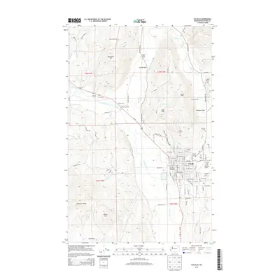
 1984 Colville1984 Print · USGSNortheastern Washington and the Idaho borderlands are documented here in the mid-1980s as the regional economy balanced forestry and mineral extraction. Genealogists and researchers can trace dozens of mountain mining operations like Van Stone Mine alongside timber settlements such as Metaline Falls and Aladdin.2 unique versions available
 - 1992 Map of Colville, 1996 Print
 1992 Colville1996 Print · USGSColville and the surrounding river valley are captured here in the early nineties, showing a landscape defined by mountain ranges and agricultural tradition. Researchers can locate the Pinkney City (Site), trace the Burlington Northern line, and find the Phipps Homestead.
 - 1992 Map of White Mud Lake, 1997 Print
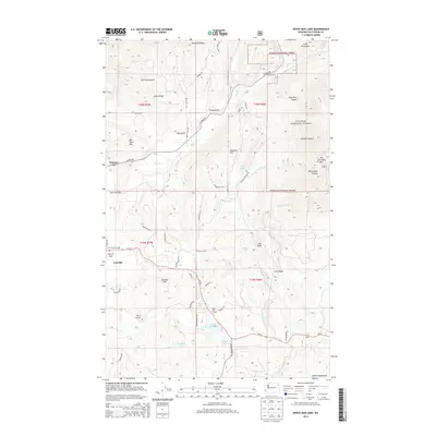
 1992 White Mud Lake1997 Print · USGSNortheastern Washington in the early nineties reveals a landscape of forestry and vanished early settlements. Genealogists can trace the locations of the Pinkney City (Site), the White Lake Sch (Aband), and the Fort Colville Grange.
 - 2011 Map of Colville, 2011 Print
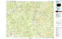
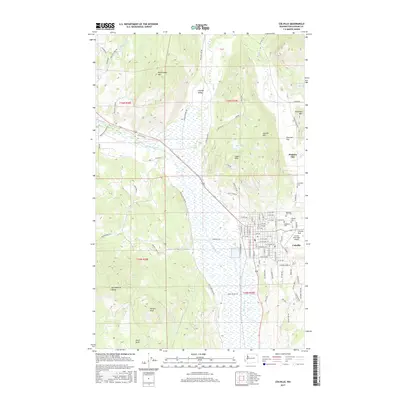
 2011 Colville2011 Print · USGSCovers Colville, including Pinkney City, Stevens County, and other nearby areas
 - 2011 Map of White Mud Lake, 2011 Print
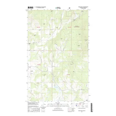
 2011 White Mud Lake2011 Print · USGSCovers Colville, including Stevens County, United States, and other nearby areas
 - 2014 Map of Colville, 2014 Print
 2014 Colville2014 Print · USGSCovers Colville, including Pinkney City, Stevens County, and other nearby areas
 - 2014 Map of White Mud Lake, 2014 Print
 2014 White Mud Lake2014 Print · USGSCovers Colville, including Stevens County, United States, and other nearby areas
 - 2017 Map of Colville, 2017 Print
 2017 Colville2017 Print · USGSCovers Colville, including Pinkney City, Stevens County, and other nearby areas
 - 2017 Map of White Mud Lake, 2017 Print
 2017 White Mud Lake2017 Print · USGSCovers Colville, including Stevens County, United States, and other nearby areas
 - 2020 Map of Colville, 2020 Print
 2020 Colville2020 Print · USGSCovers Colville, including Pinkney City, Stevens County, and other nearby areas
 - 2020 Map of White Mud Lake, 2020 Print
 2020 White Mud Lake2020 Print · USGSCovers Colville, including Stevens County, United States, and other nearby areas
 - 2023 Map of Colville, 2023 Print
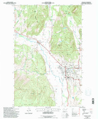
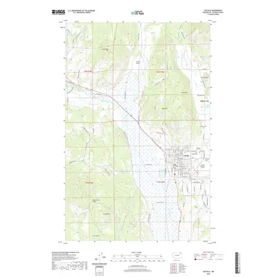
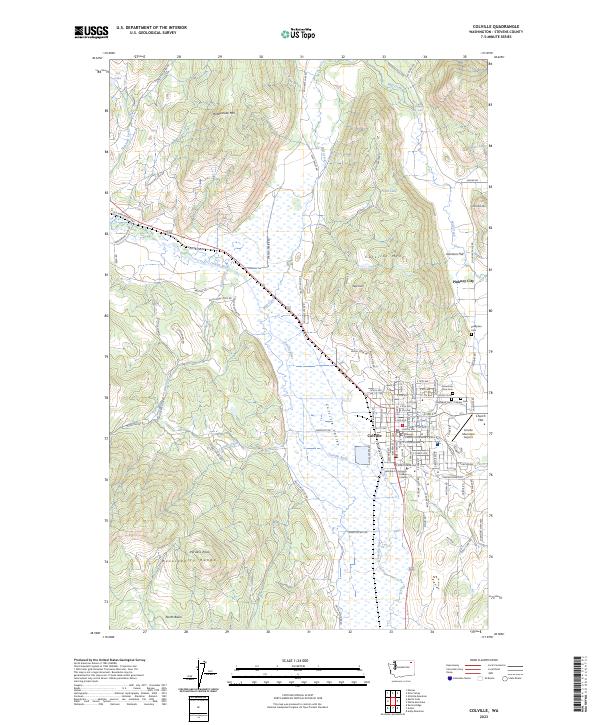 2023 Colville2023 Print · USGSColville and the surrounding Huckleberry Range appear in great detail during the early 2020s. Genealogists and local historians can trace family plots at Mountain View Cem, locate the Stevens County Courthouse, and explore the site of Pinkney City.
 - 2023 Map of White Mud Lake, 2023 Print
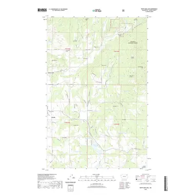
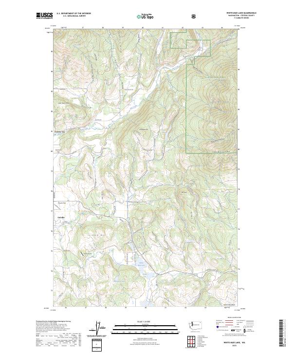 2023 White Mud Lake2023 Print · USGSSettlement and geography converge north of Colville in this modern record of the Colville National Forest. Researchers can trace old mountain roads and sites like Pinkney City, Garrison Flat, and the family-named Coonrad Hill.
End of results
Showing maps 1-19 of 19
Top cities near Colville
Frequently asked questions
- What are the different types of historical maps available for Colville?
- What is the oldest map of Colville?
- Where can I purchase historical maps of Colville for my home or office?
- Where can I download high-res historical maps of Colville?
- Are there historical topographic maps available for Colville?
- Is there historical aerial imagery available for Colville?
- Where are historical maps of Colville sourced from?