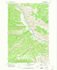
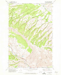
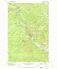
1970s Maps of Yakima County, Washington
Explore 41 historic maps of Yakima County from the 1970s. These maps offer a rare glimpse into what life looked like during the 1970s — showing old roads, neighborhoods, homes, and landmarks that have changed or disappeared over time.
Whether you're researching your family's past, planning a metal detecting trip, or studying how Yakima County's landscape evolved across the 1970s, these high-resolution maps are a powerful tool for exploring the history of this region.
- Focus on a specific era: All maps on this page are from the 1970s, giving you a focused view of this time period.
- See what’s changed: Compare century-old streets, trails, and buildings to today's modern landscape using overlays and satellite layers.
- Research with precision: Use these maps for genealogy, historical research, land use analysis, or educational projects.
- View, download, or print: Maps are fully viewable online in high resolution, and can be downloaded or printed for your own records.
Start exploring Yakima County's history through authentic maps from the 1970s. This is your window into the past.
Yakima County, WA maps
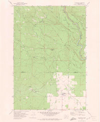
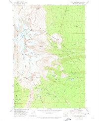
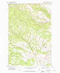
(41)- 1970 Map of Outlet Falls, 1973 Print
 1970 Outlet Falls1973 Print · USGSThe Klickitat River valley in the early seventies reveals a landscape defined by historic survey lines and remote mountain terrain. Genealogists and local historians can trace the Old RR Grade, the Klickitat State Fish Hatchery, and the landmark Outlet Falls.
 - 1970 Map of Lost Horse Plateau, 1973 Print
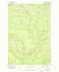
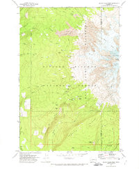
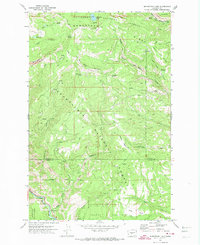
 1970 Lost Horse Plateau1973 Print · USGSThe Yakima Indian Reservation uplands come into focus in the early seventies, showing a landscape defined by high plateaus and remote creek forks. Genealogists and historians can trace old mountain routes like Old Maid Road and find isolated landmarks such as Olney Corral.
 - 1970 Map of Glenwood, 1973 Print
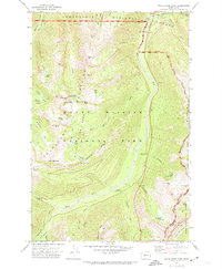
 1970 Glenwood1973 Print · USGSGlenwood and the surrounding Yakima Indian Reservation lands are documented here during the early 1970s. Local historians can trace the Old Railroad Grade and locate ancestral boundaries like the Campbell Line.
 - 1970 Map of Hamilton Buttes, 1973 Print
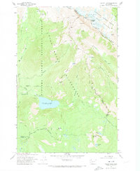
 1970 Hamilton Buttes1973 Print · USGSThe Cascade high country of the early seventies is revealed through its network of river forks and primitive trails. Trace the old Pack Trail routes that connect remote mountain waters like St John Lake and the high peaks of the Goat Rocks Wilderness.
 - 1970 Map of Fairview Ridge, 1973 Print
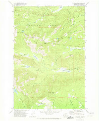
 1970 Fairview Ridge1973 Print · USGSYakima County high country is documented here in the early 1970s, showing the intersection of forest and reservation lands. Researchers can locate remote outposts like Kesslers Ranch and seasonal sites like Klickitat Camp along the Klickitat River.2 unique versions available
 - 1970 Map of Signal Peak, 1973 Print
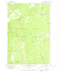
 1970 Signal Peak1973 Print · USGSThe Yakima Indian Reservation highlands are shown here in the early 1970s, focused on the forest management and lookouts of Signal Peak. Researchers can trace the 1890 Schwartz Line and find landmarks like Saxton Rock and Jungle Spring.
 - 1970 Map of Trout Lake, 1973 Print
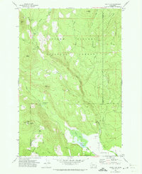 1970 Trout Lake1973 Print · USGSThe Trout Lake valley in the early seventies shows a landscape defined by forestry and river management. Trace local landmarks like the Trout Lake Big Tree, the Wicky Creek Shelter, and high-altitude lookouts atop Flattop Mtn.
 - 1970 Map of Walupt Lake, 1973 Print
 1970 Walupt Lake1973 Print · USGSThe Lewis County high country in the 1970s is documented here as a network of glaciers and pack trails. Outdoor historians can trace the paths between Walupt Lake Guard Station, Alpine Camp, and the high reaches of Gilbert Peak.
 - 1970 Map of Castile Falls, 1973 Print
 1970 Castile Falls1973 Print · USGSThe Yakima Indian Reservation highlands are captured in the early seventies, detailing a remote landscape of plateaus and steep river canyons. Researchers can trace old seasonal locations like Jerusalem Camp and water features like Castile Falls or the Fishway Tunnel.
 - 1970 Map of Poland Butte, 1973 Print
 1970 Poland Butte1973 Print · USGSThe Yakima Indian Reservation at the start of the 1970s reveals a high-country landscape of springs and historic transit routes. Trace the pathways of the Twenty Day Camp Old Indian Reservation Road and find remote sites like Lost Springs Campground and Poland Butte.
 - 1970 Map of Mount Adams West, 1974 Print
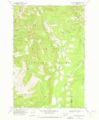
 1970 Mount Adams West1974 Print · USGSThe western slopes of Washington’s volcanic peaks are captured here in the early 1970s, as the backcountry road and trail systems were firmly established. Researchers can trace historic pack routes and find remote sites like Graveyard Camp, Riley Camp, and Lookingglass Lake.3 unique versions available
 - 1970 Map of Piscoe Meadow, 1974 Print
 1970 Piscoe Meadow1974 Print · USGSThe Yakima highlands in the early seventies are defined here by a network of seasonal trails and historic boundary lines. Genealogists and historians can trace the Schwartz Line - 1890 and find remote sites like Piscoe Meadow or Brush Corral.
 - 1970 Map of Jennies Butte, 1974 Print
 1970 Jennies Butte1974 Print · USGSHigh in the Cascades during the 1970s, this area showcases the intersection of forest management and tribal land boundaries. Researchers can trace the historic Campbell Line (1906-07) and locate remote landmarks like the Jennies Butte Lookout Tower.2 unique versions available
 - 1970 Map of Glaciate Butte, 1974 Print
 1970 Glaciate Butte1974 Print · USGSThe high volcanic country of Yakima County is captured here in the early 1970s at the intersection of tribal and national forest lands. Researchers can trace the remote Potato Hill Guard Station and historic routes like the Highline Trail and Pack Trail.2 unique versions available
 - 1970 Map of Jungle Butte, 1974 Print
 1970 Jungle Butte1974 Print · USGSThe Yakima Indian Reservation was a landscape of remote forestry camps and early survey lines in the 1970s. Researchers can trace historical boundaries like the Campbell Line 1890 and locate vanished outposts like Buck Camp or Cress Camp.
 - 1970 Map of Windy Point, 1974 Print
 1970 Windy Point1974 Print · USGSThe Yakama Indian Reservation high country in the early 1970s is shown here, characterized by volcanic peaks and high-elevation meadows. Map researchers can trace old jeep trails leading to Camp Chaparral, the waters of Fish Lake, and the summit of Johns Butte.
 - 1970 Map of Green Mountain, 1974 Print
 1970 Green Mountain1974 Print · USGSSkamania County's high-country wilderness is captured here in the early seventies, showing the remote forest management and recreational sites of the era. Researchers can trace historic routes like the PACK TRAIL and locate mountain camps at Takhlakh Lake Campground or the Cat Creek Guard Station.2 unique versions available
 - 1970 Map of Mount Adams East, 1974 Print
 1970 Mount Adams East1974 Print · USGSThe eastern slopes of Mount Adams in the 1970s reveal a landscape of glaciers and alpine meadows split between the Yakima Indian Reservation and national forest. Trace historical survey markers like the Campbell Line and Sunrise Camp or the primitive High-Line Trail (Pack).2 unique versions available
 - 1971 Map of King Mountain, 1973 Print
 1971 King Mountain1973 Print · USGSThe Cascades borderlands are documented here in the early seventies, where the Gifford Pinchot National Forest meets the reservation. Trace high-altitude routes along Aiken Lava Bed or locate markers like Gotchen Creek Guard Station and King Mountain.
 - 1971 Map of Nile, 1973 Print
 1971 Nile1973 Print · USGSThe Naches River valley in the early seventies shows the rural community of Nile tucked between the peaks of the Snoqualmie National Forest. Researchers can find old mountain landmarks like Cheney Ranch, the Nile Community Ch, and the Rattlesnake Ranger Station.2 unique versions available
 - 1971 Map of Milk Canyon, 1973 Print
 1971 Milk Canyon1973 Print · USGSYakima County rangeland is captured here in the early seventies, showing a landscape of steep ridges and working canyons. Researchers can trace the cattle and timber geography of the era through sites like Wenas (Site), Sanford Pasture, and the Lookout Tower on Cleman Mountain.2 unique versions available
 - 1971 Map of Cliffdell, 1973 Print
 1971 Cliffdell1973 Print · USGSThe Naches River valley in the early seventies shows a landscape of mountain settlements and forest recreation. Trace the community layout of Cliffdell, the grounds of Camp Roganunda, and family history at Peterson Cem.2 unique versions available
 - 1971 Map of Hudson Creek, 1973 Print
 1971 Hudson Creek1973 Print · USGSUpper Kittitas and Yakima counties are shown here in the early seventies, capturing the rugged divide where high plateaus meet deep canyons. Trace the remote network of Barber Springs Road to find Wenas Camp and the high Mud Flats.3 unique versions available
 - 1971 Map of Manastash Lake, 1974 Print
 1971 Manastash Lake1974 Print · USGSThe border of Yakima and Kittitas counties is captured here in the early seventies, showcasing a transition from timbered peaks to deep river valleys. You can trace early backcountry access via Barber Springs Road and locate remote landmarks like Manastash Lake and Milk Lake.2 unique versions available
 - 1971 Map of White River Park, 1974 Print
 1971 White River Park1974 Print · USGSMount Rainier's northeast wilderness comes into focus in the 1970s, showing the high-elevation trails and ranger outposts of the Cascades. Researchers can trace the Pacific Crest National Scenic Trail past Sheep Lake or locate the Patrol Cabin and White River Ranger Station.3 unique versions available
Showing maps 1-25 of 41
Top cities of Yakima County
- Yakima historical maps
- Sunnyside historical maps
- Grandview historical maps
- Toppenish historical maps
- Selah historical maps
- Union Gap historical maps
See more
Frequently asked questions
- What are the different types of historical maps available for Yakima County?
- What is the oldest map of Yakima County?
- Where can I purchase historical maps of Yakima County for my home or office?
- Where can I download high-res historical maps of Yakima County?
- Are there historical topographic maps available for Yakima County?
- Is there historical aerial imagery available for Yakima County?
- Where are historical maps of Yakima County sourced from?