
Historical Maps of Lac La Belle
Journey back in time with 18 historical maps of Lac La Belle, dating from 1892 to present day. Explore and discover the history of Lac La Belle through detailed topographic maps, featuring cities, landmarks, and geographical changes. Dive deeper into each map with our interactive high-resolution viewer and extensive library data. Every map in our collection is also available for purchase as a framed or unframed museum-quality print for those interested interested in bringing a part of history into their home. Begin your historical adventure now!
Lac La Belle maps (18)
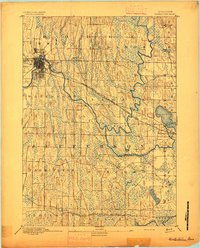
- 1892 Map of Watertown
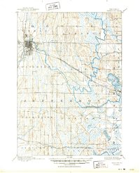
 1892 Watertown1892 Print · USGSCovers portions of Lac La Belle, including Watertown, Waukesha County, and others.
 - 1894 Map of Watertown
 1894 Watertown1894 Print · USGSCovers portions of Lac La Belle, including Watertown, Waukesha County, and others.
 - 1894 Map of Watertown, 1902 Print
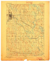 1894 Watertown1902 Print · USGSCovers portions of Lac La Belle, including Watertown, Waukesha County, and others.
 - 1894 Map of Watertown, 1910 Print
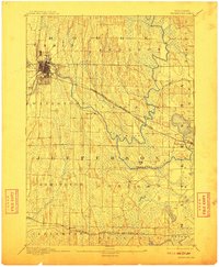 1894 Watertown1910 Print · USGSCovers portions of Lac La Belle, including Watertown, Waukesha County, and others.
 - 1894 Map of Watertown, 1925 Print
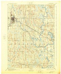 1894 Watertown1925 Print · USGSCovers portions of Lac La Belle, including Watertown, Waukesha County, and others.
 - 1894 Map of Watertown, 1950 Print
 1894 Watertown1950 Print · USGSCovers portions of Lac La Belle, including Watertown, Waukesha County, and others.
 - 1957 Map of Madison, 1967 Print
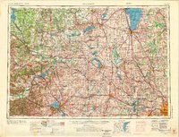
 1957 Madison1967 Print · USGSCovers portions of Lac La Belle, including Madison, Sauk County, and others.
 - 1957 Map of Madison, 1976 Print
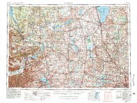
 1957 Madison1976 Print · USGSCovers portions of Lac La Belle, including Madison, Sauk County, and others.
 - 1957 Map of Madison, 1983 Print
 1957 Madison1983 Print · USGSCovers portions of Lac La Belle, including Madison, Sauk County, and others.
 - 1959 Map of Ixonia, 1961 Print
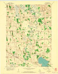 1959 Ixonia1961 Print · USGSCovers portions of Lac La Belle, including Ixonia, Waukesha County, and others.
Showing maps 1-10 of 18
Explore maps of related cities
See more
Explore maps of related counties
- Adams County, WI
- Ashland County, WI
- Barron County, WI
- Bayfield County, WI
- Brown County, WI
- Buffalo County, WI
See more
Frequently asked questions
Can I purchase a physical print of a historical map of Lac La Belle?
Why are historical maps of Lac La Belle important for research and professional purposes?
What types of historical maps are available for Lac La Belle?
What advanced features do you offer for professional use?
How can I find a specific historical map of Lac La Belle?
How can I contribute a historical map of Lac La Belle that's not in your collection?
What is the oldest map of Lac La Belle in your collection?
How can I download a map of Lac La Belle?