
Historical Maps of Dunn County, Wisconsin
What stories do these 80 old maps tell about Dunn County's past? From 1929 to present day, these maps reveal the evolution of streets, neighborhoods, iconic landmarks, and natural features in stunning high-res detail. Whether you're a history enthusiast, genealogist, or professional in education, environmental work, or architecture, these maps are perfect for exploration, research, and discovery.
Discover Dunn County's history through maps:
- Trace Dunn County's growth: Explore earlier and latest maps and editions to uncover how the region changed over time.
- Examine technical details: Each map includes its creators, publishers, scale, dimensions, and full source information.
- Layer maps with modern tools & imagery: Compare historical maps to modern-day with high-resolution satellite imagery and detailed LiDAR layers.
- Sourced from trusted archives: Carefully preserved and digitized by institutions like the United Stated Geological Survey and the US Library of Congress.
- Access in any format: View and explore in high resolution, download for offline use, or order a museum-quality print for yourself or a loved one.
Begin your journey into Dunn County's history with these remarkable must-see maps.
Dunn County, WI maps
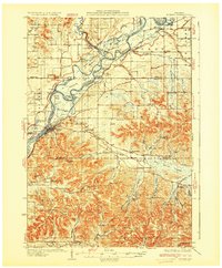
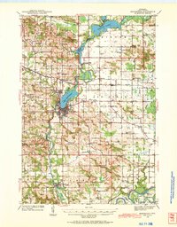
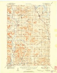
(80)- 1929 Map of Durand, 1970 Print
 1929 Durand1970 Print · USGSCovers Dunn County, including Red Cedar, Durand, and other nearby areas
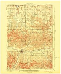
 - 1932 Map of Durand
 1932 Durand1932 Print · USGSCovers Dunn County, including Red Cedar, Durand, and other nearby areas
 - 1932 Map of Mondovi
 1932 Mondovi1932 Print · USGSCovers Dunn County, including Pleasant Valley, Mondovi, and other nearby areas
 - 1932 Map of Durand
 1932 Durand1932 Print · USGSCovers Dunn County, including Red Cedar, Durand, and other nearby areas
 - 1932 Map of Mondovi
 1932 Mondovi1932 Print · USGSCovers Dunn County, including Pleasant Valley, Mondovi, and other nearby areas
 - 1934 Map of Elk Mound, 1960 Print
 1934 Elk Mound1960 Print · USGSCovers Dunn County, including Eau Claire, Town of Wheaton, and other nearby areas
 - 1934 Map of Elk Mound, 1966 Print
 1934 Elk Mound1966 Print · USGSCovers Dunn County, including Eau Claire, Town of Wheaton, and other nearby areas
 - 1935 Map of Arkansaw
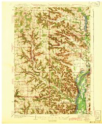
 1935 Arkansaw1935 Print · USGSCovers Dunn County, including Eau Galle, Plum City, and other nearby areas
 - 1936 Map of Elk Mound
 1936 Elk Mound1936 Print · USGSCovers Dunn County, including Eau Claire, Town of Wheaton, and other nearby areas
 - 1936 Map of Elk Mound
 1936 Elk Mound1936 Print · USGSCovers Dunn County, including Eau Claire, Town of Wheaton, and other nearby areas
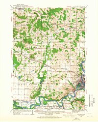
 - 1940 Map of Menomonie, 1965 Print
 1940 Menomonie1965 Print · USGSCovers Dunn County, including Menomonie, Town of Tainter, and other nearby areas
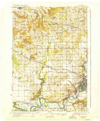
 - 1940 Map of Menomonie, 1969 Print
 1940 Menomonie1969 Print · USGSCovers Dunn County, including Menomonie, Town of Tainter, and other nearby areas
 - 1941 Map of Arkansaw
 1941 Arkansaw1941 Print · USGSCovers Dunn County, including Eau Galle, Plum City, and other nearby areas
 - 1942 Map of Arkansaw
 1942 Arkansaw1942 Print · USGSCovers Dunn County, including Eau Galle, Plum City, and other nearby areas
 - 1942 Map of Arkansaw
 1942 Arkansaw1942 Print · USGSCovers Dunn County, including Eau Galle, Plum City, and other nearby areas
 - 1942 Map of Menomonie
 1942 Menomonie1942 Print · USGSCovers Dunn County, including Menomonie, Town of Tainter, and other nearby areas
 - 1946 Map of Knapp, 1967 Print
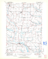
 1946 Knapp1967 Print · USGSCovers Dunn County, including Spring Valley, Elmwood, and other nearby areas
 - 1948 Map of Downing, 1970 Print
 1948 Downing1970 Print · USGSCovers Dunn County, including Glenwood City, Clear Lake, and other nearby areas
 - 1949 Map of Knapp
 1949 Knapp1949 Print · USGSCovers Dunn County, including Spring Valley, Elmwood, and other nearby areas
 - 1949 Map of New Auburn, 1967 Print
 1949 New Auburn1967 Print · USGSCovers Dunn County, including Bloomer, Tilden, and other nearby areas
 - 1949 Map of Ridgeland, 1970 Print
 1949 Ridgeland1970 Print · USGSCovers Dunn County, including Tainter, Sand Creek, and other nearby areas
 - 1950 Map of Downing
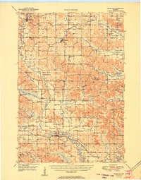
 1950 Downing1950 Print · USGSCovers Dunn County, including Glenwood City, Clear Lake, and other nearby areas
 - 1951 Map of Ridgeland
 1951 Ridgeland1951 Print · USGSCovers Dunn County, including Tainter, Sand Creek, and other nearby areas
 - 1951 Map of New Auburn
 1951 New Auburn1951 Print · USGSCovers Dunn County, including Bloomer, Tilden, and other nearby areas
 - 1953 Map of Saint Paul, 1964 Print
 1953 Saint Paul1964 Print · USGSCovers Dunn County, including Minneapolis, Saint Paul, and other nearby areas
Showing maps 1-25 of 80
Top cities in Dunn County
- Menomonie historical maps
- Tainter historical maps
- Red Cedar historical maps
- Colfax historical maps
- Elk Mound historical maps
- Boyceville historical maps
See more
Frequently asked questions
- What are the different types of historical maps available for Dunn County?
- What is the oldest map of Dunn County?
- Where can I purchase historical maps of Dunn County for my home or office?
- Where can I download high-res historical maps of Dunn County?
- Are there historical topographic maps available for Dunn County?
- Is there historical aerial imagery available for Dunn County?
- Where are historical maps of Dunn County sourced from?