1930s Maps of Forest County, Wisconsin
Explore 6 historic maps of Forest County from the 1930s. These maps offer a rare glimpse into what life looked like during the 1930s — showing old roads, neighborhoods, homes, and landmarks that have changed or disappeared over time.
Whether you're researching your family's past, planning a metal detecting trip, or studying how Forest County's landscape evolved across the 1930s, these high-resolution maps are a powerful tool for exploring the history of this region.
- Focus on a specific era: All maps on this page are from the 1930s, giving you a focused view of this time period.
- See what’s changed: Compare century-old streets, trails, and buildings to today's modern landscape using overlays and satellite layers.
- Research with precision: Use these maps for genealogy, historical research, land use analysis, or educational projects.
- View, download, or print: Maps are fully viewable online in high resolution, and can be downloaded or printed for your own records.
Start exploring Forest County's history through authentic maps from the 1930s. This is your window into the past.
Forest County, WI maps
(6)- 1938 Map of Alvin, 1956 Print
 1938 Alvin1956 Print · USGSForest and Vilas counties appear here in the late 1930s as centers of logging and new federal conservation efforts. You can trace the path of the Lumber RR, find remote Depression-era CCC Camp sites, and locate landmarks like the Jones Dam Fire Tower.2 unique versions available
 - 1938 Map of Three Lakes, 1956 Print
 1938 Three Lakes1956 Print · USGSThe lake country of Oneida and Vilas counties is shown here in the late 1930s, capturing the early layout of regional resorts and logging outposts. Genealogists can trace family footprints near Three Lakes, Sanborn Sch, and the Chicago and Northwestern rail line.2 unique versions available
 - 1939 Map of Crandon, 1955 Print
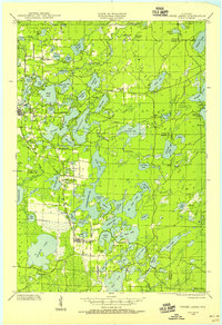
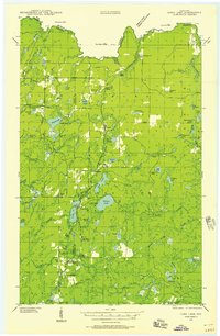
 1939 Crandon1955 Print · USGSForest County during the late 1930s was a critical junction of logging railroads and lakeside settlements. Genealogists and historians can trace rural school districts like Siding No 1 Sch and early infrastructure around Wisconsin Junction and Hiles Mill Pond.2 unique versions available
 - 1939 Map of Goodman, 1956 Print
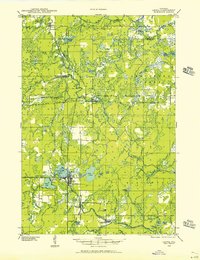
 1939 Goodman1956 Print · USGSMarinette and Forest counties are shown just before the war when the timber economy and the railroad were the lifeblood of the Northwoods. Genealogists and local historians can trace early settlements at Goodman and Fence, alongside rural landmarks like Engleking Sch and Pine Hill Cem.
 - 1939 Map of Laona, 1956 Print
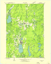
 1939 Laona1956 Print · USGSForest County during the late 1930s was a landscape defined by the timber industry and the intersection of major railroads. Trace the rail-and-river network through lumber hubs like Laona and Blackwell, or locate the CCC Camp and Laona Fire Tower.2 unique versions available
 - 1939 Map of Long Lake, 1957 Print
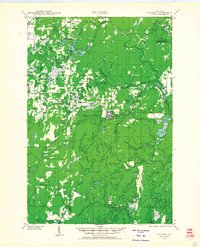
 1939 Long Lake1957 Print · USGSNortheastern Wisconsin’s timber country comes alive in this pre-war survey of Florence and Forest counties. Researchers can trace the logging spurs of the Chicago and Northwestern, the Long Lake CCC Camp, and local landmarks like Wild Rose Sch.2 unique versions available
End of results
Showing maps 1-6 of 6
Top cities of Forest County
- Crandon historical maps
- Laona historical maps
- Wabeno historical maps
- Nashville historical maps
- Argonne historical maps
- Armstrong Creek historical maps
See more
Frequently asked questions
- What are the different types of historical maps available for Forest County?
- What is the oldest map of Forest County?
- Where can I purchase historical maps of Forest County for my home or office?
- Where can I download high-res historical maps of Forest County?
- Are there historical topographic maps available for Forest County?
- Is there historical aerial imagery available for Forest County?
- Where are historical maps of Forest County sourced from?