Old Maps of Forest County, Wisconsin for Metal Detecting
Plan your next treasure hunt with 112 historic maps of Forest County. Find old homesites, ghost towns, trails, and gathering spots that may be lost to time — perfect for identifying promising metal detecting locations.
- Locate forgotten sites: Uncover places like long-lost settlements, abandoned rail lines, or gathering spots.
- Plan better hunts: Use map overlays combined with LiDAR or satellite views to narrow in on historically rich areas.
- Made for detectorists: Thousands of hobbyists use these maps to discover relics, coins, and hidden history.
Use these historic maps to boost your research and find new opportunities beneath the surface of Forest County.
Forest County, WI maps
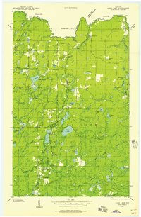
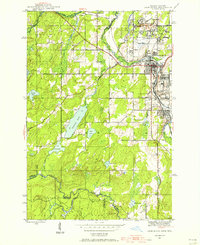
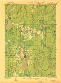
(112)- 1898 Map of Iron River, 1899 Print
 1898 Iron River1899 Print · USGSUpper Peninsula mining and timber frontiers emerge in the 1890s as railroads begin connecting remote outposts. Researchers can trace early rail lines through Iron River and Stambaugh or locate former stations and camps at Hazle, Atkinson, and Saunders.2 unique versions available
 - 1928 Map of Three Lakes
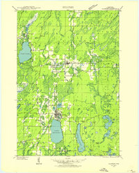
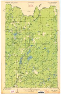
 1928 Three Lakes1928 Print · USGSThe Northwoods of Vilas and Oneida Counties come into focus in the late 1920s as early motor roads begin to connect the region's vast chain of lakes. Genealogists and local historians can locate early landmarks like Mayo Sch, the settlement of Hutchinson, and the original footprints of Eagle River and Three Lakes.
 - 1938 Map of Alvin, 1956 Print
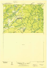
 1938 Alvin1956 Print · USGSForest and Vilas counties appear here in the late 1930s as centers of logging and new federal conservation efforts. You can trace the path of the Lumber RR, find remote Depression-era CCC Camp sites, and locate landmarks like the Jones Dam Fire Tower.2 unique versions available
 - 1938 Map of Three Lakes, 1956 Print
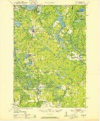
 1938 Three Lakes1956 Print · USGSThe lake country of Oneida and Vilas counties is shown here in the late 1930s, capturing the early layout of regional resorts and logging outposts. Genealogists can trace family footprints near Three Lakes, Sanborn Sch, and the Chicago and Northwestern rail line.2 unique versions available
 - 1939 Map of Crandon, 1955 Print
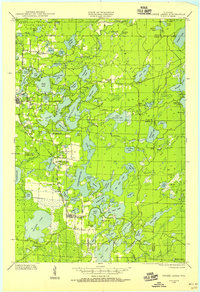
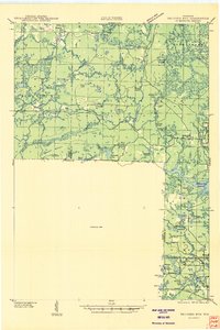
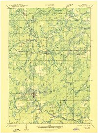
 1939 Crandon1955 Print · USGSForest County during the late 1930s was a critical junction of logging railroads and lakeside settlements. Genealogists and historians can trace rural school districts like Siding No 1 Sch and early infrastructure around Wisconsin Junction and Hiles Mill Pond.2 unique versions available
 - 1939 Map of Goodman, 1956 Print
 1939 Goodman1956 Print · USGSMarinette and Forest counties are shown just before the war when the timber economy and the railroad were the lifeblood of the Northwoods. Genealogists and local historians can trace early settlements at Goodman and Fence, alongside rural landmarks like Engleking Sch and Pine Hill Cem.
 - 1939 Map of Laona, 1956 Print
 1939 Laona1956 Print · USGSForest County during the late 1930s was a landscape defined by the timber industry and the intersection of major railroads. Trace the rail-and-river network through lumber hubs like Laona and Blackwell, or locate the CCC Camp and Laona Fire Tower.2 unique versions available
 - 1939 Map of Long Lake, 1957 Print
 1939 Long Lake1957 Print · USGSNortheastern Wisconsin’s timber country comes alive in this pre-war survey of Florence and Forest counties. Researchers can trace the logging spurs of the Chicago and Northwestern, the Long Lake CCC Camp, and local landmarks like Wild Rose Sch.2 unique versions available
 - 1940 Map of Thunder Mtn.
 1940 Thunder Mtn.1940 Print · USGSMarinette County and the surrounding woods are captured here in the early 1940s as a hub of timber production and forestry management. Genealogists and historians can trace rural schools like Silver Cliff Sch, the site of the State Fish Hatchery, and fire lookouts atop Thunder Mountain.2 unique versions available
 - 1940 Map of Monico, 1955 Print
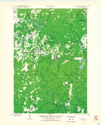
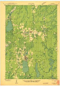
 1940 Monico1955 Print · USGSThe Northwoods of Oneida and Forest counties are captured here just before the mid-century, defined by the crossing of major rail lines and a maze of glacial lakes. Genealogists and researchers can trace the early footprints of Monico, Jennings, and Nashville, or locate local landmarks like Forest Home Cem.
 - 1941 Map of Crandon
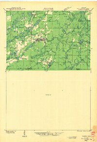
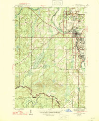
 1941 Crandon1941 Print · USGSForest County's timberlands and rail lines are mapped here in the years following the Great Depression. Genealogists can trace rural school locations like Kokoma Sch and the Argonne Cem, while following the old tracks of the St Paul and Sault Ste Marie railroad.
 - 1942 Map of Elcho
 1942 Elcho1942 Print · USGSUpper Wisconsin’s lake country appears here in the early 1940s, showing a landscape of scattered rural schools and forest townships. Genealogists and researchers can trace local roots at the Enterprise Cem, St Johns Ch, or find family landmarks near Pelican Lake.
 - 1942 Map of Wabeno
 1942 Wabeno1942 Print · USGSForest County's timberlands are captured here in the early 1940s, when rail and river still drove the local economy. Researchers can locate vanished rural schools like Rummel Sch, several local cemeteries, and the site of an Abandoned CCC Camp near Otter Lake.
 - 1942 Map of Pearson
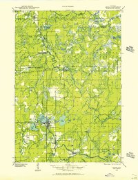
 1942 Pearson1942 Print · USGSNorthern Wisconsin lake country and timberlands are shown in the early 1940s as rail transit still defined the local economy. Genealogists and historians can trace rail stops like Jones Spur, the Woodlawn Sch, and the settlement at Mole Lake.
 - 1944 Map of Iron River, 1956 Print
 1944 Iron River1956 Print · USGSIron River and the Menominee Range are shown in the 1940s during a peak era of Michigan mining activity. Researchers can trace the extensive rail-and-mine network connecting sites like James Mine, Wauseca Mine, and the Virgil Location worker settlement.2 unique versions available
 - 1945 Map of Three Lakes, 1946 Print
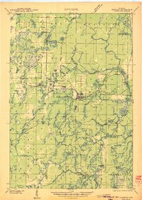
 1945 Three Lakes1946 Print · USGSThe Wisconsin Northwoods are seen here during the mid-1940s, a landscape defined by a sprawling lakeland and the Chicago and Northwestern railroad. Genealogists and historians can trace the early layout of Three Lakes and find rural landmarks like Evergreen Sch and Jones Dam.3 unique versions available
 - 1946 Map of Laona
 1946 Laona1946 Print · USGSForest and Florence counties are shown here in the 1940s during a pivotal era of rail-driven forestry and conservation. Researchers can trace the junction of the Soo Line and Chicago and Northwestern railroads or locate the CCC Camp and Newald Fire Tower.
 - 1946 Map of Iron River
 1946 Iron River1946 Print · USGSIron County’s mining heartland is captured here during the mid-1940s, showing the dense industrial corridor from Stambaugh to Caspian. Trace the iron ore legacy through the Hiawatha No 1 Mine and the many worker-housing sites like Homer Location.2 unique versions available
 - 1946 Map of Alvin
 1946 Alvin1946 Print · USGSNortheastern Wisconsin’s timberlands are shown here in the late 1930s as federal forestry and recreation infrastructure began to reshape the woods. Trace the locations of early CCC Camps, fire lookouts like the Jones Dam Fire Tower, and recreational sites such as Griswolds Camp on Butternut Lake.
 - 1946 Map of Goodman
 1946 Goodman1946 Print · USGSMarinette and Florence counties were still deeply tied to the timber industry and rail transit just before the 1940s. Genealogists and historians can trace local family roots at Pine Hill Cem or locate rural landmarks like Engleking Sch and the Goodman Fire Tower.
 - 1947 Map of Crandon
 1947 Crandon1947 Print · USGSForest County's timber and rail economy is on full display in the late 1940s, centered on the crossroads at Crandon. Genealogists can trace family roots through rural landmarks like the Argonne Cem and local schoolhouses including Sherman Sch and Kokoma Sch.
 - 1948 Map of Long Lake
 1948 Long Lake1948 Print · USGSThe timber country of Florence and Forest counties is shown here at the tail end of the New Deal era. You can locate the Long Lake CCC Camp, active logging spurs like Lindels Spur, and several rural schoolhouses including Wild Rose Sch.
 - 1950 Map of Wabeno
 1950 Wabeno1950 Print · USGSThe Northwoods of Forest County are captured here at mid-century, where logging roots and lake country recreation meet. Genealogists and historians can locate rural schoolhouses like Rummel Sch, explore the Abandoned CCC Camp, or trace the old Logging RR routes.
 - 1950 Map of Monico
 1950 Monico1950 Print · USGSOneida County at mid-century is a landscape of glacial lakes and critical rail junctions during the height of the timber and transport era. Researchers can trace rural school locations like Wolf River Sch and rail outposts including Starks, Gagen, and Lennox.
 - 1950 Map of Elcho, 1952 Print
 1950 Elcho1952 Print · USGSLanglade and Oneida Counties come into focus during the early fifties, a time when the Chicago and North Western railway still connected these timber-rich lakeside communities. You can trace early township schools like Enterprise Sch, find the Pence Lake Lookout Tower, and locate vanished landmarks along the Old Railroad Grade.3 unique versions available
Showing maps 1-25 of 112
Top cities of Forest County
- Crandon historical maps
- Laona historical maps
- Wabeno historical maps
- Nashville historical maps
- Argonne historical maps
- Armstrong Creek historical maps
See more
Frequently asked questions
- What are the different types of historical maps available for Forest County?
- What is the oldest map of Forest County?
- Where can I purchase historical maps of Forest County for my home or office?
- Where can I download high-res historical maps of Forest County?
- Are there historical topographic maps available for Forest County?
- Is there historical aerial imagery available for Forest County?
- Where are historical maps of Forest County sourced from?