2000s (21st Century) Maps of Crandon, Wisconsin
Explore 4 historic maps of Crandon from the 2000s (21st Century). These maps offer a rare glimpse into what life looked like during the 2000s — showing old roads, neighborhoods, homes, and landmarks that have changed or disappeared over time.
Whether you're researching your family's past, planning a metal detecting trip, or studying how Crandon's landscape evolved across the 2000s, these high-resolution maps are a powerful tool for exploring the history of this region.
- Focus on a specific era: All maps on this page are from the 2000s, giving you a focused view of this time period.
- See what’s changed: Compare century-old streets, trails, and buildings to today's modern landscape using overlays and satellite layers.
- Research with precision: Use these maps for genealogy, historical research, land use analysis, or educational projects.
- View, download, or print: Maps are fully viewable online in high resolution, and can be downloaded or printed for your own records.
Start exploring Crandon's history through authentic maps from the 2000s. This is your window into the past.
Crandon, WI maps
(4)- 2022 Map of Nashville, 2022 Print
 2022 Nashville2022 Print · USGSOneida and Forest counties are shown here in the early twenty-first century, featuring a landscape defined by glacial lakes and the Wolf River. Researchers can locate Jennings and several historic burial sites, including Saint Marys Cem and Wolfgram Cem.
 - 2022 Map of Monico NE, 2022 Print
 2022 Monico NE2022 Print · USGSNorthern Wisconsin lake country and the border of the Nicolet National Forest are documented in this recent survey. Researchers can trace the settlement of Atkins or locate family landmarks like Nelson's Landing and Atkins Lake.
 - 2022 Map of Argonne, 2022 Print
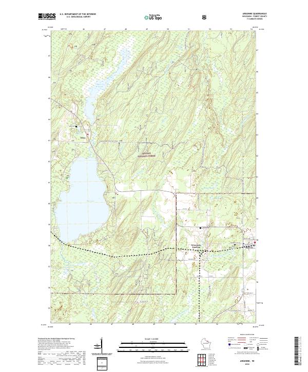 2022 Argonne2022 Print · USGSForest County's timberlands and lakefronts are shown here in the early 2020s, centered on the community of Argonne and the headwaters of the Wolf River. Genealogists can trace local roots at Saint Marys Cem or explore the lakeside landscape around Hiles and the Hiles Millpond.
 - 2022 Map of Crandon, 2022 Print
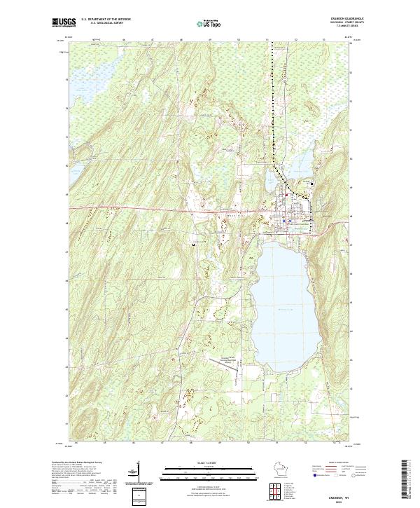 2022 Crandon2022 Print · USGSCrandon and its surrounding lake country are shown in detail during the early 2020s, centered on the historic Forest County seat. Researchers can locate the Forest County Courthouse, trace family roots at Lakeside Cem, or explore the shores of Metonga Lake and Peshtigo Lake.
End of results
Showing maps 1-4 of 4
Top cities near Crandon
- Three Lakes historical maps
- Crandon historical maps
- Laona historical maps
- Elcho historical maps
- Nashville historical maps
- Stella historical maps
See more
Frequently asked questions
- What are the different types of historical maps available for Crandon?
- What is the oldest map of Crandon?
- Where can I purchase historical maps of Crandon for my home or office?
- Where can I download high-res historical maps of Crandon?
- Are there historical topographic maps available for Crandon?
- Is there historical aerial imagery available for Crandon?
- Where are historical maps of Crandon sourced from?