1980s Maps of Albany County, Wyoming
Explore 21 historic maps of Albany County from the 1980s. These maps offer a rare glimpse into what life looked like during the 1980s — showing old roads, neighborhoods, homes, and landmarks that have changed or disappeared over time.
Whether you're researching your family's past, planning a metal detecting trip, or studying how Albany County's landscape evolved across the 1980s, these high-resolution maps are a powerful tool for exploring the history of this region.
- Focus on a specific era: All maps on this page are from the 1980s, giving you a focused view of this time period.
- See what’s changed: Compare century-old streets, trails, and buildings to today's modern landscape using overlays and satellite layers.
- Research with precision: Use these maps for genealogy, historical research, land use analysis, or educational projects.
- View, download, or print: Maps are fully viewable online in high resolution, and can be downloaded or printed for your own records.
Start exploring Albany County's history through authentic maps from the 1980s. This is your window into the past.
Albany County, WY maps
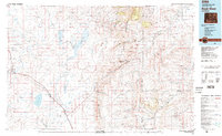
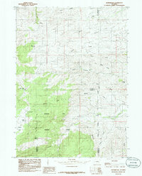
(21)- 1980 Map of Medicine Bow
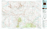 1980 Medicine Bow1980 Print · USGSCarbon County’s high plains and industrial corridors are captured here in the late twentieth century, centered on the coal-rich territory around Hanna. Genealogists and historians can trace the paths of the historic Overland Trail and the Union Pacific Railroad past settlements like Elmo and Fort Steele.
 - 1980 Map of Fort Collins, 1981 Print
 1980 Fort Collins1981 Print · USGSThe Front Range and high Rockies meet in Larimer County during the early 1980s. Local researchers can trace the growth of Fort Collins, the irrigation network around Wellington, and high-country outposts like Red Feather Lakes or the scenic canyon settlement of Mishawaka.
 - 1981 Map of Laramie
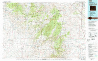
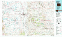 1981 Laramie1981 Print · USGSLaramie and the high plains of the Laramie Mountains are captured here in the early eighties. Researchers can trace the Union Pacific rail stops, find Greenhill Cem, and locate early routes like the Overland Trail.2 unique versions available
 - 1981 Map of Shirley Basin
 1981 Shirley Basin1981 Print · USGSThe high Wyoming desert comes alive in this early 1980s survey of Carbon County, where massive reservoirs meet rugged mountain ranges. Researchers can trace the industrial activity at Shirley Basin and Mine Dumps or explore early shoreline footprints at Seminoe State Park.
 - 1981 Map of Laramie Peak
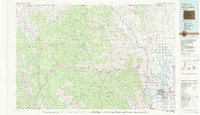
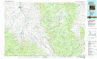
 1981 Laramie Peak1981 Print · USGSThe Laramie Mountains and Medicine Bow National Forest define this landscape in the early eighties. Genealogists and historians can trace high-country settlements like Toltec and Binford, or locate industrial sites like the Mica Mine near the North Laramie River.2 unique versions available
 - 1981 Map of Walden, 1982 Print
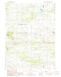
 1981 Walden1982 Print · USGSThe North Park basin in the early eighties was a high-country crossroads of ranching and industry. Researchers can trace the Union Pacific rail corridor and locate historical mining operations like the Sudduth Mine or the remote settlement of Coalmont.
 - 1982 Map of Saratoga
 1982 Saratoga1982 Print · USGSHigh country ranching and mining define this southern Wyoming region during the early 1980s. Researchers can trace the Union Pacific Railroad corridor through Foxpark or locate the historic Ferris-Haggarty Mine near the North Platte River.
 - 1982 Map of Rock River
 1982 Rock River1982 Print · USGSThe Laramie Basin and the rugged peaks of the high plains come into focus in the early eighties. Genealogists and historians can trace rail-aligned settlements like Rock River and Bosler, alongside hydraulic landmarks like Wheatland Reservoir No 2.
 - 1985 Map of Harris Park
 1985 Harris Park1985 Print · USGSThe Laramie Mountains of southeastern Wyoming are documented here in the mid-eighties, centered on the high-altitude clearings of Harris Park. Local historians and hikers can trace the remote tracks across 4WD Ridge and find landmarks like Albany Peak and Harmon Heights.
 - 1985 Map of Esterbrook
 1985 Esterbrook1985 Print · USGSThe Laramie Mountains backcountry of southeastern Wyoming is captured here in the mid-1980s. Researchers can locate the settlement of Esterbrook, trace the high slopes of Elk Mountain, and find local landmarks like Castle Rock and the Mine.
 - 1985 Map of Laramie Peak
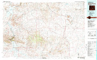
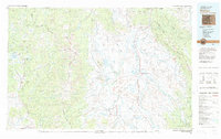
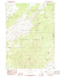 1985 Laramie Peak1985 Print · USGSThe Laramie Range in the mid-1980s is captured here, centered on the high terrain of Medicine Bow National Forest. Researchers can trace the rugged topography around Laramie Peak and find named high-country clearings like Friend Park and Kenyon Park.
 - 1987 Map of Green Top Mountain
 1987 Green Top Mountain1987 Print · USGSThe high country of the Medicine Bow front is captured here in the late eighties as it straddles the Albany and Laramie county line. Researchers can locate remote high-altitude landmarks like Eagle Rock, the secluded Grave, and several Mine sites near McKechnie Meadow.
 - 1987 Map of Sherman Mountains East
 1987 Sherman Mountains East1987 Print · USGSThe Laramie Range in the late eighties reveals a high-country landscape of granite formations and vital water catchments. Hikers and historians can trace the Old Railroad Grade or locate landmarks like Vedauwoo Glen and Hirsig.2 unique versions available
 - 1987 Map of Dale Creek
 1987 Dale Creek1987 Print · USGSAlbany County's high-elevation rail and trail corridors are captured here in the late 1980s, where the transcontinental legacy remains clearly etched. Researchers can trace the path of the Overland Trail alongside railroad landmarks like the Hermosa Tunnel and The Fill.
 - 1987 Map of Sherman Mountains West
 1987 Sherman Mountains West1987 Print · USGSThe high mountain passes of the Sherman range are captured here in the late eighties, documenting a landscape shaped by early rail and modern communications. Local historians can trace the Old Railroad Grade near the iconic Ames Monument and locate landmarks like The Summit.2 unique versions available
 - 1987 Map of King Mountain
 1987 King Mountain1987 Print · USGSThe Laramie Range highlands are captured in the late 1980s, revealing a landscape of high-country drainage and remote land use. Trace local family landmarks and industrial history through the Schoolhouse on Spring Creek and various Mines near Sherman Hill.
 - 1987 Map of Buford
 1987 Buford1987 Print · USGSHigh plains ranching and railroad history meet in the late 1980s at the Albany and Laramie county line. Genealogists and rail historians can trace the UNION PACIFIC route through historic stops at Sherman, Buford, and Harriman.
 - 1987 Map of Pilot Hill
 1987 Pilot Hill1987 Print · USGSThe high ridges of Albany County are documented here in the late twentieth century, showing the intersection of forest lands and vital water sources. Trace the rugged terrain from Pilot Hill down through Telephone Canyon or locate family-named landmarks like Laycock Spring.
 - 1987 Map of Ragged Top Mountain, 1988 Print
 1987 Ragged Top Mountain1988 Print · USGSThe high rangelands of Albany County are documented here in the late eighties as a complex network of mountain forks and headwaters. Researchers can trace the drainage of North Fork Horse Creek and locate sites like the Mine Shaft or Quarry.
 - 1988 Map of Casper
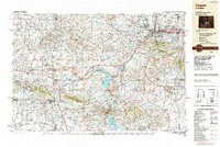 1988 Casper1988 Print · USGSHigh plains and mountain ranges define Central Wyoming in the late eighties, centered on the growth of the Casper urban corridor. Genealogists and researchers can trace the rail lines of the Chicago and North Western RR or locate small outposts like Jeffrey City and Bairoil.
 - 1988 Map of Rawlins
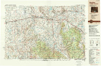 1988 Rawlins1988 Print · USGSSouthern Wyoming and the Colorado borderlands are detailed here in the late eighties, featuring the intersection of the historic Overland Trail and the Union Pacific. Researchers can trace old rail towns like Medicine Bow and Wamsutter or landmark peaks like Medicine Bow Peak.
End of results
Showing maps 1-21 of 21
Top cities of Albany County
Frequently asked questions
- What are the different types of historical maps available for Albany County?
- What is the oldest map of Albany County?
- Where can I purchase historical maps of Albany County for my home or office?
- Where can I download high-res historical maps of Albany County?
- Are there historical topographic maps available for Albany County?
- Is there historical aerial imagery available for Albany County?
- Where are historical maps of Albany County sourced from?