1950s Maps of Albany County, Wyoming
Explore 51 historic maps of Albany County from the 1950s. These maps offer a rare glimpse into what life looked like during the 1950s — showing old roads, neighborhoods, homes, and landmarks that have changed or disappeared over time.
Whether you're researching your family's past, planning a metal detecting trip, or studying how Albany County's landscape evolved across the 1950s, these high-resolution maps are a powerful tool for exploring the history of this region.
- Focus on a specific era: All maps on this page are from the 1950s, giving you a focused view of this time period.
- See what’s changed: Compare century-old streets, trails, and buildings to today's modern landscape using overlays and satellite layers.
- Research with precision: Use these maps for genealogy, historical research, land use analysis, or educational projects.
- View, download, or print: Maps are fully viewable online in high resolution, and can be downloaded or printed for your own records.
Start exploring Albany County's history through authentic maps from the 1950s. This is your window into the past.
Albany County, WY maps
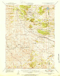
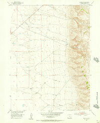
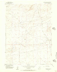
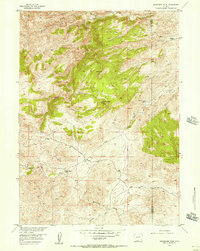
(51)- 1950 Map of Ragged Top Mountain
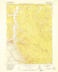
 1950 Ragged Top Mountain1950 Print · USGSHigh plains ranching and military maneuvers converge in Albany County during the mid-century, where the Medicine Bow National Forest meets the open range. Genealogists and historians can trace legacy holdings like the King Brothers Ranch or the industrial footprint of the Feldspar Strip Mine.
 - 1950 Map of Sherman Mountains
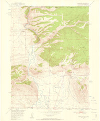
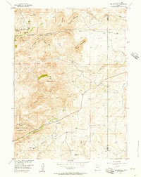
 1950 Sherman Mountains1950 Print · USGSHigh Wyoming ranching and military lands are captured here at mid-century as the Lincoln Highway and Union Pacific cross the Laramie Mountains. Genealogists can locate named homesteads like the Davis Ranch and the landmark Ames Monument.2 unique versions available
 - 1950 Map of Northgate, 1957 Print
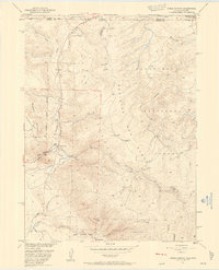
 1950 Northgate1957 Print · USGSJackson County ranching and mining operations are captured in detail at the turn of the 1950s. Genealogists and historians can trace family-named sites like the Quaintance Ranch alongside industrial landmarks including the Fluorspar Mine and Gero Tunnel.6 unique versions available
 - 1950 Map of Kings Canyon, 1959 Print
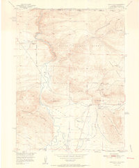
 1950 Kings Canyon1959 Print · USGSThe Colorado-Wyoming border region in the 1950s was a hub for high-country mining and specialized irrigation. Researchers can trace historic industrial sites like the Kings Canyon Mine and water infrastructure such as the Hardwork Ditch and Government Ditch.4 unique versions available
 - 1952 Map of Northgate
 1952 Northgate1952 Print · USGSHigh-altitude ranching and mining operations meet along the North Platte River in northern Colorado during the early fifties. Genealogists and historians can trace industrial sites like the Fluorspar Mine, local landmarks like Quaintance Ranch, and the Union Pacific rail corridor.2 unique versions available
 - 1952 Map of Kings Canyon
 1952 Kings Canyon1952 Print · USGSThe Colorado-Wyoming borderlands appear here in the early fifties as a rugged high-altitude frontier shaped by mining and rail. Genealogists and historians can trace the sites of Roach and Camp Nelson along the Union Pacific line.2 unique versions available
 - 1954 Map of Torrington, 1963 Print
 1954 Torrington1963 Print · USGSEastern Wyoming and the Nebraska borderlands are captured here during the mid-fifties, showing a landscape shaped by the Platte River and the Laramie Range. Researchers can trace deep history at the Fort Laramie National Historical Site, the Old Doty Ranch Site, and along the Old Fetterman Road.4 unique versions available
 - 1954 Map of Cheyenne, 1963 Print
 1954 Cheyenne1963 Print · USGSSoutheastern Wyoming's high plains and the capital city's mid-century expansion are documented here during the early Cold War. Genealogists and historians can trace rail-aligned settlements like Pine Bluffs and Hillsdale, or explore landmarks like the Ames Monument and Francis E. Warren Air Force Base.3 unique versions available
 - 1954 Map of Greeley, 1966 Print
 1954 Greeley1966 Print · USGSNorthern Colorado transitions from high-alpine peaks to the irrigated South Platte valley during this mid-century period of growth. Genealogists and historians can trace rail-connected hubs like Greeley and Longmont alongside landmarks like Horsetooth Reservoir and Estes Park.3 unique versions available
 - 1954 Map of Rawlins, 1968 Print
 1954 Rawlins1968 Print · USGSThe high plains and mountain ranges of southern Wyoming are shown here in the mid-1950s as the Union Pacific railroad and early highways fueled local industry. Genealogists and historians can trace old homesteads and outposts like the Overland Stage Station, the Utah Oil Refining Station, and the Hadsell Winter Headquarters.2 unique versions available
 - 1954 Map of Craig, 1973 Print
 1954 Craig1973 Print · USGSNorthwest Colorado and the high mountain parks are captured in the mid-fifties, showing the region's ranching, mining, and timber centers. Genealogists and historians can trace rail corridors like the Denver and Rio Grande Western and old towns such as Axial, Milner, and Coalmont.3 unique versions available
 - 1955 Map of Bosler, 1956 Print
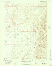
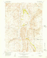
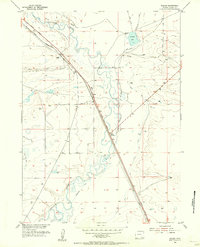 1955 Bosler1956 Print · USGSAlbany County in the mid-fifties is captured here as a critical transit point along the Union Pacific railroad. Genealogists and local historians can trace the early infrastructure of Bosler and Bosler Junction or locate the historic Diamond Ranch.2 unique versions available
 - 1955 Map of Big Judson, 1956 Print
 1955 Big Judson1956 Print · USGSAlbany County ranchlands are captured here in the mid-fifties, showing a landscape defined by water management and rural modernization. Researchers can trace the layout of the Old Northrup Ranch or locate early utility routes like the underground Telephone Cable.3 unique versions available
 - 1955 Map of Poe Mountain, 1956 Print
 1955 Poe Mountain1956 Print · USGSThe Laramie Mountains transition into high plains ranching country during the mid-fifties, dominated by the peaks of the Sybille Creek watershed. Genealogists and local historians can locate early homesteads like McGill Ranch and Lucy Ranch, or trace the grounds of the Garton Sch.3 unique versions available
 - 1955 Map of Pine Tree Ridge, 1956 Print
 1955 Pine Tree Ridge1956 Print · USGSAlbany County in the mid-1950s shows a landscape of mineral extraction and cattle ranching centered around Soda Lake. Researchers can trace the path of an Old Railroad Grade and locate an inactive Bentonite Mine near the base of Pine Tree Ridge.2 unique versions available
 - 1955 Map of Bosler SE, 1956 Print
 1955 Bosler SE1956 Print · USGSThe Albany County high plains meet the Laramie Mountains in this mid-fifties study of the Wyoming landscape. Researchers can trace the essential water infrastructure of the era, from a long Ditch to multiple Windmill locations and the paths of Wallrock Creek.3 unique versions available
 - 1955 Map of Mc Gill Lakes, 1956 Print
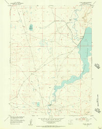 1955 Mc Gill Lakes1956 Print · USGSAlbany County ranching and water history are preserved here in the mid-1950s, showcasing the extensive reservoir systems along the Laramie River. Researchers can trace the layout of the Kite Ranch and follow historic routes like Fetterman Road.2 unique versions available
 - 1955 Map of Dodge Ranch, 1956 Print
 1955 Dodge Ranch1956 Print · USGSAlbany County ranching and water management are frozen in time during the mid-1950s. Genealogists and local historians can locate private holdings like the Kennedy Ranch and North Albany Club alongside the Laramie River.2 unique versions available
 - 1955 Map of Bluegrass Wells, 1956 Print
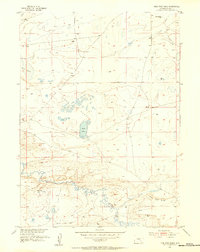
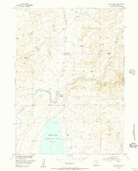
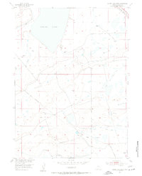
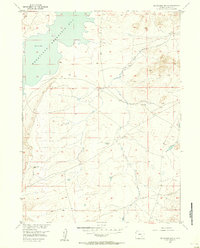 1955 Bluegrass Wells1956 Print · USGSHigh plains water management and early energy exploration define this mid-1950s Albany County landscape. Researchers can trace the massive shoreline of Wheatland Reservoir No 2 and locate the site of a solitary Oil Well (Aband).3 unique versions available
 - 1955 Map of Sevenmile Spring, 1956 Print
 1955 Sevenmile Spring1956 Print · USGSAlbany County ranching country and high plains terrain are documented here in the mid-1950s. Trace historical travel routes like the Old Fort Fetterman Road and locate essential water sources including Sevenmile Spring and Mud Springs.2 unique versions available
 - 1955 Map of Cooper Lake South, 1956 Print
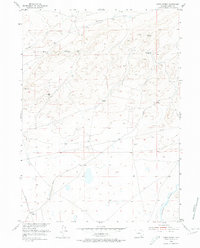
 1955 Cooper Lake South1956 Print · USGSThe high plains of Albany County are documented here in the mid-1950s, showing a landscape shaped by water management and the railroad. Genealogists and historians can trace the Harris Ranch and the vital corridor of the Union Pacific rail line.3 unique versions available
 - 1955 Map of Sybille Springs, 1956 Print
 1955 Sybille Springs1956 Print · USGSThe Laramie Mountains in the mid-1950s reveal a high-country ranching landscape centered on essential water sources and mountain crossings. Local historians can locate Farley Ranch, trace the Old Wheatland Road, and identify the inactive Woods Mine.3 unique versions available
 - 1955 Map of Ayres Spring, 1956 Print
 1955 Ayres Spring1956 Print · USGSHigh plains ranching and historic travel routes define this part of Albany County during the mid-fifties. Researchers can trace the paths of Fetterman Road and Garrett Road as they cross terrain marked by Ayres Spring and the Laramie River.3 unique versions available
 - 1955 Map of Moonshine Peak, 1956 Print
 1955 Moonshine Peak1956 Print · USGSHigh-country ranching and river navigation dominate this mid-century view of the Wyoming range near the Albany and Platte county line. Local historians and genealogists can trace family holdings like the Bookout Ranch and Meadow Spring Ranch along the banks of the Laramie River.3 unique versions available
 - 1955 Map of Indian Guide, 1956 Print
 1955 Indian Guide1956 Print · USGSAlbany County ranching country and the high canyons of the Laramie Range come into focus in the mid-1950s. Genealogists and historians can trace the Old Wheatland Road and locate the sites of the South Sybille Sch and Shaffer Sch.3 unique versions available
Showing maps 1-25 of 51
Top cities of Albany County
Frequently asked questions
- What are the different types of historical maps available for Albany County?
- What is the oldest map of Albany County?
- Where can I purchase historical maps of Albany County for my home or office?
- Where can I download high-res historical maps of Albany County?
- Are there historical topographic maps available for Albany County?
- Is there historical aerial imagery available for Albany County?
- Where are historical maps of Albany County sourced from?