
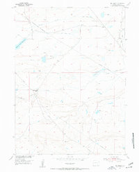
1955 Map of Big Judson
USGS Topo · Published 1956About this map
Old Northrup Ranch stands as a focal point of human activity in this high-plains landscape, situated near the winding course of Dutton Creek. The 1955 survey illustrates a territory defined by intricate water management, with numerous irrigation projects such as King Ditch No 1, King Ditch No 2, and Homer Ditch diverting flow across the terrain. These man-made improvements, alongside larger impoundments like Dutton Creek Reservoir and Cavender Reservoir, highlight the essential role of water rights and engineering in the local ranching economy of Albany County.
Find a feature on this map
15 named features on this map. Tap any name to fly to it.
Don’t see what you’re looking for? This feature index may not catch every label — zoom into the map to look around manually.
Map Details
Editions of this 1955 Big Judson Map
3 editions found

Other maps of this area

1895 · Laramie
USGS Topo · 1:125,000

1902 · Laramie
USGS Topo · 1:125,000

1905 · Laramie
USGS Topo · 1:125,000

1906 · Medicine Bow
USGS Topo · 1:125,000

1906 · Laramie
USGS Topo · 1:125,000

1908 · Laramie
USGS Topo · 1:125,000

1908 · Medicine Bow
USGS Topo · 1:125,000

1954 · Cheyenne
USGS Topo · 1:250,000

1954 · Rawlins
USGS Topo · 1:250,000

1955 · Cooper Lake South
USGS Topo · 1:24,000