Old Maps of Lander, Wyoming for Hiking & Exploration
Hike through history with 14 historic maps of Lander. Explore old trails, ghost towns, and forgotten backroads — perfect for outdoor adventurers and local explorers.
- Rediscover forgotten places: Map out old mining camps, roads, and footpaths that no longer exist on modern maps.
- Layer with modern tools: Combine with LiDAR or satellite views to plan hikes through historical terrain.
- Made for exploration: Popular among hikers, overlanders, and local history lovers.
Use these maps to find adventure and explore the hidden past of Lander.
Lander, WY maps
(14)- 1952 Map of Lander, 1954 Print
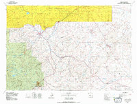
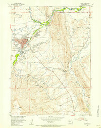 1952 Lander1954 Print · USGSLander and the eastern edge of the Wind River Indian Reservation are captured here in the early fifties during a period of steady civic growth. Genealogists and researchers can locate the State Training School, the old Iiams School (Aband), and the rail terminus of the Chicago and North Western line.
 - 1953 Map of Fossil Hill, 1955 Print
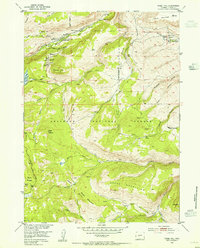 1953 Fossil Hill1955 Print · USGSThe Wind River foothills come alive in the 1950s, showing a mix of geological research and high-altitude ranching. Genealogists and historians can trace family-named sites like Eversole Ranch or locate the University of Missouri Geology Camp.4 unique versions available
 - 1953 Map of Mount Arter SE, 1955 Print
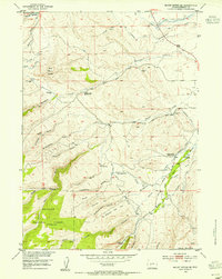 1953 Mount Arter SE1955 Print · USGSCovers Lander, including Fremont County, United States, and other nearby areas3 unique versions available
 - 1955 Map of Lander, 1976 Print
 1955 Lander1976 Print · USGSMid-century central Wyoming is captured here as a landscape of high alpine wilderness and burgeoning energy development. Genealogists and historians can trace the path of the Oregon Trail or locate early industrial sites like the Big Sand Draw Oil and Gas Field and the State Training School.2 unique versions available
 - 1958 Map of Lander
 1958 Lander1958 Print · USGSThe high peaks of the Wind River Range meet the Great Divide Basin in the 1950s. Researchers can trace historic migrations past the Oregon Trail Monument or locate early energy infrastructure at the Beaver Creek Gas and Oil Field and the Oregon Trail Oil Field.
 - 1960 Map of Lander, 1961 Print
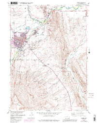
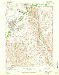 1960 Lander1961 Print · USGSLander and the Popo Agie River valley are captured here in the early 1960s, showing a landscape defined by irrigation and early industry. Researchers can trace the Chicago and Northwestern tracks to Hudson Siding or locate local landmarks like Mt Hope Cem and the historic Ft McGraw.3 unique versions available
 - 1961 Map of Lander
 1961 Lander1961 Print · USGSThe high peaks and desert basins of central Wyoming appear here in the early sixties, showing the landscape of the Shoshone Indian Reservation and the Wind River Range. Researchers can trace the path of the Oregon Trail and locate early settlements like Lander and the mining remains at South Pass City.2 unique versions available
 - 1978 Map of Lander, 1979 Print
 1978 Lander1979 Print · USGSFremont County settlement and energy development are captured here in the late seventies. Trace historic western migrations along the EMIGRANT TRAIL and Baldwin Trail, or locate industrial sites like the Columbia-Geneva Mines and Dallas Oil Field.2 unique versions available
 - 1978 Map of Lander, 1991 Print
 1978 Lander1991 Print · USGSLander and the Popo Agie River valley are shown here in the late seventies as the community grew between the river and the mountain ridges. Researchers can trace local history through sites like the Mt Hope Cem, the State Training Sch, and the Chicago and North Western Railroad.
 - 1991 Map of Fossil Hill, 1997 Print
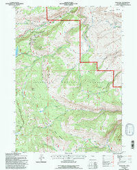 1991 Fossil Hill1997 Print · USGSThe high-elevation wilderness of the Shoshone National Forest is captured here in the early nineties. Researchers and hikers can trace the unique hydrology of Sinks Canyon State Park, the University of Missouri Geology Camp, and the heights of the Freak Mountains.
 - 1991 Map of Mount Arter SE, 1997 Print
 1991 Mount Arter SE1997 Print · USGSHigh-country water systems and canyon geology define this Wyoming landscape in the 1990s. Trace old rural landmarks like the Bonner Garden School (Aban'd) and industrial sites like the Hydroelectric Plant near Sinks Canyon.2 unique versions available
 - 2021 Map of Fossil Hill, 2021 Print
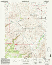
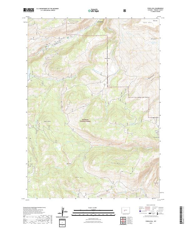 2021 Fossil Hill2021 Print · USGSThe high basins and peaks of the Wind River Range are preserved here in the early twenty-first century. Outdoorsmen and geologists can trace the paths of the Middle Popo Agie River, find the height of Fossil Hill, and locate old waterworks like Enterprise Ditch.
 - 2023 Map of Mount Arter SE, 2023 Print
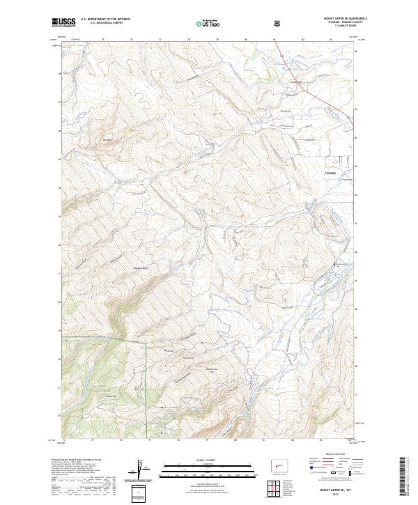 2023 Mount Arter SE2023 Print · USGSLander and the rugged foothills of the Wind River Range are captured in this contemporary look at Fremont County. Researchers can trace the complex irrigation systems like the Nicol Table Mountain Ditch or locate landmarks such as the Borner Garden Cem and Red Butte.
 - 2023 Map of Lander, 2023 Print
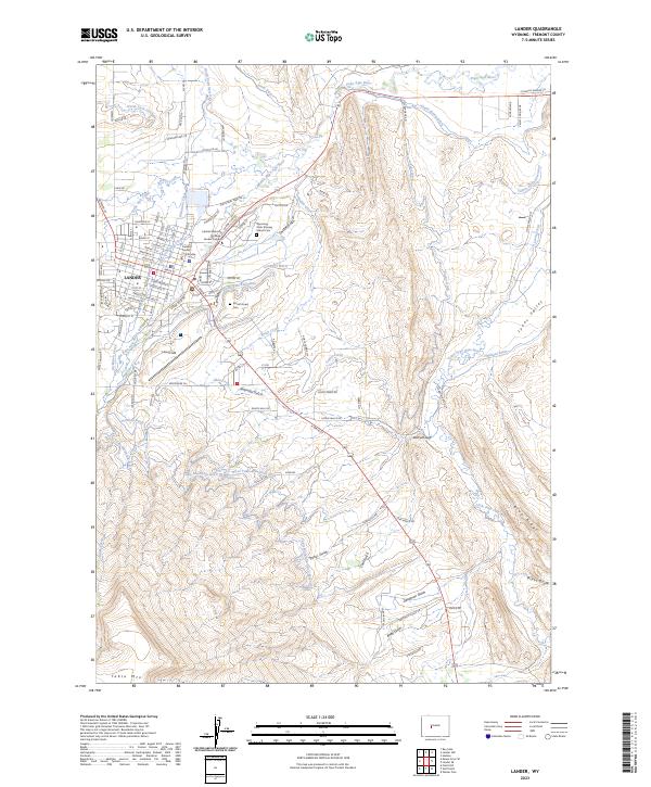 2023 Lander2023 Print · USGSLander and its surrounding river forks are documented in this contemporary survey of central Wyoming. Researchers can trace the complex irrigation network of the Sioux Ditch, locate the Mount Hope Hope Cem, or explore the canyon geography of Deadman Gulch.
End of results
Showing maps 1-14 of 14
Top cities near Lander
Frequently asked questions
- What are the different types of historical maps available for Lander?
- What is the oldest map of Lander?
- Where can I purchase historical maps of Lander for my home or office?
- Where can I download high-res historical maps of Lander?
- Are there historical topographic maps available for Lander?
- Is there historical aerial imagery available for Lander?
- Where are historical maps of Lander sourced from?