Old Maps of Newcastle, Wyoming for Academic Research
Study the evolution of Newcastle with 12 high-resolution historic maps. Whether you're teaching, researching, or modeling changes in land use, these maps provide essential visual documentation of urban, environmental, and geographic change.
- Analyze long-term change: Track patterns in development, transportation, and natural features.
- Ideal for environmental or urban studies: Support academic projects with primary historical map data.
- Use in the classroom or lab: Educators and researchers rely on these maps to bring historical context to life.
These maps are a powerful tool for teaching, research, and visualizing how Newcastle has changed over the decades.
Newcastle, WY maps
(12)- 1899 Map of Newcastle, 1964 Print
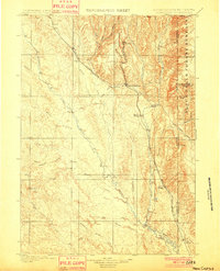
 1899 Newcastle1964 Print · USGSThe Wyoming-South Dakota borderlands appear here at the close of the nineteenth century, as railroads and ranching reshaped the Black Hills. Researchers can trace early cattle operations like YT Ranch and mining infrastructure at Cambria and Newcastle.
 - 1901 Map of Newcastle
 1901 Newcastle1901 Print · USGSThe Wyoming-South Dakota borderlands come alive in this survey conducted just before the turn of the century, centered on the railroad hub of Newcastle. Genealogists and historians can trace early cattle history at Lak Ranch and the industrial spur leading to the coal-mining town of Cambria.3 unique versions available
 - 1951 Map of Newcastle, 1953 Print
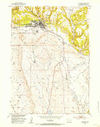 1951 Newcastle1953 Print · USGSThe railroad town of Newcastle is captured here in the early fifties, showing the interplay of canyon terrain and valley settlement. Genealogists and historians can locate Greenwood Cem, the local Fairground, and the siding at Spencer.3 unique versions available
 - 1951 Map of Osage SE, 1953 Print
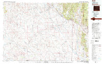
 1951 Osage SE1953 Print · USGSWeston County at the dawn of the 1950s shows a landscape transitioning into a major energy corridor. Family researchers and historians can locate the Boulden Ranch and trace early petroleum infrastructure like the Oil Pump Sta and the Chicago Burlington and Quincy rail line.4 unique versions available
 - 1955 Map of Newcastle, 1963 Print
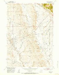
 1955 Newcastle1963 Print · USGSThe high plains of eastern Wyoming and western South Dakota are captured in the mid-fifties, showing a landscape of sprawling ranches and emerging oil fields. Researchers can locate family landmarks like Saunders Ranch, trace the Chicago Burlington & Quincy RR, and explore small rail towns such as Osage and Edgemont.2 unique versions available
 - 1958 Map of Newcastle
 1958 Newcastle1958 Print · USGSThe high plains of eastern Wyoming meet the Black Hills in the late fifties, showcasing a landscape of rail-connected towns and historic trails. Trace the path of the Chicago Burlington & Quincy RR through Newcastle or locate the Bozeman Trail Monument and Summitt Ridge Lookout Tower.
 - 1958 Map of Newcastle, 1960 Print
 1958 Newcastle1960 Print · USGSNewcastle and the eastern Wyoming borderlands are captured here during a period of infrastructure growth and ranching stability. Genealogists and historians can locate family-named landmarks like the LAK Ranch, the historic Cambria mining area, and the Greenwood Chapel.2 unique versions available
 - 1979 Map of Newcastle
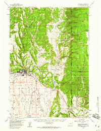
 1979 Newcastle1979 Print · USGSThe energy-rich plains of Weston County meet the Black Hills in the late seventies as oil production and ranching define the landscape. Researchers can trace the Burlington Northern rail lines and explore the vast Fiddler Creek Oil Field or the remote Darlington School.
 - 1984 Map of Cambria
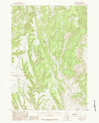 1984 Cambria1984 Print · USGSWeston County high country is captured here during the 1980s, detailing a landscape of high tables and deep canyons. Researchers can locate the settlement of Cambria and map out water sources like Corral Spring and Sweetwater Creek among the ridges of Jumbo Table.
 - 2021 Map of Osage SE, 2021 Print
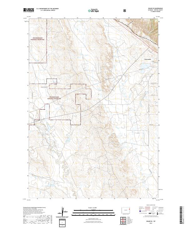 2021 Osage SE2021 Print · USGSWeston County's high plains are captured here in the early twenty-first century, showcasing the open range of the Thunder Basin National Grassland. Genealogists and land researchers can trace family-named routes like Eberspecher Rd and water features like Shostak Reservoir.
 - 2021 Map of Newcastle, 2021 Print
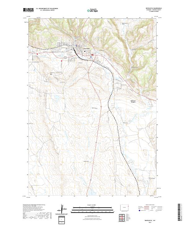 2021 Newcastle2021 Print · USGSNewcastle and the Weston County plains are captured here in the early twenty-first century as the community balances its civic roots and mining heritage. Genealogists can locate Greenwood Cem, while historians can trace the area's geography from the Weston County Courthouse to the Coal Mine at the edge of the draws.
 - 2021 Map of Cambria, 2021 Print
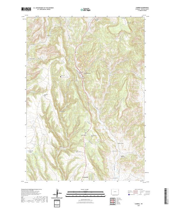 2021 Cambria2021 Print · USGSThe northern outskirts of Newcastle and the high ridges of the Black Hills foothills are captured here in the early twenty-first century. Genealogists can locate the Cambria Cem while hikers and historians trace paths like Breakneck Trl and Rustler Trl.
End of results
Showing maps 1-12 of 12
Frequently asked questions
- What are the different types of historical maps available for Newcastle?
- What is the oldest map of Newcastle?
- Where can I purchase historical maps of Newcastle for my home or office?
- Where can I download high-res historical maps of Newcastle?
- Are there historical topographic maps available for Newcastle?
- Is there historical aerial imagery available for Newcastle?
- Where are historical maps of Newcastle sourced from?