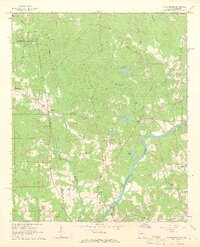
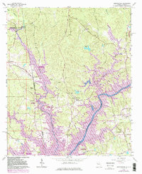
1964 Map of Abbottsford
USGS Topo · Published 1966About this map
The Chattahoochee River carves through the landscape of Troup County, Georgia, and Chambers County, Alabama, defining a borderland rich in small-scale rural infrastructure. This 1964 field-checked survey reveals a network of country churches and community landmarks including Antioch Ch, Bethlehem Ch, and State Line Ch, many of which served as the social anchors for scattered settlements like Abbottsford and Standing Rock. Transport through the area relied on a mix of old and new, from the Atlantic Coast Line railroad to traditional crossings such as a Covered Bridge and the Glass Bridge.
Find a feature on this map
57 named features on this map. Tap any name to fly to it.
Don’t see what you’re looking for? This feature index may not catch every label — zoom into the map to look around manually.
Map Details
Editions of this 1964 Abbottsford Map
5 editions found
Other maps of this area

1899 · Wedowee
USGS Topo · 1:125,000

1902 · Wedowee
USGS Topo · 1:125,000

1907 · Opelika
USGS Topo · 1:125,000

1909 · Opelika
USGS Topo · 1:125,000

1953 · Atlanta
USGS Topo · 1:250,000

1955 · Phenix City
USGS Topo · 1:250,000

1957 · Phenix City
USGS Topo · 1:250,000

1957 · Atlanta
USGS Topo · 1:250,000

1958 · Phenix City
USGS Topo · 1:250,000

1958 · Atlanta
USGS Topo · 1:250,000