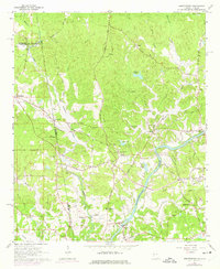
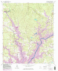
1964 Map of Abbottsford
USGS Topo · Published 1975About this map
The Chattahoochee River defines the landscape of the Georgia and Alabama borderlands in the mid-1960s, just as the valley was being reshaped by the rising waters of West Point Lake. This survey captures the rural character of Troup County and Chambers County before extensive flooding, showing the original course of Wehadkee Creek and Whitewater Creek as they met the river near Abbottsford.
Find a feature on this map
36 named features on this map. Tap any name to fly to it.
Don’t see what you’re looking for? This feature index may not catch every label — zoom into the map to look around manually.
Map Details
Editions of this 1964 Abbottsford Map
5 editions found
Other maps of this area

1899 · Wedowee
USGS Topo · 1:125,000

1902 · Wedowee
USGS Topo · 1:125,000

1907 · Opelika
USGS Topo · 1:125,000

1909 · Opelika
USGS Topo · 1:125,000

1953 · Atlanta
USGS Topo · 1:250,000

1955 · Phenix City
USGS Topo · 1:250,000

1957 · Phenix City
USGS Topo · 1:250,000

1957 · Atlanta
USGS Topo · 1:250,000

1958 · Phenix City
USGS Topo · 1:250,000

1958 · Atlanta
USGS Topo · 1:250,000