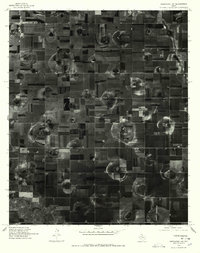
1976 Map of Abernathy NW
USGS Topo · Published 1978About this map
Cotton Center serves as the primary focal point in this 1976 orthophotoquad, revealing the intensive agricultural patterns of the Texas High Plains during the late 1970s. The aerial imagery highlights a landscape dominated by a rigid grid of large-scale rectangular fields, punctuated by distinctive circular center-pivot irrigation patterns that were rapidly transforming the region's farming practices. Cutting across the lower-left corner of the sheet, the natural course of Blackwater Draw provides a sharp contrast to the surrounding geometric human intervention. This document captures a specific moment in the evolution of the Ogallala Aquifer-dependent agricultural economy, where the layout of access roads and rural farmsteads reveals the high degree of mechanization required to manage this productive but arid terrain.
Find a feature on this map
2 named features on this map. Tap any name to fly to it.
Don’t see what you’re looking for? This feature index may not catch every label — zoom into the map to look around manually.
Map Details
Editions of this 1976 Abernathy NW Map
This is the sole edition of this map. No revisions or reprints were ever made.
Other maps of this area

1954 · Lubbock
USGS Topo · 1:250,000

1954 · Plainview
USGS Topo · 1:250,000

1954 · Clovis
USGS Topo · 1:250,000

1954 · Brownfield
USGS Topo · 1:250,000

1957 · Anton
USGS Topo · 1:62,500

1957 · Abernathy
USGS Topo · 1:62,500

1958 · Brownfield
USGS Topo · 1:250,000

1958 · Clovis
USGS Topo · 1:250,000

1958 · Plainview
USGS Topo · 1:250,000

1962 · Brownfield
USGS Topo · 1:250,000