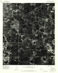
1976 Map of Abernathy SE
USGS Topo · Published 1978About this map
The community of Abernathy serves as the focal point of this 1976 orthophotograph, showcasing the stark, geometric layout of the High Plains of Texas. This aerial perspective, captured in March of that year, highlights the intensive agricultural grid surrounding the town, where massive center-pivot irrigation systems leave distinct circular imprints across the landscape. To the southwest, the subtle drainage of Blackwater cuts through the repetitive pattern of fields, indicating the natural hydrology of the Llano Estacado. The imagery provides a clear record of the town's footprint and industrial development at the Lubbock county line during a period of significant regional irrigation expansion. Researchers can observe the exact road networks and residential blocks of the era, contrasting the concentrated settlement of Abernathy against the expansive, productive farmland that defines the region's economy and history.
Find a feature on this map
3 named features on this map. Tap any name to fly to it.
Don’t see what you’re looking for? This feature index may not catch every label — zoom into the map to look around manually.
Map Details
Editions of this 1976 Abernathy SE Map
This is the sole edition of this map. No revisions or reprints were ever made.
Other maps of this area

1954 · Lubbock
USGS Topo · 1:250,000

1956 · Shallowater
USGS Topo · 1:24,000

1956 · New Deal
USGS Topo · 1:24,000

1957 · Lubbock
USGS Topo · 1:62,500

1957 · Abernathy
USGS Topo · 1:62,500

1965 · Idalou
USGS Topo · 1:24,000

1965 · Heckville
USGS Topo · 1:24,000

1968 · Julia Lake
USGS Topo · 1:24,000
1976 · Abernathy NW
USGS Topo · 1:24,000
1976 · Abernathy NE
USGS Topo · 1:24,000