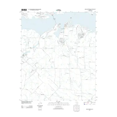
2012 Map of Ables Springs
USGS Topo · Published 2012About this map
Lake Tawakoni dominates the northern landscape of this region, its irregular shoreline defined by the branching waters of Wounded Man Reach, Medicine Man Reach, and Waco Bay. The northern peninsula is marked by distinct topographical features like White Point and Black Point, with the White Point Causeway and Duck Cove Bridge providing essential transit across the inlets. This 2012 survey illustrates the residential expansion around the lake's edge, contrasting with the more traditional rural layout further south.
Find a feature on this map
114 named features on this map. Tap any name to fly to it.
Don’t see what you’re looking for? This feature index may not catch every label — zoom into the map to look around manually.
Map Details
Editions of this 2012 Ables Springs Map
This is the sole edition of this map. No revisions or reprints were ever made.
Other maps of this area

1954 · Dallas
USGS Topo · 1:250,000

1956 · Tyler
USGS Topo · 1:250,000

1956 · Quinlan
USGS Topo · 1:62,500

1956 · Emory
USGS Topo · 1:62,500

1958 · Dallas
USGS Topo · 1:250,000

1962 · Elmo
USGS Topo · 1:24,000

1962 · Wills Point
USGS Topo · 1:24,000
1962 · Edgewood
USGS Topo · 1:24,000
1979 · Quinlan
USGS Topo · 1:24,000
1979 · Ables Springs
USGS Topo · 1:24,000