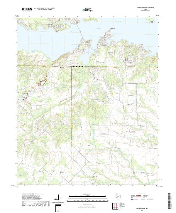
2022 Map of Ables Springs
USGS Topo · Published 2022About this map
The sprawling waters of Lake Tawakoni dominate the northern landscape of this region, where Hunt, Kaufman, and Van Zandt Counties meet. The shoreline is deeply articulated by geographic points and reaches with distinctive names like Wounded Man Reach, Medicine Man Reach, and Red Bear Reach. This modern survey reveals how the reservoir has reshaped the local geography, creating sheltered areas such as Kitsee Inlet and Mustang Cove that now define the northern boundary of the traditional farming communities to the south.
Find a feature on this map
124 named features on this map. Tap any name to fly to it.
Don’t see what you’re looking for? This feature index may not catch every label — zoom into the map to look around manually.
Map Details
Editions of this 2022 Ables Springs Map
This is the sole edition of this map. No revisions or reprints were ever made.
Other maps of this area

1954 · Dallas
USGS Topo · 1:250,000

1956 · Tyler
USGS Topo · 1:250,000

1956 · Quinlan
USGS Topo · 1:62,500

1956 · Emory
USGS Topo · 1:62,500

1958 · Dallas
USGS Topo · 1:250,000

1962 · Elmo
USGS Topo · 1:24,000

1962 · Wills Point
USGS Topo · 1:24,000
1962 · Edgewood
USGS Topo · 1:24,000
1979 · Quinlan
USGS Topo · 1:24,000
1979 · Ables Springs
USGS Topo · 1:24,000