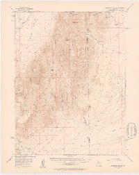
1956 Map of Ackerman Canyon
USGS Topo · Published 1957About this map
Park Range peaks and high-desert basins define this central Nevada landscape during the mid-1950s, a period when isolated ranching outposts and mineral exploration remained the primary human footprint. The map documents a rugged interior geography where survival depended on localized water sources such as Potato Canyon Spring, Cottonwood Spring, and Fagin Mtn Springs. Settlement patterns are sparse, represented by family-named operations including Santa Fe Ranch, Ferguson Ranch, and Dry Creek Ranch.
Find a feature on this map
37 named features on this map. Tap any name to fly to it.
Don’t see what you’re looking for? This feature index may not catch every label — zoom into the map to look around manually.
Map Details
Editions of this 1956 Ackerman Canyon Map
4 editions found

Other maps of this area

1926 · Roberts Mountains
USGS Topo · 1:250,000

1929 · Roberts Mountains
USGS Topo · 1:250,000

1949 · Roberts Creek Mtn
USGS Topo · 1:62,500

1951 · Roberts Creek Mtn
USGS Topo · 1:62,500

1955 · Millett
USGS Topo · 1:250,000

1956 · Bartine Ranch
USGS Topo · 1:62,500

1956 · Mount Callaghan
USGS Topo · 1:62,500

1956 · Walti Hot Springs
USGS Topo · 1:62,500

1956 · Antelope Peak
USGS Topo · 1:62,500

1956 · Hall Creek
USGS Topo · 1:62,500