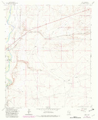
1962 Map of Acme
USGS Topo · Published 1982About this map
The Pecos River floodplain and the sprawling wetlands of the Bitter Lake National Wildlife Refuge define the western edge of this Chaves County landscape. In the early 1960s, the rural community of Acme served as a small node along the Atchison Topeka and Santa Fe railroad, which cuts diagonally across the high plains. The map reveals a land divided between industrial extraction and traditional ranching, evidenced by numerous sandpits and scattered family operations like Kitchen Ranch, Smith Ranch, and Dallas Ranch.
Find a feature on this map
22 named features on this map. Tap any name to fly to it.
Don’t see what you’re looking for? This feature index may not catch every label — zoom into the map to look around manually.
Map Details
Editions of this 1962 Acme Map
2 editions found
Other maps of this area

1949 · L-E Ranch
USGS Topo · 1:24,000

1950 · Comanche Spring
USGS Topo · 1:24,000

1950 · Bitter Lake
USGS Topo · 1:24,000

1955 · Roswell
USGS Topo · 1:250,000

1958 · Roswell
USGS Topo · 1:250,000

1962 · Roswell
USGS Topo · 1:250,000

1962 · Eightmile Draw
USGS Topo · 1:24,000
1962 · Bitter Lake
USGS Topo · 1:24,000

1962 · Acme
USGS Topo · 1:24,000
1962 · Melena
USGS Topo · 1:24,000