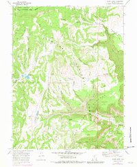
1968 Map of Acord Lakes
USGS Topo · Published 1979About this map
Fishlake National Forest and Manti-La Sal National Forest converge on this high plateau landscape, defined by a network of drainage systems like Convulsion Canyon and Quitchupah Canyon. The 1968 field check captures the area's transition into more intensive land management, evidenced by the presence of Skumpah Reservoir and numerous water developments. Resource use is clearly marked by the historic Jolly Mill site near Jolly Mill Point, alongside family-named landmarks such as Lizonbee Springs and Collier. The terrain is characterized by high ridges like White Mountain and Big Ridge that drop into deep hollows, including Eldridge Hollow and Mud Spring Hollow. An extensive network of jeep trails indicates the rugged accessibility of the Old Woman Plateau and Duncan Mountain for ranching and timber activities in the late 1960s.
Find a feature on this map
44 named features on this map. Tap any name to fly to it.
Don’t see what you’re looking for? This feature index may not catch every label — zoom into the map to look around manually.
Map Details
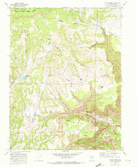
Editions of this 1968 Acord Lakes Map
2 editions found
Other maps of this area

1885 · Manti
USGS Topo · 1:250,000

1885 · Fish Lake
USGS Topo · 1:250,000

1895 · Manti
USGS Topo · 1:250,000

1896 · Fish Lake
USGS Topo · 1:250,000

1922 · Wasatch
USGS Topo · 1:31,680

1925 · Acord Lakes
USGS Topo · 1:62,500

1956 · Salina
USGS Topo · 1:250,000

1956 · Price
USGS Topo · 1:250,000

1960 · Price
USGS Topo · 1:250,000

1960 · Salina
USGS Topo · 1:250,000