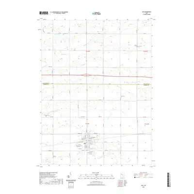
2019 Map of Ada
USGS Topo · Published 2019About this map
Ada serves as the focal point of this Northwest Ohio survey, dominated by the campus of Ohio Northern University. The landscape reflects a highly organized agricultural tradition, defined by a rigid grid of township roads and an extensive network of drainage features such as Binkley Ditch and Cummins Ditch that manage the headwaters of Ottawa Creek and Riley Creek. For genealogists and local historians, the sheet preserves the locations of several small burial grounds scattered across the countryside, including McClure Cemetery and Hasson Cemetery. The historical Lincoln Highway traverses the northern portion of the quadrangle, illustrating the enduring path of early transcontinental travel through Hardin County. Further south, the Ada Airport and various municipal streets like West North Avenue show the modern infrastructure surrounding the university town.
Find a feature on this map
71 named features on this map. Tap any name to fly to it.
Don’t see what you’re looking for? This feature index may not catch every label — zoom into the map to look around manually.
Map Details
Editions of this 2019 Ada Map
This is the sole edition of this map. No revisions or reprints were ever made.
Other maps of this area

1905 · Arlington
USGS Topo · 1:62,500

1907 · Bluffton
USGS Topo · 1:62,500

1907 · Arlington
USGS Topo · 1:24,000

1913 · Alger
USGS Topo · 1:48,000

1915 · Alger
USGS Topo · 1:62,500

1915 · Kenton
USGS Topo · 1:62,500

1943 · Alger
USGS Topo · 1:62,500

1944 · Kenton
USGS Topo · 1:62,500

1950 · Marion
USGS Topo · 1:250,000

1960 · Bluffton
USGS Topo · 1:24,000