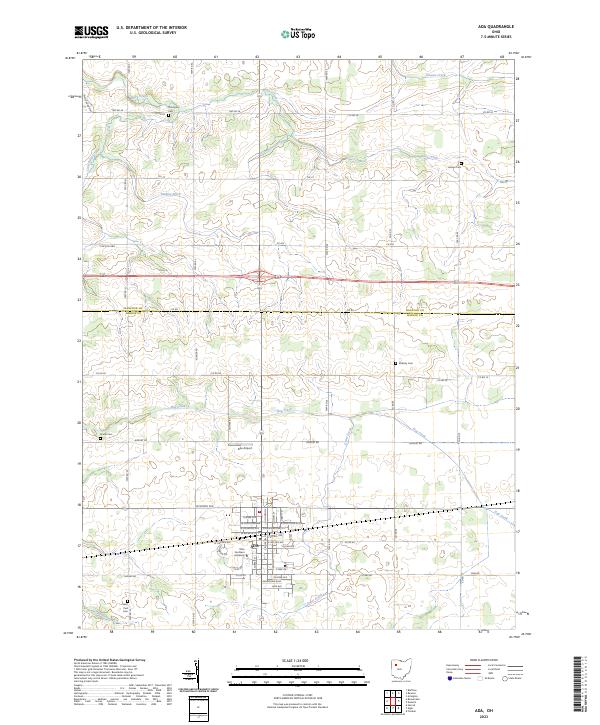
2023 Map of Ada
USGS Topo · Published 2023About this map
Ohio Northern University serves as a major anchor for the village of Ada, which is situated within a landscape defined by a grid of agricultural fields and water management systems. The town’s layout is centered around several key thoroughfares, including W North Ave, N Johnson St, and W Buckeye St. The surrounding countryside in Hancock and Hardin Counties is drained by a network of waterways such as Riley Creek, Hog Creek, and Grass Creek, alongside human-engineered features like Cummins Ditch and Binkley Ditch. Several family and community burial grounds, including Thompson Cem, Hasson Cem, and Kindle Cem, are scattered throughout the rural sections. Evidence of modern infrastructure is seen in the Ada Airport and the path of the Lincoln Hwy, reflecting the area's long-standing role as a crossroads for local and regional travel in northwest Ohio.
Find a feature on this map
68 named features on this map. Tap any name to fly to it.
Don’t see what you’re looking for? This feature index may not catch every label — zoom into the map to look around manually.
Map Details
Editions of this 2023 Ada Map
This is the sole edition of this map. No revisions or reprints were ever made.
Other maps of this area

1905 · Arlington
USGS Topo · 1:62,500

1907 · Bluffton
USGS Topo · 1:62,500

1907 · Arlington
USGS Topo · 1:24,000

1913 · Alger
USGS Topo · 1:48,000

1915 · Alger
USGS Topo · 1:62,500

1915 · Kenton
USGS Topo · 1:62,500

1943 · Alger
USGS Topo · 1:62,500

1944 · Kenton
USGS Topo · 1:62,500

1950 · Marion
USGS Topo · 1:250,000

1960 · Bluffton
USGS Topo · 1:24,000