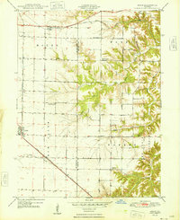
1948 Map of Adair
USGS Topo · Published 1948About this map
The Camp Ellis Military Reservation dominates the southeastern corner of this Illinois landscape, situated along the border of McDonough and Fulton Counties. This 1940s topography captures the region as it transitioned from traditional rural agriculture to supporting significant wartime military infrastructure. The western half of the map is defined by the rigid grid of townships like Mound and New Salem, while the eastern portion breaks into the more complex drainage systems of Barker Creek and Francis Creek.
Find a feature on this map
24 named features on this map. Tap any name to fly to it.
Don’t see what you’re looking for? This feature index may not catch every label — zoom into the map to look around manually.
Map Details
Editions of this 1948 Adair Map
This is the sole edition of this map. No revisions or reprints were ever made.
Other maps of this area

1912 · Macomb
USGS Topo · 1:62,500

1914 · Macomb
USGS Topo · 1:62,500

1915 · Avon
USGS Topo · 1:62,500

1916 · Good Hope
USGS Topo · 1:62,500

1918 · Vermont
USGS Topo · 1:62,500

1918 · Good Hope
USGS Topo · 1:62,500

1921 · Vermont
USGS Topo · 1:62,500

1944 · Avon
USGS Topo · 1:62,500

1947 · Vermont
USGS Topo · 1:24,000

1947 · Adair
USGS Topo · 1:24,000