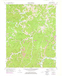
1971 Map of Adams
USGS Topo · Published 1978About this map
Blaine Creek and its many winding tributaries like Little Blaine Creek and Rich Creek define this rural Kentucky landscape during the early 1970s. The region is characterized by a dense network of hollows and branches, many bearing family names such as Milard Bradley Hollow, Jeff Gilliam Br, and McCracken Hollow. Small communities and gathering places are scattered throughout the hills, including Adams, Busseyville, and the Ledocio PO.
Find a feature on this map
97 named features on this map. Tap any name to fly to it.
Don’t see what you’re looking for? This feature index may not catch every label — zoom into the map to look around manually.
Map Details
Editions of this 1971 Adams Map
3 editions found
Other maps of this area

1886 · Prestonsburg
USGS Topo · 1:125,000

1892 · Prestonsburg
USGS Topo · 1:125,000

1903 · Kenova
USGS Topo · 1:125,000

1904 · Kenova
USGS Topo · 1:125,000

1911 · Louisa
USGS Topo · 1:48,000

1913 · Louisa
USGS Topo · 1:62,500

1914 · Inez
USGS Topo · 1:48,000

1915 · Paintsville
USGS Topo · 1:48,000

1916 · Inez
USGS Topo · 1:62,500

1917 · Paintsville
USGS Topo · 1:62,500