
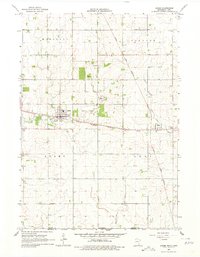
1965 Map of Adams
USGS Topo · Published 1967About this map
The agricultural landscape of Mower County is defined by the rail junction at Adams and the surrounding townships of Marshall, Clayton, and Lodi. Two major rail lines intersect in this region: the east-west Chicago Milwaukee St Paul and Pacific passing through Adams, and the north-south Chicago Great Western corridor, which serves the smaller community of Taopi. This transportation network supported a local economy focused on agriculture and industry, evidenced by several Gravel Pits and a central Substation.
Find a feature on this map
22 named features on this map. Tap any name to fly to it.
Don’t see what you’re looking for? This feature index may not catch every label — zoom into the map to look around manually.
Map Details
Editions of this 1965 Adams Map
2 editions found
Other maps of this area

1954 · Austin
USGS Topo · 1:62,500

1954 · Mason City
USGS Topo · 1:250,000

1957 · Mason City
USGS Topo · 1:250,000

1958 · Mason City
USGS Topo · 1:250,000

1965 · Le Roy
USGS Topo · 1:24,000

1965 · Dexter
USGS Topo · 1:24,000

1965 · Grand Meadow
USGS Topo · 1:24,000

1972 · Mc Intire
USGS Topo · 1:24,000

1972 · Little Cedar
USGS Topo · 1:24,000
1972 · Stacyville
USGS Topo · 1:24,000