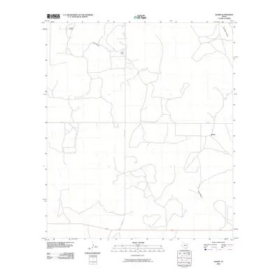
2010 Map of Adams
USGS Topo · Published 2010About this map
O'Harrow Oil Field and the Otto Oil Field punctuate the northern landscape of this central Texas region, marking the industrial footprint on the Edwards Plateau. The small settlement of Adams sits along a quiet corridor to the east, while the terrain is defined by the winding drainage systems of Poor Hollow and East Poor Hollow. This 2010 survey reflects a landscape shaped by both ranching and natural resource extraction, where long-established paths like Toe Nail Trl and Budd Rd provide the primary connections across the open country. The distribution of wells and watercourses provides a detailed record of land use in Schleicher County during the early 21st century.
Find a feature on this map
9 named features on this map. Tap any name to fly to it.
Don’t see what you’re looking for? This feature index may not catch every label — zoom into the map to look around manually.
Map Details
Editions of this 2010 Adams Map
This is the sole edition of this map. No revisions or reprints were ever made.
Other maps of this area

1892 · San Angelo
USGS Topo · 1:125,000

1893 · Fort McKavett
USGS Topo · 1:125,000

1954 · Sonora
USGS Topo · 1:250,000

1954 · San Angelo
USGS Topo · 1:250,000

1958 · Sonora
USGS Topo · 1:250,000

1958 · San Angelo
USGS Topo · 1:250,000

1963 · Adams
USGS Topo · 1:24,000

1963 · Adams NW
USGS Topo · 1:24,000

1963 · Adams SE
USGS Topo · 1:24,000

1963 · Adams SW
USGS Topo · 1:24,000